Boarding Locations

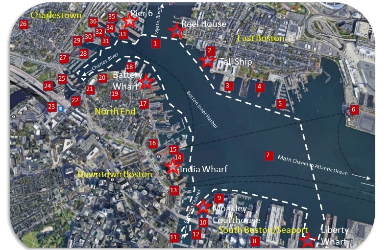
Public Cruises board at

Pier 6 Restaurant/Marina - Charlestown Navy Yard
Our Homebase for Public Cruises & Private Charters
the most convenient parking and bathroom options for private charters
1 Eight St Charlestown MA 02129
Parking garage at Flagship Wharf just a few steps to our boarding location at first gangway on the right side of Pier6

Liberty Wharf Dock - South Boston/Seaport
270 Northern Ave Northern Ave, South Boston MA 02210
Private Charter boarding option
Behind Legal Seafood Harbourside Restaurant

Tall Ship Oyster Bar & Food Court Dock - East Boston
65 Lewis Street East Boston MA 02128 Private Charter boarding option

India Wharf Dock - Downtown Waterfront
85 India Row, Boston, MA 02110 Private Charter boarding option
next to Boston Aquarium and 5min walk from Aquarium T Station
Public Parking available across the street at Harbor Guarage

Moakley Courthouse Dock - South Boston/Seaport
1 Courthouse Way Boston, MA 02210 Private Charter boarding option
Next to the Barking Crab. The gangway is diagonally across from the Envoy Hotel

Battery Wharf - North End Boston
3 Battery Wharf Boston, MA 02019 Private Charter boarding option
Take Commercial Street to Battery Wharf
Walk down Battery Wharf and follow the Harbourwalk to the left.
The Harbourwalk will lead you to the dock.

Reel House Restaurant Dock - East Boston
6 New Street Boston, MA 02128 Private Charter boarding option

map of locations

Click on Attraction Below to Learn More

Before recorded history, Native Americans and then later colonists used weirs to catch alewives and fertilize their crops. In 1631, after the arrival of the English, the first ship built by Europeans in Massachusetts, the Blessing of the Bay, was launched from the river’s shores. A few years later (1637) the first bridge was built; neighboring towns squabbled about the costs for more than a hundred years.

Over one hundred years later, the Mystic River played a role in the American Revolution when on September 1, 1774, a force of roughly 260 British regulars rowed from Boston up the Mystic River to a landing point near Winter Hill in today’s Somerville. From there, they marched about a mile (1.6 km) to the Powder House where a large supply of provincial gunpowder was kept, and after sunrise they removed all the gunpowder, sparking a popular uprising known as the Powder Alarm. In 1775, the Battle of Chelsea Creek took place in the river’s watershed in May, and the British attacked via the river’s beach in the Battle of Bunker Hill in June.

In 1805 the Middlesex Canal linked the Charles and Mystic Rivers to the Merrimack River in Lowell, and during the 19th century, 10 shipyards along the Mystic River built more than 500 clipper ships. Shipbuilding peaked in the 1840s as schooners and sloops transported timber and molasses for rum distilleries between Medford and the West Indies.

By 1865, overfishing and pollution all but eliminated commercial fishing.

Extensive salt marshes lined the banks of the Mystic until 1909, when the first dam (Craddock Locks) was built across the river, converting salt marsh to freshwater marsh and enabling development. A dam named for Amelia Earhart, was built in 1966. It has three locks to allow the passage of boats, and is equipped with pumps to push fresh water out to the harbor even during high tide. Dam operators leave the locks open at times to allow the passage of fish. There is a fish ladder, but it has never been functional. The dam is closed to the public.

In 1950, construction was completed on the Maurice J. Tobin Bridge which spans the Mystic River, joining Charlestown and Chelsea.

Wildlife

At one time, the Mystic River was home to many species of fish, including salmonalewifeblueback herringstriped bassbluefishsmallmouth basslargemouth bassbluegillcarp and more. Although most of these species still live in the Mystic River, pollution and dam building have severely damaged the populations. Pollution came from various mills and a small ship building yard in the past. The main source of pollution in the 20th century and into the present is from drainage from cities and towns in the watershed. Many of the records of nearby drainage pipes have been lost, or have undocumented changes and diversions. Once described as having so many herring that one could cross the river on their backs, the Mystic River herring run is much smaller than it was in historic times. Pollution has raised bacteria levels and turbidity, making it unfavorable for fish to live in.

In popular culture

In 1844, Medford abolitionist and writer Lydia Maria Child described her journey across the Mystic to her grandfather’s house in the poem “Over the River and Through the Wood.” (Grandfather’s House, restored by Tufts University in 1976, still stands near the river on South Street in Medford.)

John Townsend Trowbridge‘s popular 1882 novel, The Tinkham Brothers’ Tide-Mill, had its setting along the river at a time when saltwater still reached the Mystic Lakes.

In Dennis Lehane‘s novel of the same name, Boston-area Mystic River holds a pivotal narrative development in the mystery. Later, Clint Eastwood directed the acclaimed film adaptation.

In the 1861 poem “Paul Revere’s Ride” by Henry Wadsworth LongfellowPaul Revere rides along the banks of the Mystic River.

The landmass that is East Boston today originally comprised five islands sited east of the confluence of the Malden, Mystic, and Charles rivers, and across the harbor from the westerly city of Boston. These islands included: Noddle’s; Hog’s; Governor’s; Bird; and Apple. The town of East Boston was first developed on the largest of these, Noddle’s, a noted source of timber and grazing land, used for farming by English colonists throughout the eighteenth century.[7]

Early development of the city

Boston Harbor, including Noddle’s, Hog’s, Governor’s, Bird’s and Apple Islands (1711)

Sumner and Noddle’s Island

As early as 1801, William H. Sumner, who had inherited a large tract on Noddle’s Island, proposed that the federal government of the United States create a turnpike to connect Massachusett’s North Shore (along with Sumner’s property on Noddle’s) to Boston, arguing that such a road would create a valuable, direct route across Boston’s harbor, making it easier for Boston, at the time an isolated peninsula surrounded by water, to expand: “There is no doubt but that the necessities of the town of Boston will some time require a connection with Noddle’s Island.”[8] When this plan was rejected in favor of a route through Chelsea (a route, not coincidentally, that left the Boston navy yard in nearby Charlestown with ocean access), Sumner moved onto other plans to improve Noddle’s value.

By 1833, Sumner, with partners Steven White and Francis J. Oliver, had bought up half of Noddle’s acreage. Together, they founded the East Boston Company, and continued to consolidate additional landholdings. By 1834, the East Boston Company had complete control over the island. The company’s purpose was to own and develop the land and call it East Boston. In anticipation of population growth, the proprietors adopted a grid street plan, the first planned neighborhood in the city of Boston. Jeffries Point, located at the southern end of the peninsula that faced Boston, was the earliest area of East Boston to be settled.[9]

A bridge to Chelsea was built, roads were laid out, and houses were built. Much of this activity was spurred by the formation of the East Boston Lumber Company. During this period, the Boston Sugar Refinery was also founded, which was the first manufacturing establishment in East Boston. They are credited for the creation of white granulated sugar.[10]

East Boston in 1838

The Boston Shipyards and Donald McKay

By 1835, ten wharves had been built. The abundance of wharf area opened the new East Boston to further rapid expansion, and it was the shipbuilding companies that soon became East Boston’s most famous industry, and the mainstay of its economy. In 1836, as development began to totally change the former islands, East Boston was annexed to Boston.

In 1845, Donald McKay, as a sole owner, established his own shipyard on Border Street. His ships included the Flying Cloud (1851), which made two 89-day passages from New York to San Francisco and the Sovereign of the Seas (1852), which posted the fastest speed ever by a sailing ship (22 knots) in 1854.[11]

In the 1840s and 1850s, the principal shipbuilders besides McKay included Paul Curtis and Samuel Hall. In addition, Sylvanus Smith became a noted shipbuilder in East Boston.[12]

Connections to the mainland

East Boston in 1879

In the 1830s, the largest problem keeping East Boston from thriving was transportation. The East Boston Company believed the neighborhood could not become a valuable asset until people had a way to reach the area from the Boston mainland. As a temporary solution, they set up a paddle steamer to carry 15 people at a time from Boston Proper to the neighborhood. It was used primarily for occasional visits from public officials and laborers. Though they did not have the ridership to support additional boats, the company purchased the Tom Thumb steamboat.

The steam railroad system was still in its infancy at this point, and the East Boston Company was approached by an inventor of a new type of rail system, the suspension railway. This system was one of the earliest suspended railroads to be built. The railroad cars were propelled by a steam engine hanging from a suspended track. Henry Sargent, the inventor, stated “that his invention would make the Island a center of attraction to many people.” The Company allowed it to be built on its land and it was in use for nine days in 1834, then closed citing lack of ridership.

In the mid-1830s, the Company made several investments to further East Boston’s development. They continued attempts to get the Eastern Railroad to come to East Boston. The Maverick and East Boston ferries began service from Lewis Wharf on the mainland to East Boston.

The ferry service from Noddle’s Island was replaced in 1904 by the streetcar tunnel that became the MBTA Blue Line, the first underwater tunnel in North America.[9]

Boston’s “Ellis Island”

Since the mid-19th century, the community served as a foothold for immigrants to the United States: Irish and Canadians came first, followed by Russian Jews and Italians, then Southeast Asians, and, more recently, an influx from Central and South American countries.[13] The Orient Heights section of East Boston was the first area in Massachusetts to which Italians immigrated in the 1860s and 1870s, and today the heart of the Italian community remains in East Boston. The Madonna Shrine, which is the national headquarters of the Don Orione order, sits on top of the Heights and is a replica of the original religious structure in Rome. In the 1880s, the Immigrants House operated in East Boston to help immigrants during their arrivals with economic support and social services. The building in which the Immigrants House operated was later named Landfall and served as the first senior citizen housing in the community.[14]

Internment Camps, East Boston, MA: German gardens, constructed by men of interned liners (1918)

During World War I, areas of East Boston served as an internment camp for Germans taken off of ships. Period images show small unfenced buildings and tiny gardens built by the internees, leading right up to the water’s edge. In 1919, moves were undertaken to formalize these facilities. Originally officials planned to use one of the Harbor Islands to replace their rented quarters on Long Wharf, but this plan was abandoned for a site on Marginal Street, directly on the East Boston wharves. Construction began in late 1919 on the East Boston Immigration Station, which served as Boston’s first purpose-built immigration station.[15] The East Boston Immigration Station operated from 1920 to 1954 as the region’s immigration hub. In 2011, the Immigration Station was torn down.[16]

Unlike Ellis Island in New York, inspectors at the East Boston station processed immigrants at steamship docks, only transferring to the immigration station problem cases who had issues with their paperwork or required a secondary interview.[17] Opposite the station, steps leading to East Boston were called the ‘Golden Stairs’ “because they represented the final climb to golden opportunity in America for countless Europeans.”[18] The station operated from 1920 to 1954 as the region’s immigration hub.

Waterfront view of the immigration station (c. 1922)

The population of East Boston, which was recorded as a mere thousand in 1837, exploded to a high of just over 64,000, according to the 1925 census. The sudden rise is attributed to the immigrants who came from Southern Italy. Today, the neighborhood is home to over 40,000 inhabitants, with a median income per household of around $46,000.[19][20]

Kennedy family

When my great grandfather left here to become a cooper in East Boston, he carried nothing with him except two things: a strong religious faith and a strong desire for liberty. I am glad to say that all of his great grandchildren have valued that inheritance.

— President Kennedy addressing the people of New Ross, Ireland, June 1963

The Kennedy Family lived on Meridian Street in what is now a small home wedged between a Hispanic market and hardware store, approaching the Meridian Street branch of the Boston Public Library. The family later moved to a larger home on Monmouth Street. P. J. Kennedy‘s success enabled him to purchase a home for his son, Joseph, and another for his two daughters at Jeffries Point.

In 1954, John F. Kennedy famously paraded through East Boston with his wife, Jackie, in anticipation for his campaign to run for United States Senate, to secure votes from the neighborhood. In a famous photograph, Kennedy is shown walking down Chelsea Street heading towards Maverick Square, waving to the crowd in front of Santarpio’s Pizza.[21]

On numerous occasions throughout his career in the United States Senate, Senator Ted Kennedy mentioned that his family’s roots are embedded in East Boston.

Pier One in East Boston.
The ship features three custom built mahogany bars, built around the grand mast, and forward and aft of the shift while guests enjoy uninterrupted views of the city skyline and harbor.

The galley kitchen will offer local oysters, shellfish, and charcuterie boards. About Pier One Alongside the majestic tall ship, activated and built out the pier into a 40,000 sq ft waterfront experience that will feature live entertainment, retail, food vendors, food.

Piers Park is a beautifully landscaped park providing direct access to the waterfront along with spectacular views of downtown Boston across the inner harbor. Follow a 600-foot pedestrian promenade to two pavilions, which provide a view of the city skyline across the water, and four smaller shade pavilions. One pavilion honors the memory of Donald McKay, the noted builder of clipper ships whose facility was in East Boston. The park also features an amphitheater, an
outdoor fitness system, and a large playground.

If you are interested in hosting an event in the park, contact the Massachusetts Port Authority

The current incarnation of Rowes Wharf (built 1987)[1] is a modern development in downtown BostonMassachusetts. It is best known for the Boston Harbor Hotel‘s multi-story arch over the wide public plaza between Atlantic Avenue and the Boston Harbor waterfront. Along the waterfront can be found a marina, restaurants, a water transportation terminal, and a floating stage offering free concerts and movies during the summer.[2]

MBTA boat services link the wharf to Hingham, while water taxis operate to and from Logan International Airport. Cruise boats also operate from the wharf.

History

18th century

In 1666 a protective battery called the “Sconce”, or the “South Battery”, was built at the foot of Fort Hill in the area now known as Rowes Wharf. In peacetime, the Battery had a company assigned to it in case of invasion, but had only one gunner. During the 1740s, the Battery was extended into the harbor and was defended by thirty-five guns. In 1764, John Rowe bought the land and built the first Rowes Wharf, which extended a short distance into Boston Harbor, and in 1765 Foster’s Wharf was built on the site of the old Battery.

Foster’s Wharf was originally called “Apthorp’s Wharf”. Charles Ward Apthorp was a staunch Tory and backed the losing side in the American Revolution; it was his confiscated land and wharf that merchant William Foster bought for 6,266 pounds, 12 shillings in May 1782.[3][4] Rowes Wharf, however, has carried its original builder’s name since its inception. For the next 150 years or so, commercial shipping continued to be a main user of the area.[5][6]

19th-20th century

Detail of 1899 map of Boston, showing Rowes Wharf

Yachts moored at Rowes Wharf, 2007

With the opening of the Boston, Revere Beach and Lynn Railroad in 1875, a ferry connection was established from Rowes Wharf to the railroad’s southern terminus in East Boston. With the construction of the Atlantic Avenue Elevated in 1901, a station at Rowes Wharf connected the wharf to Boston’s elevated and subway rail system. However, by the middle of the 20th century, both the railroad – and by October 1938, the elevated railway – had closed, and the wharf had become dilapidated, the victim of changing patterns in shipping. This remained the case until the 1980s, when the current development was constructed.[5]

The Boston Harbor Hotel is the principal occupant of the current Rowes Wharf building, which was completed in 1987, and designed by Adrian Smith while he was working for Skidmore, Owings and Merrill (SOM).[7]

The New England Aquarium is a public aquarium located in Boston, Massachusetts. The species exhibited include harbor and northern fur sealsCalifornia sea lionsAfrican and southern rockhopper penguinsgiant Pacific octopusesweedy seadragons, and thousands of saltwater and freshwater fishes. In addition to the main aquarium building, attractions at Central Wharf include the Simons Theatre and the New England Aquarium Whale Watch. More than 1.3 million guests visited the aquarium each year prior to the outbreak of the COVID-19 pandemic.[1]

The Anderson Cabot Center for Ocean Life at the New England Aquarium conducts long-running research on the North Atlantic right whale, and its Quincy Animal Care Center rescues and rehabilitates hundreds of sea turtles annually.[2][3]

History

Boston has had multiple aquariums since the 1880s, the last before the New England Aquarium being the South Boston Aquarium at Marine Park, which closed its doors in the 1950s.[4]

A building under construction on a wharf

The base of the Giant Ocean Tank under construction on the decaying Central Wharf in 1966

As part of the city’s goal of revitalizing the waterfront, a new, modern aquarium, designed by Peter Chermayeff of Cambridge Seven Associates, was planned starting in 1962.[5] David B. Stone led the project as President of the New England Aquarium Corporation.[6] The brutalist concrete building with its cavernous interior was opened to the public in 1969. The Giant Ocean Tank, a 200,000-US-gallon (760,000 L) cylindrical exhibit made of concrete and glass, opened in 1970.[7]

In 1974, a purpose-built, multi-storied barge, Discovery, was moored next to Central Wharf.[7] As the aquarium’s location on the wharf limited its ability to expand, Discovery served as a floating addition containing a 1,000-seat amphitheater overlooking a 116,000-US-gallon (440,000 L) saltwater pool for marine mammals. In addition to the aquarium’s first California sea lionsbottlenose dolphins performed there until they were transferred in the mid-1990s. The aging Discovery was finally decommissioned in the mid-2000s due to rising maintenance costs.

The new West Wing, designed by Schwartz/Silver Architects, was completed in 1998.[8] The glass and steel addition to the original concrete building also included a new gift shop and the Harbor View Café.

The 428-seat Matthew and Marcia Simons IMAX Theatre opened in 2001 in a separate building on Central Wharf designed by E. Verner Johnson and Associates. A renovation in 2020 replaced the IMAX system with a digital projector capable of showing 2D and 3D films on the theatre’s new 80-foot (24 m) by 43-foot (13 m) screen.[9] The current theatre seats 378 and has a stage for hosting special events.[9] Also in 2020, contemporary artist Shepard Fairley designed and painted the mural A Vital and Vibrant Ocean for All, featuring a North Atlantic right whale, on the façade of the theatre.[10]

In 2009, the New Balance Foundation Marine Mammal Center opened on the rear of the aquarium. This open-air exhibit lets guests and passersby view the aquarium’s California sea lions and northern fur seals.

In 2010, the new Animal Care Center opened. The 23,000-square-foot (2,100 m2) off-site facility, located in Quincy, has large tanks for holding animals during exhibit renovations, quarantining new arrivals, and rehabilitating rescued sea turtles.

A weedy seadragon

A weedy sea dragon in the Temperate Gallery

In 2011, the aquarium added an Australian Great Southern Reef exhibit, featuring leafy and weedy seadragons, to the Temperate Gallery and started its own captive breeding program for the species.

In the last of $42 million in upgrades that started in 2007, the aquarium once again worked with Cambridge Seven Associates to make improvements to the Giant Ocean Tank, including an expanded coral reef, larger, acrylic viewing windows, and a more advanced lighting array. The Yawkey Coral Reef Center was also added to the viewing area at the top of the exhibit, which reopened in 2013. During the renovation, the Giant Ocean Tank’s residents lived temporarily in the penguin habitat at the base of the exhibit, while the penguins were relocated to the Quincy Animal Care Center.

In 2019, the aquarium replaced the original Indo-Pacific coral reef tank in the Tropical Gallery with a new, floor-to-ceiling exhibit with an artificial coral habitat based on the Phoenix Islands Protected Area, which the aquarium helped to establish.[11]

Whale Watch

A large white boat sailing into the distance

The Aurora, a New England Aquarium Whale Watch boat

During the months of April–October, the aquarium partners with Boston Harbor Cruises to bring whale watchers 30 miles (48 km) east of Boston Harbor to the Stellwagen Bank Marine Sanctuary.[20] Boats keep a responsible distance as on-board naturalists provide narration. Sightings of whales and many other marine animals is all but guaranteed as the sanctuary is a rich feeding ground is for humpback whalesfinback whalesminke whalespilot whales, large pods of dolphins, and the endangered North Atlantic right whale. Most trips last around 3 to 4 hours. If no whales are sighted, guests receive a voucher for another cruise.

In popular culture

  • In 1981, director Sidney Poitier shot scenes at the aquarium for the comedy film Traces.
  • In an episode from the fourth season of Fetch! with Ruff Ruffman, entitled “How to Break the Ice and Also Waddle on It”, Ruff sends Isaac Bean to learn about penguins and volunteer in the penguin exhibit.
  • A scene in the 2012 comedy film Ted starring Mark Wahlberg and Seth MacFarlane prominently features the Giant Ocean Tank. The tank that John and Ted sit in front of, however, is computer generated.
  • The 2018 superhero film Aquaman features a scene set in the “Boston Aquarium”, a fictionalized version of the New England Aquarium filmed primarily at the Georgia Aquarium in Atlanta and augmented with computer-generated imagery.
  • A 2021 episode of Wildlife Nation with Jeff Corwin on ABC featured the aquarium and its sea turtle rescue program.

Long Wharf is a historic American pier in Boston, Massachusetts, built between 1710 and 1721. It once extended from State Street nearly a half-mile into Boston Harbor; today, the much-shortened wharf (due to land fill on the city end) functions as a dock for passenger ferries and sightseeing boats.[1]

History

A wide view of a port town with several wharves. In the foreground there are eight large sailing ships and an assortment of smaller vessels. Soldiers are disembarking from small boats onto a long wharf. The skyline of the town, with nine tall spires and many smaller buildings, is in the distance. A key at the bottom of the drawing indicates some prominent landmarks and the names of the warships.

Boston in 1768, with Long Wharf extending into the harbor. Engraving by Paul Revere.

18th century

Construction of the wharf began around 1710. As originally built the wharf extended from the shoreline adjacent to Faneuil Hall and was one-third of a mile long, thrusting considerably farther than other wharves into deep water and thus allowing larger ships to tie up and unload directly to new warehouses and stores. “Constructed by Captain Oliver Noyes, it was lined with warehouses and served as the focus of Boston’s great harbor.”[2] Over time the water areas surrounding the landward end of the wharf were reclaimed, including the areas now occupied by Quincy Market and the Customs House.[3]

“At the wharf’s head in the 18th century was the Bunch-of-Grapes Tavern. The painter John Singleton Copley spent his childhood on the wharf, where his mother had a tobacco shop.”[4] The 1760s Gardiner Building, once home to John Hancock‘s counting house and now a Chart House restaurant, is the wharf’s oldest surviving structure.[5]

19th century

Long Wharf, c.19th century

Among several similar structures, a grand granite warehouse known as the Custom House Block was built in 1848 atop the wharf; it has survived into the 21st century.[6] The mid-19th century was the height of Boston’s importance as a shipping center, lasting roughly until the American Civil War. Long Wharf was the central focus of much of this economic activity.[7]

In the late 1860s, as the city’s port began to decline in importance as an international shipping destination,[7] Atlantic Avenue was cut through this and other wharves, changing the face of the waterfront.

20th century

The construction of the elevated Central Artery along Atlantic Avenue in the 1950s separated Long Wharf from Boston’s business district.

The wharf and the 19th-century Custom House Block were recognized as a National Historic Landmark in recognition for the role they played in the history of Boston and its importance as a major 19th-century shipping center.[7]

21st century

Custom House Block, 2011

Gardiner Building

Viewing plaza at end of the wharf

The Big Dig put the Central Artery below ground level, which partially restored the original close relationship between Long Wharf and downtown. Since ca.1990, Long Wharf has been transformed from a failing commercial waterfront area into a recreational and cultural center.[3]

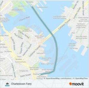
Today, Long Wharf is adjacent to the New England Aquarium, and is served by the Aquarium station on MBTA’s Blue Line subwayMBTA boat services link the wharf to the Boston Navy Yard in CharlestownLogan International AirportHull, and Quincy. Other passenger ferry services operate to the islands of the Boston Harbor Islands National Recreation Area, and to the cities of Salem and Provincetown. Cruise boats operate various cruises around the harbour. The wharf itself is occupied by a hotel, several restaurants and shops. At the seaward end, there is a large plaza with extensive views of the harbor. Now much shortened by land reclamation at its landward end, today it serves as the principal terminus for cruise boats and harbor ferries operating on Boston Harbor.

Custom House Block

The Custom House Block (42°21′35.95″N 71°2′58.53″W), built in 1845-87[8] in BostonMassachusetts, is a former warehouse on Long Wharf, at the end of State Street. Architect Isaiah Rogers designed the four-storey building, constructed of granite and brick. In its 19th-century heyday, it contributed to the life of “Boston’s busiest pier, commercial port, and embarkation point for travelers.” Today private owners maintain the site.[9][10]

The building was renovated in 1973 by Anderson, Notter, Feingold.[8]

Gardiner Building

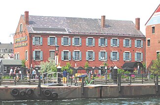
The Gardiner Building (42.360°N 71.050°W), located on Long Wharf, is a brick Colonial style warehouse built in 1763 and rebuilt in 1812. At one time it was used as John Hancock‘s counting house. Long Wharf was once filled with this kind of building, but this is the only one remaining;[8] it is the wharf’s oldest surviving structure.[5] The building was renovated in 1973 by Anderson, Notter, Feingold.[8] It is currently a Chart House seafood restaurant.

The Gardiner Building features a slate roof and “six-over-six” windows with shutters. The lintels and sills are granite

History

According to a self-published work by the Massachusetts State Council of the Knights of Columbus, in 1967, their organization voted to establish a non-profit corporation to construct affordable housing.[1] The Boston Redevelopment Authority selected them to develop a parcel, but the Supreme Council of the Order did not like the idea.[1] The Massachusetts State Council constructed the Christopher Columbus Waterfront Park instead in honor of their patron, Christopher Columbus.[1]

Other sources suggest the park was originally going to be known as Waterfront Park, planned by the efforts of local banker Frank S. Christian (d. 1970),[2] the placement of an Italian marble statue of Columbus was entirely ad hoc, and the park was only renamed for Christopher Columbus through the efforts of local provocateur Arthur Stivaletta with the approval of Mayor Kevin White in the weeks prior to his 1979 reelection with new-found Italian-American support.[3][4]

The Massachusetts Beirut Memorial on the site was dedicated in the park in 1992.

In 1999, the director of the Massachusetts Historical Society denounced the park as a poor use of city resources with inappropriate symbolism, observing that Boston has no connection to Christopher Columbus. He recommended restoring the park to commemorate its historical use as a fishing wharf.[5]

The Columbus statue was frequently vandalized: with red paint and the word “murderer” in 2004, beheaded for the first time in 2006, and spray painted with “Black Lives Matter” in 2015.[6] Most recently, in the early morning hours of June 9, 2020, the head portion of the statue of Columbus was removed and stolen. Mayor Marty Walsh said the remaining portion of the stature would be removed and placed into storage and the city would be reviewing if the Italian marble statue would ever be placed in a high visibility location in the future.[6] Walsh announced a few days prior to Columbus Day 2020 that the statue would not return, and would instead possibly be replaced with one commemorating Italian immigrants to America under the guidance of the Boston Art Commission.[7][8]

The Charles is a tidal river 80 miles long with a watershed of 309 square miles. For 280 years, Bostonians used the rise and fall of the river tides to perform municipal functions, from powering mills to flushing away sewage and industrial waste.

Charles River, Gridley Locks, Harbor Walk

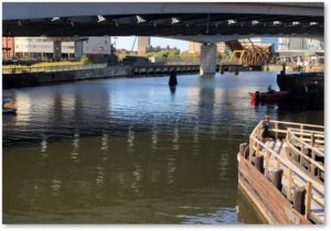
Looking upstream from the locks

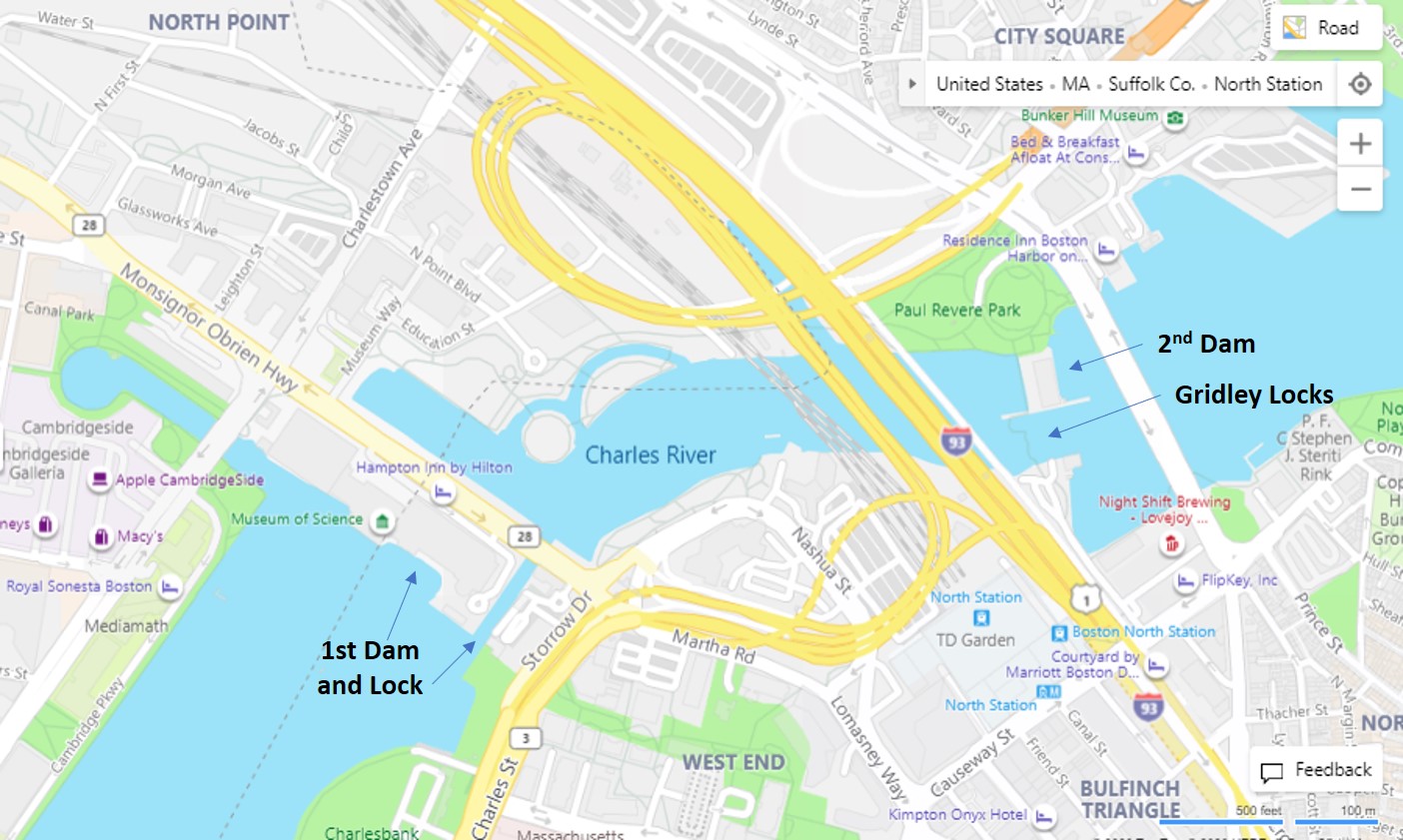
That tidal fluctuation stopped with the construction of the first Charles River Dam in 1910. This turned the river from a tidal estuary into a fresh-water basin. If you ever visited the Museum of Science(opens in a new tab), you stood on this dam.

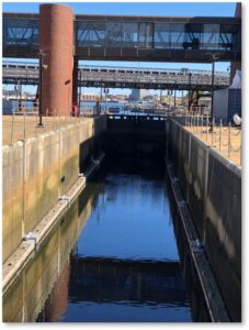
And if you looked at the narrow channel that runs between the museum and the Boston shore, you saw the very first lock that allowed river traffic to pass through the dam safely. That first dam no longer functions to control the river’s water level. Both the lock and the eight sluices under the Science Museum remain open.

Charles River, Dams, Locks, Map

The New Charles River Dam and Locks

Narrow Lock, Gridley Locks, Charles River, Boston Harbor

Narrow lock looking downstream

A new, larger Charles River Dam with the Gridley Locks and Pumping Station were constructed in 1978 just a short way downriver.

The new structure was named for Colonel Richard Gridley, George Washington’s chief engineer in the Continental Army. Col. Gridley engineered the fortifications at the Battle of Bunker Hill in 1775, and at Dorchester Heights, where General Howe and his army were forced to evacuate Boston in March of 1776.

I’m not going to go into detail on how the locks work or what it’s like to go through them. That’s a separate, and more technical, topic. You can learn all about it, however, and go through the locks yourself by taking Boston By Foot’s Architecture Cruise(opens in a new tab). This tour should resume next year when, I hope, life has returned to something resembling normality.

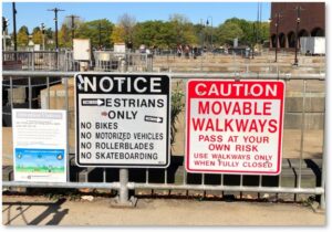
The dam contains three individual locks, two narrow and one wide, and those lock gates hold the pedestrian pathway across the Charles. That’s right, you walk across the tops of the lock gates when they are closed. When they are open, you wait for the boat or barge to clear the lock.

Crossing the Charles

Gridley Locks, Warning signs, Movable walkways, Harbor Walk

This is the entrance

The walk across the locks can go quickly or slowly, depending on the seasons. In the summer, boat traffic from the Charles into Boston Harbor and from the harbor into the river can be heavy. The locks work continually, with boats circling or waiting for their turn.

In the fall and winter, river traffic drops off and you can walk the zig-zag metal grid from one shore to the other with no delays. Pedestrians, bikers (walk your bike), and dogs all use the locks to cross the river. The long brick building close to the Cambridge side, holds the dam mechanism that prevents flooding and keeps the river’s water level steady.

How to Cross the Gridley Locks

Lovejoy Wharf, Harbor Walk, Charles River Dam, Zakim Bridge

Lovejoy Wharf: walk straight ahead

Getting to the Gridley Locks is pretty easy but you have to know where you’re going. In typical Boston fashion, the signage is less than helpful.

  1. Start on Causeway Street.
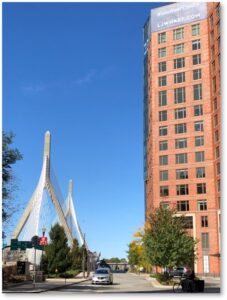
  2. Turn onto Lovejoy Wharf, keeping the Zakim Bridge(opens in a new tab) on your left and the new condominiums on your right. The sign points you toward the Harborwalk, which you can pick up on the other side of the Lovejoy Wharf buildings. There, you can turn toward either the Charlestown Navy Yard or South Station.
  3. Walk past the brick Lovejoy Wharf complex(opens in a new tab). (It’s huge; you can’t miss it.) You will see a State Police building and State Police boats on the right.
  4. Look for the entrance to the locks. It’s straight ahead, marked by signs warning that the gates move. You will probably see people walking in both directions.
  5. Take the path.The floor is a metal grid and there are handrails along the way, so don’t worry about falling into the water. You will also encounter wider places where you can wait if a crowd is coming through or the gates are opening.
  6. The path passes along the dam structure and ends at Paul Revere park in Cambridge.

The Gridley Locks and Photo Ops

That’s it. Easy peasy. And it’s fun. Also, pretty.

Stop along the way and take pictures. On a beautiful day, you can get some lovely shots of the river, nearby bridges (more than you think), and construction of the new Charlestown Bridge(opens in a new tab). (Yes, I know its official name is the North Washington Street Bridge but no one calls it that.) This structure has been so stripped down it took me a few minutes to identify what I was looking at. Should you be so inclined, you can photograph the progress of building the new bridge from this vantage point.

And now you know. Happy crossing.


Zakim Bridge, Harborwalk, Charles River, Gridley Locks

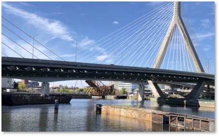
The Zakim Bridge from the locks

Battle of Bunker Hill, with Breed’s Hill at the center.
Location of the Battle of Bunker Hill and the Bunker Hill Monument Due to its close proximity to Boston and its pivotal role during the Battle of Bunker Hill, Breed’s Hill  in Charlestown is mostly remembered for its colonial and revolutionary ties. Settled by English colonists in 1625 and first known as “Cherton,” Charlestown became an important location of craft production thanks to deposits of clay and other raw materials. Home to three hills, there have been disagreements about the names of these heights since the 1600s. According to historian Richard M.

Ketchum:
To the south of it [Bunker Hill], and connected to it by a lower, sloping ridge, was a height of land not sufficiently distinguished to bear any particular name. Some called it Charlestown Hill; others, considering it an appendage of Bunker Hill, referred to it by that title; while some of the local people, out of deference to a farmer whose cattle
grazed there, called it Breed’s. Its steep western flank, covered with orchards and gardens, leveled out near the settlement of Charlestown.

Bunker and Ebenezer Breed, were mostly undeveloped with some farmhouses and pastures.2 Lacking trees along the hills, residents of Boston had an unobstructed view of the Charlestown Heights from the northern section of town.3
After the skirmishes at Lexington and Concord, both the British and colonial forces focused on defensible locations surrounding the town of Boston. As the colonials dug trenches in Roxbury and  Cambridge, the British forces began to prepare to take both the Charlestown and Dorchester Heights: “First, a detachment would move out against Dorchester Neck, throw up two redoubts there, and then attack the rebel post at Roxbury. Once Boston was safe from attack in that direction, Howe would take a large force to Charlestown Heights and either attack the Americans in
Cambridge or outflank that post.” Planned for June 18, General Gage and his staff felt confident they would prevail by the end of the day.4

Learning of the plan, the colonial forces arrived at the Charlestown Heights first on June 16, 1775. Though there are conflicting reports of where the redoubt should have been placed, construction began around 12:30 am on June 17 at Breed’s Hill. After building their defenses throughout the course of the day, the colonists held the high ground as the British troops landed along the Charlestown shoreline. Over the course of about two hours, the battle raged throughout the peninsula. Pitting 2,200 British troops against a varying number of Provincial (colonial) troops led by
Colonel William Prescott, it would become one of the bloodiest battles of the American Revolution.

Over 1,000 British soldiers, officers, and Marines were killed or wounded. Approximately 300 to 500 of the 1,400 to 1,800 provincial soldiers were killed, wounded, or captured. Breed’s Hill would remain in the hands of the British Army until March 1776.5  Though the King Solomon Lodge Masons dedicated a Monument dedicated to Joseph Warren in 1783, a new effort to honor all those who fought during the battle did not begin until the 1820s. On
June 17, 1825, on the 50th anniversary of the battle, a large crowd gathered for a cornerstone-laying ceremony for the future Bunker Hill Monument located at the top of Breed’s Hill. Among those present that day were the General Marquis de Lafayette and former Massachusetts senator, Daniel Webster. It took another 18 years for the Monument to be realized.6

Established on just four of the original 10 acres of the battle, the rest of the area soon became house lots and, eventually, the original Charlestown High School. Annexed by Boston in 1874, Charlestown became a popular neighborhood for working-class Irish immigrants.

In 1923, the Commonwealth of Massachusetts, then the caretaker of the Bunker Hill Monument, installed this plaque (below) on the exterior of the Bunker Hill Lodge adjacent to the Monument.

Breed family members had appealed to the state, as they had previously appealed to the Bunker Hill Monument Association when the Association owned the Monument, that the name “Breed’s Hill” was not displayed somewhere prominently on the hill. State officials agreed and installed this plaque.7


Tudor Wharf

Known also as the Boston Naval Shipyard and the Boston Navy Yard, the Charlestown Navy Yard opened in 1800 as one of the first navy yards of the US Navy. The Charlestown Navy Yard lies in Boston’s Inner Harbor and is at the junction of the Charles and Mystic Rivers. By the time the Yard closed in 1974, it had spread across many acres and contained numerous buildings, piers, dry docks, and more.

Long before the United States established the Charlestown Navy Yard, the tidal flats of this area provided seasonal sustenance to local Indigenous communities for thousands of years. These communities, whose descendants are the Massachusett, called the land Mishawum or “Great Springs.” These flats also became a landing for British infantry transports in the Battle of Bunker Hill on June 17, 1775.

The newly-formed United States emerged from its War of Independence facing threats to its overseas trade. As recommended by President George Washington in 1794, Congress passed the Navy Act, approving the construction of six frigates. This act reestablished the United States Navy that originated as the Continental Navy during the American Revolution. One of those six frigates from 1794 was the USS Constitution.

Getting Started

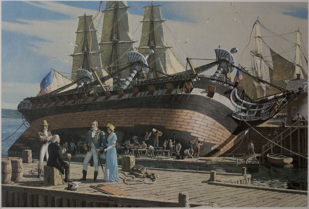
The US Navy established the Charlestown Navy Yard along with five other navy yards. The other yards were located along the Atlantic coast of the 16-state union: Portsmouth, New Hampshire; New York City, New York; Philadelphia, Pennsylvania; Washington D.C.; and Norfolk, Virginia. Among the first buildings constructed in the Yard was a storehouse, called the Navy Store, now known as Building 5, and military housing: the Commandant’s House, the Officers’ Quarters, and the Marine Barracks. The first ship built in the Navy Yard was the USS Independence in 1814. As the biggest ship, called a ship-of-the-line, in the early US Navy, it served alongside smaller frigates like the USS Constitution.

Workers in the Yard built and repaired ships that challenged the British Navy in the War of 1812. Among those ships repaired in the Yard were five of the original six frigates ordered in 1794. All were at least 13 years old by the start of the War of 1812 and all needed repairs. None of these frigates had been built in the Navy Yard. The War of 1812 and the Mexican American War (1846) presented the first big challenges for the workers in the Charlestown Navy Yard since it opened in 1800.

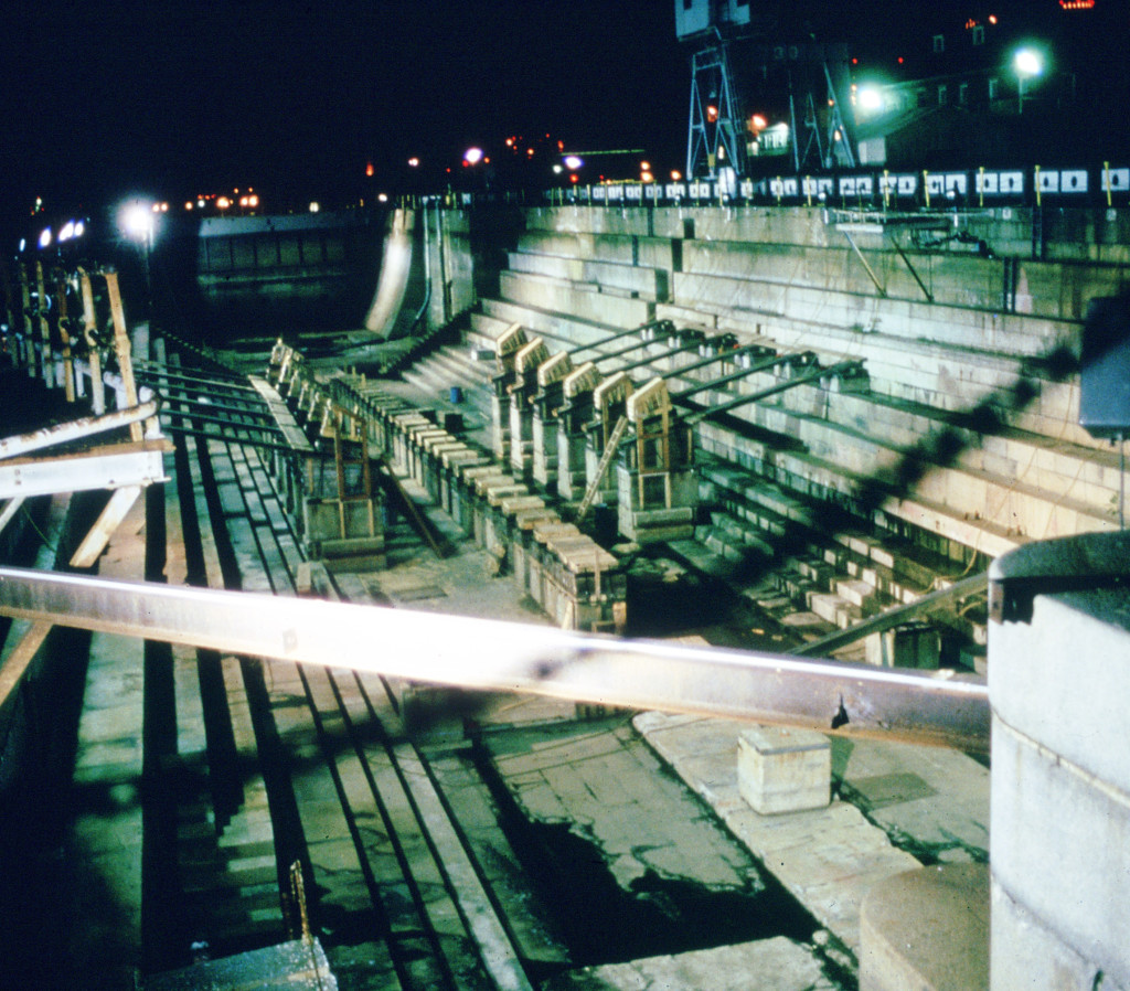
By the 1850s, many ships in the US Navy had steam-powered engines for propulsion, with masts and sails kept as a secondary source of power. The Navy added two new features to the Charlestown Navy Yard by the 1850s: the Ropewalk and Dry Dock 1, both steam-powered. Two of the most famous of the wooden, steam ships built in the Yard were the USS Hartford, which became the flagship of Admiral David G. Farragut during the Civil War, and the USS Merrimack, which became the Confederacy’s Virginia.

The Civil War

The biggest challenge that faced the US Navy in the 19th century was the American Civil War. During the Civil War, the US Navy had to patrol and blockade over 3,000 miles of the southern coast of the United States, some of its interior rivers and international waters. The Navy had fewer than 90 ships in 1861 and it now needed hundreds more. During the war, the Charlestown Navy Yard became one of the Navy’s most productive yards.

Workers at the Charlestown Navy Yard built, repaired, or remodeled over 170 warships during the war. Some of these ships included private ships workers converted to warships to augment the US naval fleet. One of the newer buildings operating in the Navy Yard during the Civil War was the Machine Shop. Machine Shop workers specialized in steam engines for wooden ships and for the newer ironclad ships.

The most well-known naval battle of the Civil War was the clash of the ironclad ships at Hampton Roads, Virginia. This battle inspired the building of numerous ironclad ships by the US Navy. Workers at the Navy Yard and at nearby contractors’ yards launched about ten ironclads during the war.

The American Civil War also led to the innovative ship design known as the double-ender, a ship intended for river travel. This ship could change direction without turning around; workers in the Charlestown Navy Yard made five of them.

In 1865, workers installed a railway system in the Yard to move supplies into and around the Yard. Following the Civil War, the workload and the number of workers decreased at the Charlestown Navy Yard, continuing a Navy tradition of post-war lulls in shipbuilding.

Dirt road lined with trees stretches into the distance on the left side of the photograph, buildings and piles of cannons are on the right side.
Charlestown Navy Yard in 1874 before the modern industrial era of World War I and II.

BNHP, BOSTS 8650-2

The New Navy

A modernization period began in the US Navy in the 1880s, called the era of the New Navy. The US Congress authorized the building of a fleet of steel warships. Part of this authorization included building a second, larger dry dock (Dry Dock 2), additional piers, and a new Forge Shop for the Charlestown Navy Yard. The Navy expected the Yard to build and repair larger steel ships and manufacture all the anchors and anchor chains for this New Navy.

By the Spanish-American War in 1898, Navy ships had hulls of iron or steel and Charlestown Navy Yard workers repaired over fifty of these ships during this short war. In 1904, sixty-five thousand spectators witnessed the launching of the first all-steel ship built at the Charlestown Navy Yard, the USS Cumberland.

By 1915, the Navy had expanded the Yard by constructing nearly 50 new buildings and further developing the Yard’s railroad system. The US Navy was becoming one of the world’s largest navies.

World War I

When the U.S. formally entered World War I (WWI) in 1917, the US Navy had the large task of transporting thousands of US Army soldiers to France and back. Charlestown Navy Yard workers converted three captured German ocean liners and other ships into troop transports; one of the converted liners, the USS America, made nine round trips.

Yard workers repaired and outfitted over 450 ships during WWI including battleships and submarines. Because many Yard workers enlisted in the armed forces in WWI, the Navy turned to women to fill jobs at the Charlestown Navy Yard. The Navy created an enlistment rank called Yeomen (F), F for female, in the Naval Reserve. Over 700 Yeomen (F) worked as telephone and telegraph operators, stenographers, bookkeepers, and typists in the Yard.

In 1917, ten thousand spectators came to the Charlestown Navy Yard to witness the launching of the largest ship ever built in the Yard up until that time, the USS Bridge. The Bridge was the first refrigerated supply ship built by the US Navy. A post-war decrease in U.S. naval forces plus an international treaty that limited navy sizes decreased the work force at the Charlestown Navy Yard in the 1920s.

The hull of a ship from within a dry dock.
USS BRIDGE in Dry Dock 2, Charlestown Navy Yard, 1917. The largest ship built in the Yard up until then.

BNHP, BOSTS 10536-136

World War II

Starting in the 1930s, workers in the Charlestown Navy Yard started the biggest ship-building and ship-repair era in the history of the Charlestown Navy Yard. By the time World War II (WWII) ended in 1945, workers in the Yard launched over 6,000 naval vessels. Destroyers that took one year to complete in 1941 were finished in only 3-4 months by 1945. Due to increased production during WWII, the Charlestown Navy Yard did not have enough space to complete the workload. In response, the Navy built additional facilities at the South Boston Annex along Boston’s Outer Harbor.

Over half the ships ever built in the Yard were built by its workforce during WWII when the Yard had over 50,000 employees. During this time of crisis, the Navy Yard opened its doors to women and people of color. For the first time, the opportunity to make livable wages was available to thousands of people.

The Cold War

After World War II, workers in the Charlestown Navy Yard upgraded Navy vessels including the Fletcher-class destroyer, the USS Cassin Young. These vessels received advanced radar and sonar systems, and some received new engines, missiles, and other enhancements during the 1950s and 1960s in the Yard. The Charlestown Navy Yard specialized in the building and repair of destroyers during WWII and the Cold War. Although not built in the Yard, the USS Cassin Young symbolizes that effort. The USS Cassin Young has been a part of the National Parks of Boston since 1980.

Navy Yard workers were mostly civilians supervised by naval officers, and the Yard functioned like any other industrial plant. While these workers provided critical labor and many excelled in their positions, some experienced racism, sexual harassment, and discrimination. The naval officers had to resolve these issues and others that involved wages, working hours, conditions, and apprenticeship programs. Safety was always a concern since some jobs in the shipyard were hazardous; injuries and deaths from accidents were not unknown over the Yard’s long history.

More than a Shipyard

Within the Charlestown Navy Yard, the Navy provided housing to its military personnel, including the Marines, who worked in the Yard. The Charlestown Navy Yard also had a succession of Receiving Ships docked at the Yard for over a hundred years. A Receiving Ship was a barracks for new sailors and for sailors moving from one ship to another. Sailors also had on-the-job training aboard Receiving Ships. Starting in 1933, sailor housing and training was brought ashore, ending the era of the Receiving Ships.

Starting in 1915, the Yard served as the headquarters of the First Naval District. Naval officers in the Yard had the responsibility of defending parts of the Atlantic Coast of the U.S. There was also a small military prison in the Yard.

During all its years of service, the Charlestown Navy Yard not only provided ships with food, clothing, fuel, weapons, and other items, but also sent supplies to overseas naval stations. The Charlestown Navy Yard supported humanitarian and non-military missions. For example, in 1847, the USS Jamestown departed the Navy Yard to deliver food to the people of Ireland during the Great Famine and Admiral Richard Byrd’s Antarctica scientific expedition sailed from the Yard in 1933.

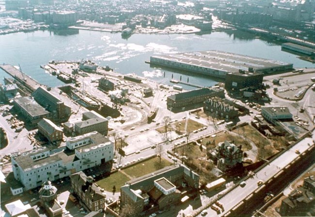
Aerial view of the Charlestown Navy Yard from the 1970s, with Boston harbor in the background.
Aerial view of the Charlestown Navy Yard from February 1974. The Marine Barracks, Commandant’s House, Officers’ Quarters, and Building 5 are all visible.

BNHP, BOSTS 8627

The End

The Charlestown Navy Yard operated for nearly 175 years from the age of sail to the age of steel. The U.S. Navy promoted and protected American interests across the globe, and Charlestown Navy Yard workers provided the Navy with ships and supplies. The Yard also served as the center of production for rope, anchors, and anchor chains for the entire Navy.

The federal government closed the Yard in 1974 and the Navy planned to rely more on private shipyards for its needs. The federal government set aside 30 acres of the Yard to serve as a national historic site; the remaining 100 acres and over 100 buildings became privately owned.

By preserving a portion of the Charlestown Navy Yard, the National Park Service memorializes the contributions of thousands of civilian workers and military personnel. The exhibit, “Serving the Naval Fleet” in the Charlestown Navy Yard Visitor Center in Building 5 tells some of this story. The USS Constitution and the USS Constitution Museum, affiliated with the ship since 1972, are also part of the historic Charlestown Navy Yard. The Charlestown Navy Yard became a National Historic Landmark in 1966.

United States lightship Nantucket (LV-112) is a National Historic Landmark lightship that served at the Lightship Nantucket position. She was the last serving lightship and at time of its application as a landmark, one of only two capable of moving under their own power.[2] She served as the lightship for such notable vessels as the liners United StatesQueen Mary, and Normandie.[4]

The ship was officially designated Light Vessel No. 112 or LV-112 to permanently identify the vessel as the practice was to paint the name of the marked hazard or station on the vessels that often occupied multiple stations.[5] LV-112 was built to replace LV-117 which had been sunk in a collision while assigned to Nantucket Shoals with special safety features and was the largest light vessel ever built. The vessel was somewhat unusual in being only at the Nantucket station except for the war years of 1942-1945 and 1958-1960 when assigned as the relief vessel for the 1st District during which several stations were occupied relieving other vessels.[6]

Government service

Background

Light Vessel 117, serving at the Lightship Nantucket position from 1931, was rammed and sunk on 15 May 1934 by Olympic, a sister ship to Titanic, with loss of seven of the eleven crew aboard.[2][7] The $300,956 cost of the replacement vessel, to be designated LV-112, was paid for by the British Government in compensation for the collision and sinking of LV-117 and was greater than that of any predecessor.[2][6] LV-112 was built to be indestructible, and outlasted all others, serving until 1983.[2]

Construction

The light vessel’s keel was laid for the U.S. Department of CommerceBureau of Lighthouses by the Pusey and Jones Corporation, Wilmington, Delaware, under the firm’s contract 1063 as yard hull 431 on 17 July 1935.[8][9][10] The vessel was launched on 21 March and delivered on 9 May 1936.[8]

The ship was steel hull and superstructure designed for safety in emergencies. The hull was designed with a high degree of compartmentalization with longitudinal and transverse bulkheads with six exits to the upper deck. Length overall was 148 ft 10 in (45.4 m), 121 ft 6 in (37.0 m) length between perpendiculars, beam of 32 ft (9.8 m) and draft of 16 ft 3 in (5.0 m) with the vessel displacing 1,050 tons. Two oil fired Babcock & Wilcox water tube boilers provided steam for the compound reciprocating engine of 600 i.h.p. to give a maximum speed of 12 kn (14 mph; 22 km/h). In 1960 the steam engine was replaced with a 900 h.p. Cooper-Bessemer diesel.[6][8][11]

As built the vessel had a light signal composed of a 500 mm (19.7 in) electric lantern on each of the two mastheads. Fog sound signals were a two tone air diaphone synchronized with a radio beacon, a submarine acoustic oscillator (removed in 1939) and a hand operated bell. For station keeping the ship had a radio direction finder. In 1943 radar was added. In 1960 the lights were replaced with a 500 mm (19.7 in) duplex lens on the foremast and light composed of a four sided revolving lamp with six locomotive headlights on each face on the main mast.[6][11]

Operations

The vessel was stationed on Nantucket Shoals from 1936 to 1942. During the war the vessel was withdrawn from the station, armed with a 3″ gun, and served as an examination vessel operating out of Portland, Maine until reassigned to the station in 1945. In 1958 LV-112 was replaced on the station by the Relief vessel WLV-196 while LV-112 became the 1st District Relief vessel. LV-112 served at Boston, Pollock Rip ShoalStonehorse, Cross Rip, Buzzards Bay and Brenton Reef during that period. In April 1960 the vessel underwent major modification during a refit and modernization at the Coast Guard’s Curtis Bay YardLV-112 was again assigned to Nantucket Shoals from 1960 until 1975.[6]

Retirement

On 21 March 1975 LV-112 was withdrawn from Nantucket station and replaced by WLV-612 and decommissioned on 28 March 1975 for lay up at Chelsea, Massachusetts. During 6–7 December a volunteer crew of Nantucket Islanders delivered the ship to Nantucket for use as a museum ship until 1984. The vessel was sold in 1986 to Nantucket Lightship Preservation, Inc., of Boston for restoration and preservation.[6]

Private ownership[edit]

The vessel was declared a National Historic Landmark in 1989. At that time, the ship was located at the Southern Maine Vocational Technical Institute Pier in South Portland, Maine, but touring along the New England Coast.[12] An organization[clarification needed] was seeking a permanent home for her in Portland, Maine.[2]

She later was planned to be located permanently in Staten Island, New York, but sojourned for several years at Oyster Bay, New York. Some controversy has arisen over damage to wharves and unsightliness at Oyster Bay; other locals have wanted her retained there.[13][14][15]

She was purchased in October 2009 by the United States Lightship Museum (USLM) under the leadership of Robert Mannino Jr. for $1 and arrived under tow in Boston Harbor on 11 May 2010.[16] She will be restored in two phases over the next several years, a job that will cost $1 million.[17] She is currently undergoing renovations as a floating museum, but is open to the public at Boston Harbor Shipyard and Marina at 256 Marginal Street in East BostonMassachusetts.

General Edward Lawrence Logan International Airport[4] (IATABOSICAOKBOSFAA LIDBOS), also known as Boston Logan International Airport[5][6] and commonly as Boston LoganLogan Airport or simply Logan, is an international airport that is located mostly in East Boston and partially in Winthrop, Massachusetts. It opened in 1923, covers 2,384 acres (965 ha), has six runways and four passenger terminals, and employs an estimated 16,000 people. It is the largest airport in both the Commonwealth of Massachusetts and the New England region in terms of passenger volume and cargo handling as well as the busiest airport in the Northeastern United States outside the New York metropolitan area. The airport saw 42 million passengers in 2019, the most in its history. It is named after General Edward Lawrence Logan, a 20th-century war hero native to Boston.

Logan has non-stop service to destinations throughout the United States, Canada, Latin America, the Caribbean, the North Atlantic region (including Bermuda and the Azores), Europe, Africa, Asia, and the Middle East.[7] BOS is the northeastern hub for Cape Air and is the secondary transatlantic hub for Delta Air Lines, serving several destinations in Europe. It is also an operating base for JetBlue.[8][9] American Airlines and United Airlines also carry out significant operations from the airport, including daily transcontinental flights, as well as daily flights to London-Heathrow. All of the major U.S. air carriers offer flights from Boston to all or the majority of their primary and secondary hubs.

History

Origins

Logan Airport opened on September 8, 1923, and at that time it was mainly used by the Massachusetts Air National Guard and the United States Army Air Corps. during this time, it was known as Jeffrey Field. The first scheduled commercial passenger flights to start at the new airfield were on Colonial Air Transport between Boston and New York City, starting in 1927.[10] On January 1, 1936, the airport’s weather station became the official point for Boston’s weather observations and records by the National Weather Service.[11]

Early postwar development

During the 1940s and 1950s, due to the rise in demand for air travel, the airport added 1,800 acres (2.8 sq mi; 7.3 km2; 730 ha) of landfill in Boston Harbor, taken from the former GovernorsNoddle’s and Apple Islands. During this time, the airport expanded the terminals, adding terminals B and C in 1949, which are still in use today. In 1943, the state of Massachusetts renamed the airport after Maj. Gen. Edward Lawrence Logan, a Spanish–American War officer from South Boston, a statue of whom by sculptor Joseph Coletti was unveiled and dedicated on May 20, 1956.[10][12][13] In 1952, Logan Airport became the first in the United States with an indirect rapid transit connection, with the opening of the Airport station on the Blue Line.[14]

Boston became a transatlantic gateway after World War II. In the late 1940s, American Overseas Airlines began operating a weekly Boston-Shannon-London service,[15] shortly after, Pan Am began operating nonstop service to Shannon Airport in Ireland and Santa Maria Airport in the Azores, continuing to London and Lisbon respectively.[16] By the early 1950s, BOAC had started nonstop Stratocruiser service to Glasgow and Prestwick in Scotland,[17] and Air France began operating a multi-stop Constellation service linking Boston to Orly Airport in Paris.[18] BOAC thereafter began service on the new De Havilland Comet, the first commercial jetliner in the world, on direct flights to Boston from London Heathrow. In April 1957, the Official Airline Guide showed 49 weekday departures with the list as follows: American, 31 Eastern, 25 Northeast Airlines, 8 United Airlines, 7 TWA domestic, 6 National Airlines, 6 Mohawk Airlines, 2 Trans-Canada Air Lines and one Provincetown-Boston Airlines. In addition TWA had nine departures a week to or from the Atlantic, Pan Am had 18, Air France 8, BOAC 4 and Alitalia 4.[19] Aer Lingus launched nonstop Constellation service to Shannon in 1958.[20]

The airport was renamed General Edward Lawrence Logan International Airport by an act of the state legislature on April 29, 1954, reflecting the growing international market.[21]

Introduction of the jumbo jet and early international expansion

The jumbo jet era began at Logan in the summer of 1970, when Pan Am started daily Boeing 747 service to London Heathrow. Until 2020, the Boeing 747-400 was scheduled on flights to Boston by British Airways.[22] Lufthansa operates Boeing 747s, including the latest-model Boeing 747-8, on its daily nonstop flights to Frankfurt.[23]

Terminal E was the second largest international arrivals facility in the United States when it opened in 1974.[24] Between 1974 and 2015, the number of international travelers at Logan tripled.[25] International long-haul travel has been one of the fastest growing market sector’s at the airport. Massachusetts Port Authority (Massport) undertook the “Logan Modernization Project” from 1994 to 2006: a new parking garage, a new hotel, moving walkways, terminal expansions and improvements, and two-tiered roadways to separate arrival and departure traffic.[10]

Massport’s relationship with nearby communities has been strained since the mid-1960s,[26] when the agency took control of a parcel of residential land and popular fishing area near the northwest side of the airfield. This land included Frederick Law Olmsted‘s 46-acre Wood Island Park, a valued recreational area for a neighborhood with “fewer park and recreation facilities than other neighborhood in the city.”[27] After decades of litigation, the forfeiture was undertaken to extend Runway 15R/33L, which later became Logan’s longest runway via artificial land.[28] Outside of the park on Neptune Road, residents of the neighborhood, formerly, with its convenient park access, the “most prestigious street in East Boston,”[27] were bought out of their homes and forced to relocate. Public opposition came to a head when residents laid down in the streets to block bulldozers and supply trucks from reaching the construction zone.[29]

Modern international expansion and runway additions

Cargo loading of a Lufthansa Boeing 747-400 during a temporary closure due to heavy snowfall

Runway 14/32, Logan’s first major runway addition in more than forty years, opened on November 23, 2006. It was proposed in 1973, but was delayed in the courts.[30] According to Massport records, the first aircraft to use the new airstrip was a Continental Express ERJ-145 regional jet landing on Runway 32, on the morning of December 2, 2006.

In April 2007, the FAA approved construction of a center field taxiway long-sought by Massport. The 9,300-foot (2,830 m) taxiway is between, and parallel to, Runways 4R/22L and 4L/22R. News of the project angered neighboring residents.[31] In 2009 the taxiway opened ahead of schedule and under budget.[32] To ensure the taxiway is not mistaken for a runway, “TAXI” is written in large yellow letters at each end.

A scene from the 2006 film The Departed was filmed at Logan, inside the connector bridge between Terminal E and the Central Parking Garage. Terminal C and several United Airlines and Northwest Airlines aircraft can be seen in the background. Parts of the Delta Air Lines 2007 “Anthem” commercial were filmed in Terminal A as well as the connector bridge between Terminal A and Central Parking.

In October 2009 US Airways announced it would close its Boston crew base in May 2010. The airline cited an “operations realignment” as the reason.[33] Over 400 employees were transferred or terminated.[34]

After starting service to Logan in 2004, JetBlue was a major operator at Logan Airport by 2008 and its largest carrier by 2011, with flights to cities throughout North America and the Caribbean.[35]

The Airbus A380 first landed at Logan International Airport for compatibility checks on February 8, 2010. On March 26, 2017, British Airways began flying the A380 to Logan, operating the aircraft three times per week.[36] British Airways announced in October 2018, that A380 service to Boston would expand to daily frequency during the summer 2019 season, beginning on March 31, 2019.[37] Likewise, in January 2019, Emirates announced that it would be deploying the A380 on its daily flight between Logan and Dubai during the June–September 2019 summer season, as high peak seasonal services replacing the B777-300ER on that route. Emirates intends to utilise the A380 as a daily service once the market demand has been achieved.[38]

It is included in the Federal Aviation Administration (FAA) National Plan of Integrated Airport Systems in which it is categorized as a large hub primary commercial service facility.[39]

Boston Harbor is a natural harbor and estuary of Massachusetts Bay, and is located adjacent to the city of BostonMassachusetts. It is home to the Port of Boston, a major shipping facility in the Northeastern United States.[1]

History

Brig “Antelope” in Boston Harbor, by Fitz Henry Lane, 1863 (Museum of Fine Arts, Boston)

Since its discovery to Europeans by John Smith in 1614,[2] Boston Harbor has been an important port in American history. Early on, it was recognized by Europeans as one of the finest natural harbors in the world due to its depth and natural defense from the Atlantic as a result of the many islands that dot the harbor. It was also favored due to its access to the Charles RiverNeponset River and Mystic River which made travel from the harbor deeper into Massachusetts far easier.[3] It was the site of the Boston Tea Party, as well as almost continuous building of wharves, piers, and new filled land into the harbor until the 19th century. By 1660, almost all imports came to the greater Boston area and the New England coast through the waters of Boston Harbor. A rapid influx of people transformed Boston into an exploding city.

Pollution and cleanup efforts

The health of the harbor quickly deteriorated as the population of Boston increased. As early as the late 19th century Boston citizens were advised not to swim in any portion of the Harbor. In the 19th century, two of the first steam sewage stations were built (one in East Boston and one later on Deer Island). With these mandates, the harbor was seeing small improvements, but raw sewage was still continuously pumped into the harbor. In 1919, the Metropolitan District Commission was created to oversee and regulate the quality of harbor water. However, not much improvement was seen and general public awareness of the poor quality of water was very low. In 1972, the Clean Water Act was passed in order to help promote increased national water quality.

Signage on the streets of Boston

Boston did not receive a Clean Water Act waiver from the Environmental Protection Agency, leaving Boston with little incentive to increase water quality of the harbor.[clarification needed] Since the mid-1970s organizations within the Boston community have battled for a cleaner Boston Harbor. More recently, the harbor was the site of the $4.5 billion Boston Harbor Project. Failures at the Nut Island sewage treatment plant in Quincy and the companion Deer Island plant adjacent to Winthrop had far-reaching environmental and political effects. Fecal coliform bacteria levels forced frequent swimming prohibitions along the harbor beaches and the Charles River for many years.[4] The city of Quincy sued the Metropolitan District Commission (MDC) and the separate Boston Water and Sewer Commission in 1982, charging that unchecked systemic pollution of the city’s waterfront contributed to the problem. That suit was followed by one by Conservation Law Foundation and finally by the United States government, resulting in the landmark[5] court-ordered[6] cleanup of Boston Harbor.[7]

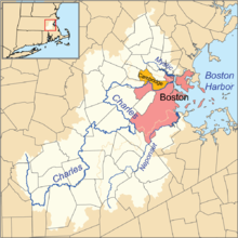
The CharlesMystic, and Neponset rivers empty into Boston Harbor.

The lawsuits forced then-Massachusetts Governor Michael Dukakis to propose separating the water and sewer treatment divisions from the MDC, resulting in the creation of the Massachusetts Water Resources Authority in 1985. The slow progress of the cleanup became a key theme of the 1988 U.S. presidential election as George H. W. Bush defeated Dukakis partly through campaign speeches casting doubt on the governor’s environmental record,[8] which Dukakis himself had claimed was better than that of Bush.[9] The court-ordered cleanup continued throughout the next two decades and is still ongoing.[7][10]

Before the clean-up projects, the water was so polluted that The Standells released a song in 1965 called “Dirty Water” which referred to the sorry state of the Charles River. Neal Stephenson, who attended Boston University from 1977 to 1981, based his second novel, Zodiac, around pollution of the harbor.

Since the writing of the song, the water quality in both the Harbor and the Charles River has significantly improved, and the projects have dramatically transformed Boston Harbor from one of the filthiest in the nation to one of the cleanest. Today, Boston Harbor is safe for fishing and for swimming nearly every day, though there are still beach closings after even small rainstorms, caused by bacteria-laden storm water and the occasional combined sewer overflow.

In 2022, pieces of plastic transmission line used in rock explosives, (known as explosive shock tubing) began washing up on coastal shores of Cape Cod and Rhode Island.[1] This led to an investigation that was conducted by the U.S. Army Corps of Engineers, it was suspected to have been related to a concluded Boston Harbor dredging project. The outcome was to seek to find methods to prevent future environmental impacts from reoccurring.

Geography

A section of the Boston Harborwalk

Coast Guard escorts an LNG tanker in Boston Harbor, 2016

Boston Harbor is a large harbor which constitutes the western extremity of Massachusetts Bay. The harbor is sheltered from Massachusetts Bay and the open Atlantic Ocean by a combination of the Winthrop Peninsula and Deer Island to the north, the hooked Nantasket Peninsula and Point Allerton to the south, and the harbor islands in the middle. The harbor is often described as being split into an inner harbor and an outer harbor.[11][12][13] The harbor itself comprises 50 square miles (130 km2) with 180 miles (290 km) of shoreline and 34 harbor islands.

Inner harbor

The inner harbor was historically the main port of Boston and is still the site of most of its port facilities as well as the Boston waterfront, which has been redeveloped for residential and recreational uses. The inner harbor extends from the mouths of the Charles River and the Mystic River, both of which empty into the harbor, to Logan International Airport and Castle Island, the latter now connected by land in 1928 to Boston, where the inner harbor meets the outer harbor.

Outer harbor

The outer harbor stretches to the south and east of the inner harbor. To its landward side, and moving in a counterclockwise direction, the harbor is made up of the three small bays of Dorchester BayQuincy Bay and Hingham Bay. To seaward, the two deep water anchorages of President Roads and Nantasket Roads are separated by Long Island. The outer harbor is fed by several rivers, including the Neponset River, the Weymouth Fore River, the Weymouth Back River and the Weir River.[11][12][13]

Dredged deepwater channels stretch from President Roads to the inner harbor, and from Nantasket Roads to the Weymouth Fore River and Hingham Bay via Hull Gut and West Gut. Some commercial port facilities are located in the Fore River area, an area which has a history of shipbuilding including the notable Fore River Shipyard.[11][12][13]

Land fill

In the 1830s, members of the maritime community observed physical decay in the harbor. Islands in the outer harbor were visibly deteriorating and erosion was causing weathered materials and sediment to move from where it was protecting the harbor to where it would do the most harm. Recent shoaling experiences and comparisons with old charts caused observers to insist that the inner harbor was also filling and created widespread anxiety about the destruction of the Boston Harbor. Although the scientific understanding of hydraulics was still in its infancy and there were high degrees of uncertainty regarding the meeting of land and water, scientists and engineers began to describe the Boston Harbor as a series of channels created and maintained by the scouring force of water moving in and out of the harbor, river systems, and tidal reservoirs. This interpretation came to be known as the theory of Tidal scour. This understanding of the harbor as a dynamic landscape assuaged concerns some had over the negative impacts of land fill operations of land and real estate developers.[14]

As the 19th century progressed, the acceleration of urban growth dramatically increased the need for more land. The Ordinance of 1641 extended the property rights of riparian owners from the line of low tide to a maximum distance of 100 rods (1,600 ft; 500 m) from the line of high tide. Generally, other states drew the line of private property at high tide. However, extending shore lines into bordering bodies of water was not unique to Boston. Chicago built into Lake Michigan, New York extended itself into the Hudson and East rivers, and San Francisco reclaimed sections of its bay. The Boston Harbor’s unique geography inspired the law that made land reclamation such a widespread activity in Boston. By the end of the nineteenth century, the city had created more land in two generations than it had in the previous two centuries.[15]

Harbor Islands

Georges Island, with star-shaped Fort Warren

Boston Harbor contains a considerable number of islands, 34 of which have been part of the Boston Harbor Islands National Recreation Area since its establishment in 1996. The following islands exist within the harbor, or just outside it in Massachusetts Bay:

State Police inflatable patrols off Logan International Airport

Former warehouse repurposed as housing and a restaurant, on Commercial Wharf near Atlantic Avenue

Two former islands, Castle Island and Deer Island, still exist in a recognizable form. Castle Island was joined to the mainland by land reclamation, while Deer Island ceased to be an island when the channel which formerly separated it from the mainland was filled in by the New England Hurricane of 1938.

Nut Island is a small former island in Boston Harbor that was joined by landfill to the Houghs Neck peninsula in northeastern Quincy by the 1940s so it could be used as the site of a sewage treatment facility.[16]

Two other former islands, Apple Island and Governors Island, have been subsumed into land reclamation for Logan International Airport.

The Harbor Islands have made up Boston’s least populated electoral area, Ward 1, Precinct 15, since 1990, though the polling place is on the mainland at Columbia Point. Since 1920, Boston must pass legislation to redistrict. As of 2018, there were two active voters, staff at the Thompson Island Outward Bound Educational Center. There were previously registered voters at a recovery center and a homeless shelter on Long Island, but few voted and they have closed.[17][18]

Aquaculture

In 1996, the Boston Globe reported that Mayor Thomas Menino and MIT engineer Clifford Goudey were planning a program to use the great tanks on Moon Island as a fish farm or a temporary home for tuna or lobster in an attempt to implement a recirculating aquaculture system in Boston Harbor.[19][20][21] The prices of both these fish types vary by season. The plan was to collect and store fish in the tanks and sell the fish at higher prices when they were out of season. Nothing has come of this plan to date.

25 Harbor Shore Drive
Boston, MA 02210
617-478-3100
A stunning waterfront museum, the ICA is Boston’s destination for discovering the art and artists of our time.

Located in a breathtaking building on Boston Harbor, the ICA is within walking distance from downtown Boston and is easily accessible by public transportation. Experience dynamic exhibitions and performances in a spectacular waterfront setting.

The North End is a neighborhood of BostonMassachusetts.[1] It has the distinction of being the city’s oldest residential community, which has been inhabited since it was colonized in the 1630s. It is only 0.36 square miles (0.93 km2), yet the neighborhood has nearly one hundred establishments and a variety of tourist attractions. It is known for its Italian American population and Italian restaurants.

History

The Clough House, built in 1712

Hanover Street, 1930

Hanover Street, 2010

17th century

The North End as a distinct community of Boston was evident as early as 1646.[2] Three years later, the area had a large enough population to support the North Meeting House. The construction of the building also led to the development of the North Square, which was the center of community life.[2][3]

Increase Mather was the minister of the North Meeting House, an influential and powerful figure who attracted residents to the North End.[2] His home, the meeting house, and surrounding buildings were destroyed by a fire in 1676, but the meeting house was rebuilt soon afterwards. The Paul Revere House was later constructed on the site of the Mather House.[2] Part of Copp’s Hill was converted to a cemetery, called the North Burying Ground (now known as Copp’s Hill Burying Ground). The earliest grave markers located in the cemetery date back to 1661.[3]

18th century

The North End became a fashionable place to live in the 18th century.[3] Wealthy families shared the neighborhood with artisans, journeymen, and laborers.[2] Two brick townhouses are still standing from this period: the Pierce-Hichborn House and the Ebenezer Clough House on Unity Street.[3] The Old North Church was constructed during this time as well, now known as Christ Church. It is the oldest surviving church building in Boston.[3]

The Hutchinson Mansion in North Square was attacked by anti-Stamp Act rioters on the evening of August 26, 1765, forcing Lieutenant Governor Thomas Hutchinson to flee through his garden.[4] In 1770, 11 year-old Christopher Seider was part of an angry crowd that attacked the home of Ebenezer Richardson which was located on Hanover Street. Richardson fired a gun into the crowd, hitting and fatally wounding the boy.[2]

During the Siege of Boston, the North Meeting House was dismantled by the British for use as firewood.[2][4]

19th century

In the first half of the 19th century, the North End experienced a significant amount of commercial development. This activity was concentrated on Commercial, Fulton, and Lewis Streets. During this time the neighborhood also developed a red-light district, known as the Black Sea.[2] By the late 1840s, living conditions in the crowded North End were among the worst in the city.[4][5] Successive waves of immigrants came to Boston and settled in the neighborhood, beginning with the Irish and continuing with Eastern European Jews and Italians.[6] Boston as a whole was prosperous, however, and the wealthy residents of the North End moved to newer, more fashionable neighborhoods such as Beacon Hill.[4]

In 1849, a cholera epidemic swept through Boston, hitting the North End most harshly; most of the seven hundred victims were North Enders.[4][7] In 1859, tensions between the Catholic Irish immigrants and the existing Protestant community led to the Eliot School Rebellion. By 1880, the Protestant churches had left the neighborhood.[2]

The Boston Draft Riot of July 14, 1863 began on Prince Street in the North End.[4][8]

In the latter half of the 19th century, several charitable groups were formed in the North End to provide aid to its impoverished residents. These groups included The Home for Little Wanderers and the North End Mission. The North Bennet Street Industrial School (now known as North Bennet Street School) was also founded at around this time to provide North End residents with the opportunity to gain skills that would help them find employment.[2] Beginning in the 1880s, North End residents began to replace the dilapidated wooden housing with four- and five-story brick apartment buildings, most of which still stand today. The city contributed to the revitalization of the neighborhood by constructing the North End Park and Beach, Copp’s Hill Terrace, and the North End Playground.[2]

20th century

North End as viewed from the Custom House Tower

In the early 20th century, the North End was dominated by Jewish and Italian immigrants.[6] Three Italian immigrants founded the Prince Macaroni Company, one example of the successful businesses created in this community.[4][9] Also during this time, the city of Boston upgraded many public facilities in the neighborhood: the Christopher Columbus School (now a condominium building), a public bathhouse, and a branch of the Boston Public Library were built.[2][10] These investments, as well as the creation of the Paul Revere Mall (also known as the Prado), contributed to the North End’s modernization.[2] The Civic Service House‘s Night School, established in 1901, set out to do specialized settlement work along civic lines, and purposed to reach a constituency approaching or within the privileges of citizenship.[11]

In 1918, the Spanish Influenza Pandemic hit the crowded North End severely; so many children were orphaned as a result of the pandemic that the city created the Home for Italian Children to care for them.[4] The following year, in 1919, the Purity Distilling Company’s 2.3 million gallon molasses storage tank explosively burst open, causing the Great Molasses Flood. A 25 ft wave of molasses flowed down Commercial Street towards the waterfront, sweeping away everything in its path. The wave killed 21 people, injured 150, and caused damage worth $100 million in today’s money.[2][6][12]

In 1927, the Sacco and Vanzetti wake was held in undertaker Joseph A. Langone, Jr.’s Hanover Street premises. The funeral procession that conveyed Sacco and Vanzetti’s bodies to the Forest Hills Cemetery began in the North End.[4]

In 1934, the Sumner Tunnel was constructed to connect the North End to Italian East Boston, the location of the then-new Boston Airport (now Logan International Airport). In the 1950s the John F. Fitzgerald Expressway (locally known as the Central Artery) was built to relieve Boston’s traffic congestion. Hundreds of North End buildings were demolished below Cross Street, and the Artery walled off the North End from downtown, isolating the neighborhood.[2][5] The increased traffic led to the construction of a second tunnel between the North End and East Boston; this second tunnel (the Callahan Tunnel) opened in 1961.[2] Although the construction of the Central Artery created years’ worth of disorder, in the 1950s the North End had low disease rates, low mortality rates, and little street crime.[2] As described by Jane Jacobs in The Death and Life of Great American Cities, in 1959 the North End’s “streets were alive with children playing, people shopping, people strolling, people talking. Had it not been a cold January day, there would surely have been people sitting. The general street atmosphere of buoyancy, friendliness, and good health was so infectious that I began asking directions of people just for the fun of getting in on some talk.”[13]

Throughout the 1960s and 1970s, the North End experienced population loss. During this time, many shops in the neighborhood closed, the St. Mary’s Catholic School and the St. Mary’s Catholic Church closed, and the waterfront industries either relocated or went defunct. During the 1970s and 1980s, the Boston Redevelopment Authority approved high-rise, high-density housing projects in the neighborhood while North End residents worked to build affordable housing for the elderly. One of these projects, the Casa Maria Apartments, stands on the site of the St. Mary’s Catholic Church.[2]

In 1976, the neighborhood welcomed President Ford and Queen Elizabeth II, who each visited the North End as part of the United States Bicentennial Celebrations.[2]

During the late 20th century through the early 21st century, the Central Artery was dismantled and replaced by the Big Dig project.[14] Throughout the construction process, access to the North End was difficult for both residents and visitors; as a result, many North End businesses closed.[2] The Rose Kennedy Greenway is now located on the former site of the Central Artery.[2]

Geography

Boston in 1775. The entire city lies on the Shawmut Peninsula. The North End is the smaller promontory at the northeast corner of the peninsula, separated from the rest of the city by a large mill pond. Copp’s Hill is called Corps Hill, and Hanover Street, the main thoroughfare of the community, is called Middle Street on this map.

The North End describes its location in the historic Shawmut Peninsula, which centuries of infill have obscured. Copp’s Hill is the largest geographic feature and is close to the center of the neighborhood.

The North End’s modern boundaries are to the northeast of the Rose Fitzgerald Kennedy Greenway, with the outlet of the Charles and Mystic Rivers to the North, and Boston Harbor to the East. Government CenterQuincy Market, and the Bulfinch Triangle neighborhoods lie across Greenway. The Charlestown Bridge crosses the mouth of the Charles River to connect the North End to Charlestown, while the Callahan TunnelSumner Tunnel, and MBTA Blue Line tunnel connect it to East Boston.

Commercial Street and Atlantic Avenue border the neighborhood on the harbor side, while Hanover Street bisects the neighborhood and is the main north-south street. Cross Street and North Washington Street runs along the community’s western edge. The North End Parks of the Greenway occupy the site of the former elevated Central Artery (demolished in 2003). Other notable green spaces include Cutillo Park, Polcari Park, Langone Park, DeFilippo Playground, the Paul Revere Mall (The Prado),and the Christopher Columbus Waterfront Park.

No MBTA subway station is within the neighborhood, but stations serving the Blue, Orange, and Green Lines are within 5-10 minute walks, including AquariumHaymarket, and North Station.

Demographics

According to the 2010 Census data, the neighborhood’s population is 10,131, a 5.13% rise from 2000. The majority of the North End’s residents are White (90.88%), followed by Hispanic or Latino (3.69%), Asian (2.83%), Black/African Americans (1.13%), two or more races/ethnicities (1.01%) other race/ethnicity (0.29%), American Indian and Alaska Native (0.15%), and Native Hawaiian and Other Pacific Islander (0.03%).[15][16]

Crime

The North End is located within the A-1 police district (Downtown, Beacon Hill, and Chinatown are also included in this district).[17] Residents complain of repeated noise and litter problems stemming from loud partying in the neighborhood. As of 2012, Boston police officers have increased patrols in the North End to deal with noise complaints.[18] Other areas of ongoing concern are several attacks on women in recent years and a series of breaking and enterings to residential apartments.[19][20][21]

Members of the Patriarca crime family have historically lived in or operated out of the North End, including Gennaro AngiuloGaspare Messina, and the Dinunzio brothers (Anthony & Carmen).[22]

African American community

A small community of free African Americans lived at the base of Copp’s Hill from the 17th to the 19th century. Members of this community were buried in the Copp’s Hill Burying Ground, where a few remaining headstones can still be seen today.[2][6] The community was served by the First Baptist Church.[2]

By the late 19th century, the African American community of the North End was known as New Guinea. By that time, however, much of the community had actually moved to Beacon Hill.[2]

Irish community

Between 1845 and 1853, a massive wave of Irish immigrants settled in the North End; the neighborhood became predominantly Irish (the city’s overall population was also affected, going from a predominantly Yankee-Protestant city to being one-third Irish in just a few years).[4] Between 1865-1880, the North End was almost exclusively Irish (or Irish-American) and Catholic.[2]

Jewish community

In the late 19th century, a stable Jewish community began to develop in the North End. Much of the community settled along Salem Street. The community founded places of worship, a Hebrew School, and social programs. In 1903, the first and only new synagogue to be built in the North End was constructed. Carroll Place was renamed “Jerusalem Place” in honor of the new building.[2] By 1922, however, the majority of Jewish residents had moved out of the North End, preferring other neighborhoods such as Roxbury.[2]

Italian community

By 1890, the North Square area was known as Little Italy.[2] The population of Italian immigrants in the North End grew steadily until reaching its peak, in 1930, of 44,000 (99.9% of the neighborhood’s total population).[23] Although many businesses, social clubs, and religious institutions celebrate the neighborhood’s Italian heritage, the North End is now increasingly diverse.[24] Both the population of the North End and the percent of that population who are Italian have decreased over the years; as of 2014 the population of the North End was 7,360, of whom 824 (11%) had been born in Italy and an additional 2,772 (38%) were of Italian heritage.[25]

In 1923, the Michael Angelo (later renamed “Michelangelo”) School was built in the North End and named in honor of the Italian residents. The street on which the building was constructed was renamed Michelangelo Street, and remains the only street in the North End with an Italian name.[2] The Michelangelo School closed in 1989, and the building was converted into housing.[2]

Italian bakeries, restaurants, small shops, and groceries opened in the first half of the 20th century. The first immigrants found work selling fruit, vegetables, wine, cheese and olive oil. Later immigrants found more opportunities in the construction trades, and by 1920 the neighborhood was served by Italian physicians, dentists, funeral homes, and barbers.[23] Residents founded businesses, some of which still exist today, including Prince Pasta,[9] the Pastene Corporation,[2][23][26] and Pizzeria Regina.

The Italian American community faced anti-Italian sentiment, prejudice, and neglect. After World War II, however, Italian Americans began to gain political power which then helped the community to address these issues. Today, the “old world” Italian atmosphere of the North End helps to drive tourism, and many of the small neighborhood shops have been replaced by restaurants.[23] Italian feasts, such as the Feast of St. Anthony and the Fisherman’s Feast, are still celebrated in the streets of the North End, and draw large crowds.[23]

Sector Boston, “The Birthplace of the Coast Guard,” is a regional operational command responsible for coastal safety, security, and environmental protection from the New Hampshire-Massachusetts  border southward to Plymouth, Massachusetts out to 200nm offshore. Sector Boston directs over 1,500 Active Duty, Reserve, and Auxiliary members, four multi-mission response boat stations, 3 multi-mission cutters, and an Aids to Navigation Team to protect and secure vital infrastructure,  rescue mariners in peril at sea, enforce federal law, maintain our navigable waterways, and respond to all hazards impacting the maritime transportation system and coastal region.

The institutions that form the modern day Coast Guard were born here. The first commissioned cutter in the Revenue Cutter Service, the MASSACHUSETTS, was built in Newburyport in 1789, homeported in Boston, and commanded by Boston-born John Foster Williams; his final resting place is in the North End within sight of the Sector. Fabled lifesaver, Joshua James, served in the surfboat services from 1841 starting at age 15 until his death in 1902 at the age of 75; he was personally credited with over 200 lives saved. He received command of the Point Allerton Lifesaving Station in Hull, Massachusetts in 1889 at age 62 and died on the beach after drilling with his hand-rowed surf boat crew. During his 13-year command, his station was credited with 540 lives saved. The Coast Guard operates a station at Point Allerton to this day. Boston Light celebrated its 300th anniversary in September 2016 and was the first light house constructed in what is now the United States. Built in 1716 on Little Brewster Island in Boston Harbor, it was destroyed by withdrawing British forces in 1776 during the Revolutionary War, and later reconstructed to the same exact dimensions in 1783 by the Massachusetts government. The Light was ceded to the United States government in 1790 and was administered under several Lighthouse bureaus before being made part of the U.S. Coast Guard in 1942. It is the only remaining permanently manned light house in federal service.

The men and women of Sector Boston maintain the same traditions as those who founded our nation and our service and serve the nation and coastal Massachusetts with the same dedication. We take inspiration from those that heroically laid our foundation and are devoted to remaining “Semper Paratus”, Always Ready, just as they did.

One if by land, and two if by sea…

– Henry Wadsworth Longfellow, “Paul Revere’s Ride,” 1860

On the evening of April 18, 1775 Robert Newman and John Pulling quietly entered Old North and carefully climbed to the top of the church’s bell tower. They briefly hung two lanterns near the windows and made their escape. This signal, from the tallest structure in the town of Boston, served as an early warning that a detachment of the British Army was crossing the Charles River and heading west towards the towns of Lexington and Concord. By the end of the next night, the American Revolutionary War had begun.


Old North’s Divided Congregation

Christ Church, long known as “Old North,” has deep roots in Boston’s North End. Though it is remembered today as a symbol of patriot defiance, the story of Old North is a reflection of the deepening divisions between “Friends of the Government” and “Sons of Liberty” in Revolutionary Boston.

Built in 1723, Old North was an Anglican, or official church of England, rather than a Congregational, or Puritan, church. Although the Charter of 1692 required greater religious tolerance in Massachusetts, many Bostonians still feared the influence of the official Church of England. Nonetheless, many wealthy merchants, government officials, and skilled tradesmen were drawn to “Old North.” The stained glass windows, expensive pews, and Georgian architecture represented a stunning contrast to the simplicity of Congregational churches like Old South Meeting House.

Despite being an Anglican church, “Old North” was different from other Church of England parishes in New England. While many people viewed Anglican churches as “tory” or “loyalist” congregations, Christ Church was split. Political and financial disputes plagued the church, resulting in the church’s minister and vocal loyalist Rev. Mather Byles Jr. resigning on April 18, 1775. That same night, the church’s sexton, Robert Newman, and a vestryman (lay-leader) of the church, John Pulling, entered the sanctuary to aid the patriot cause.

The Signal

According to an account by Paul Revere, on the night of April 18, 1775, he “called upon a friend, and desired him to make the Signals.”1 That friend was John Pulling, and Pulling, with the assistance of Robert Newman, secretly fulfilled Revere’s request. The signal was arranged just days before: One lantern if British regular troops march out of Boston by land, two if they depart by boats across the river. Revere himself was not waiting for this signal. He arranged the signal because it would be the fastest and most reliable means to send warning outside Boston. After conferring with Pulling, Revere still had to stop by his home, get on a boat, and be carefully rowed to Charlestown past a British warship. There were many opportunities when Revere could have been detained or arrested before even getting on horseback.

After the lanterns briefly hung, Pulling fled Boston to evade arrest. Newman, who lived with his mother, had British soldiers as boarders in his home. Newman had to climb through his bedroom window to avoid detection. The next day, Newman was arrested and questioned but was ultimately released. By the end of that same day, April 19, 1775 a running battle had unfolded along twenty miles of Massachusetts countryside. Thanks in part to the signals atop Christ Church, the Revolutionary War had begun.

Boston’s North End has long been known as a stronghold of Italian culture and cuisine, especially in the summer when nearly every weekend seesthousands of visitors pack its narrow streets to attend one of its many religious festivals. One word not often associated with the neighborhood, however, is “beach.” Believe it or not, this compact area once hosted just such a gathering spot that was a popular destination for residents during the sweltering days of the season.

In the late 19th and early 20th centuries, in the interest of promoting good health practices, there was a movement to create public bathhouses so the working poor living in nearby, often bathroom-less urban tenements could have a place to get clean. The famed L Street Bathhouse in South Boston was part of this effort. In the North End, a bathhouse with attached gymnasium was completed in 1910, yet a sandy, six-acre area on the congested, working waterfront known as the North End Beach—first opened in 1893—wasthe preferred option for bathing and exercise when the weather wasright. This urban oasis, which had separate bathing areasfor men and women, also included lockers, a playground and floating platformsjust off the shoreline. The locale’s other claim to fame during the height of the North End Beach era was the Great Molasses Flood of January 15, 1919, which occurred when a faulty tank near the waterfront burst on an unseasonably warm winter day, flooding the streets with sticky goo and killing 21 people. A plaque along Commercial Street commemoratesthe ignominious event.

Eventually,the land wasredeveloped into a more modern recreational facility. Today, visitors can still cool down in the same area where the beach once existed by visiting Mirabella Pool. A membership pass for adultsis $20 for residents, $40 for non-residents. The adjacent Puopolo Playground, along with the neighboring Langone Park, recently began a multi-million dollar renovation to update part of the grounds’ surface with artificial turf, rebuild the Little League diamond, add a batting cage and expand other amenities, including additional bocce courts, landscaping and improved drainage to safeguard against a rising sea level

The Hoosac Stores is a historic warehouse at 115 Constitution Road (formerly Water Street) in Charlestown, Massachusetts. Originally designated Hoosac Stores 1 & 2, it is a six-story load-bearing brick warehouse, set just outside the gate of the Boston Navy Yard.[2] A second, adjacent warehouse, identified as Hoosac Stores 3, was demolished in 2000 because it was structurally unsound.[3]

The Hoosac Stores 1 & 2 warehouse was built in 1895 as part of wide-ranging state effort to draw trade activity by the Fitchburg Railroad, which operated rail service to Albany, New York. The railroad notoriously included the Hoosac Tunnel, an expensive and politically controversial project in western Massachusetts that was eventually taken over by the state. The Charlestown terminal was known as the “Hoosac Dock”.[4] Hoosac Stores 3 was built in 1875 for the Cunningham Iron Works, and was leased by the railroad in 1919, which used it into the 1960s.[2] The surviving building is now owned by the National Park Service and is managed as part of the Boston National Historical Park‘s Navy Yard facilities.[4]

Huzzah! Her sides are made of iron!

USS Constitution is the oldest commissioned ship in the United States Navy. Naval officers and crew still serve aboard the ship today. The USS Constitution is operated by the United States Navy, a partner to the National Parks of Boston. The Naval History and Heritage Command, Detachment Boston in Building 24 at the Charlestown Navy Yard is responsible for the maintenance, repair, and restoration of USS Constitution. Across the pier from Constitution in Building 22 is the USS Constitution Museum. The Museum serves as the memory and educational voice of USS Constitution and provides engaging and hands-on experiences for all visitors. Here you can explore how the ship was built, sailed, and preserved.

Boston’s Most Storied Ship

Prior to independence, the thirteen American colonies enjoyed protection from pirates and foreign navies under the British Royal Navy. However, once the United States won independence, the young nation had to defend itself. In 1794, Congress authorized the construction of six warships to became the new United States Navy. One of these warships, USS Constitution, was built at Hartt’s shipyard in the North End of Boston. Construction began in 1794 and Constitution launched on October 21, 1797. The ship sailed its first cruise the next year as the Quasi-War with France emerged. Later it served in engagements with pirates off the Barbary Coast in the Mediterranean.

The greatest glory for Constitution, however, came during the War of 1812. Constitution‘s crew defeated four British frigates during three separate engagements. In battle, Constitution earned the nickname “Old Ironsides” because it appeared as if enemy cannonballs could not penetrate the ship’s strong oak hull.

Before and after these voyages, Constitution had to undergo constant repairs and refits. Most of this work was completed here at the Charlestown Navy Yard. After over 200 years in the Navy, Constitution still calls Charlestown home and relies on the same facilities for maintenance and repair.

Today, USS Constitution occasionally sails through Boston Harbor for special anniversaries and commemorations. USS Constitution and its US Navy crew go underway with the assistance of tugboats as they sail down the coast to Castle Island. In the harbor near Castle Island, the Navy crew fires a cannon salute before they turn around to return to the Charlestown Navy Yard.

Greyhound of the Seas

The first destroyers were designed at the beginning of the twentieth century to counter a small, but feared, ship – the torpedo boat. The destroyer, which also carried the newly invented torpedo, was developed to protect capital ships from torpedo boat attacks. Bainbridge, the first American destroyer, was commissioned in 1902. She displaced 400 tons, was 250 feet in length, mounted two three-inch guns and two torpedoes. As the new destroyers grew in size and carried more torpedoes, they replaced torpedo boats and assumed the role of torpedo attack ships.

In World War II, destroyers were truly all-purpose ships, ready to fight off attacks from the air, the surface and under the surface. They handled a variety of duties such as picket ship, escorting larger ships and convoys, shore bombardment, rescuing pilots who were forced down at sea and even acting as mailman for the fleet. The 2,050-ton Fletcher-Class destroyer was considered one of the best destroyers of the period. One hundred seventy-five of these ships were built between March 1941 and February 1945. Being 376 feet, 6 inches, in length meant that they could carry five five-inch dual-purpose guns, ten torpedoes, depth charges and antiaircraft guns. Their ability to refuel at sea enabled them to carry less fuel yet operate effectively in the vastness of the Pacific. Fletcher-Class destroyers incorporated the lessons learned from earlier destroyer construction along with ongoing combat operation.

Destroyers are still the workhorse ships in the modern navies of the world. Although they now carry guided missiles and are twice as large as Cassin Young, the destroyer is still an important and versatile type of combat vessel.

The Ship in the 1940s

USS Cassin Young was built by Bethlehem Steel Corporation at San Pedro, California and commissioned on December 31, 1943. Assigned to the Central Pacific, Cassin Young first experienced combat in April 1944, attacking Japanese strongholds in the Caroline Islands. In June, the ship escorted American amphibious forces that invaded the islands of Saipan, Tinian and Guam. In August, the ship was reassigned to Task Group (TG) 38.3, which included several aircraft carriers. For the remainder of the Pacific war, Cassin Young would be in the forefront of the naval offensive against the Japanese.

Between October 23 and October 27, 1944, TG 38.3 and Cassin Young participated in several actions that were part of the Battle for Leyte Gulf. She rescued over 120 men from carrier Princeton when that ship sank on October 24 and participated in the Battle of Cape Engano the next day when four Japanese carriers were sunk by the American carriers that Cassin Young was helping to escort. During the remainder of 1944, the ship continued to escort the carriers of TG 38.3 as they provided air cover to American troops engaged in the liberation of the Philippines. Cassin Young also experienced the new Japanese suicide tactic of the kamikaze aircraft for the first time.

In January 1945, TG 38.3 went to sea for attacks against the island of Formosa, Indochina (Vietnam) and southern China. American ships had proved that they could penetrate deep within enemy waters and the stage was set for the invasions of Iwo Jima and Okinawa. During February and March, Cassin Young supported Marine operations on Iwo Jima and helped “soften up” Okinawa for the upcoming assault on that island. In preparation for the Okinawa operation, Cassin Young was reassigned to Task Force 54, the gunfire and covering force for the entire invasion fleet.

April 1, 1945, was D-day at Okinawa. After escorting assault craft to the beaches and providing shore bombardment, Cassin Young took up the duties of radar picket ship, possibly the most hazardous duty performed by any warship during World War II. The picket’s role was to provide early warning of impending air attacks to the main fleet. The ships assigned to the fifteen picket stations bore the brunt of over fifteen hundred kamikaze attacks in the weeks and months ahead. Radar Picket (RP) Stations 1,2, and 3 faced the worst of these attacks. On April 6 the Japanese launched the first of ten massed attacks, sending 355 kamikazes and 341 bombers towards Okinawa. Cassin Young was on duty at RP Station 3. The ship downed three “bogeys” (enemy planes) and picked up survivors from the destroyers assigned to RP Stations 1 and 2 (both were hit and sunk by kamikazes).

Cassin Young was then assigned to RP Station 1 where, on April 12, the ship came under massive attack. Six kamikazes were shot down, but one hit the mast and exploded fifty feet above the ship. One sailor was killed and 59 were wounded. After repairs, Cassin Young returned to Okinawa in July for further duty. Only individual kamikaze attacks were now occurring as the Japanese hoarded 10,000 aircraft to throw against the U.S. fleet in the upcoming invasion of Japan.

Cassin Young’s most severe test came just sixteen days before Japan surrendered. At 3:26 a.m. on July 30, a single kamikaze crashed the starboard side of the main deck near the forward smoke stack. There was a tremendous explosion amidships and the ship lay dead in the water. The crew contained the damage, restored power in one engine and got the ship underway within twenty minutes. Casualties were 22 men dead and 45 wounded. Cassin Young was the last ship hit by kamikazes in the vicinity of Okinawa. For her determined service and gallantry on the Okinawa radar picket line she was awarded the Navy Unit Commendation. After returning to California, the ship was repaired, decommissioned on May 28, 1946, and placed in the reserve or “mothball” fleet.

The Ship in the 1950s

With the outbreak of the Korean Conflict, many destroyers were recalled to service. Cassin Young was recommissioned on September 7, 1951, and initially served in Atlantic and Mediterranean waters. In 1952, Cassin Young underwent a major overhaul at the Charlestown Facility, Boston Naval Shipyard, beginning her association with this navy yard.

In 1954, as part of an around-the-world cruise, the ship carried out patrols in Korean waters. From 1955-1959, Cassin Young performed routine duties in Atlantic and Caribbean waters with four Mediterranean deployments. During those years, the ship returned to the Boston Naval Shipyard five more times for overhauls to keep ahead of unavoidable problem: old age. But Cassin Young could still perform well, which she proved in 1959 when the ship was awarded the Battle Efficiency “E” for overall excellent performances in all exercises that year. On April 29, 1960, Cassin Young was again decommissioned and mothballed at Norfolk Naval Shipyard, Virginia.

The Ship Today

USS Cassin Young now has a new mission. Maintained and staffed by National Park Service staff and volunteers, Cassin Young is an example of the type of ship built, repaired, and modernized in the Charlestown Navy Yard. Although built in California, fourteen Fletcher-Class destroyers just like her were produced at this yard.

Before dry docks came into use in the late 15th century in England, the only way to service a ship’s hull was to “careen” it—heave it over on its side, still floating, or laying in the mud at low tide. It was difficult and time-consuming and put great strain on the hull. The answer was the dry dock. The concept is simple: float the vessel into a three-sided basin, then close the seaward end and remove all the water. The vessel settles on a cradle, its hull accessible. To undock: re-flood the basin, open the seaward end and float the vessel out.


282-2a_001
“Recoppering the Constitution” by Aiden Lassell Ripley, ca. 1965. [Courtesy Paul Revere Life Insurance Co. / USS Constitution Museum Collection 282.2a]

But the concept’s execution required a finely-engineered complex of masonry, engines, pumps, reservoir, tunnels, culverts, valves, and gates—in effect a huge well-coordinated machine. The Charlestown dry dock and the one built concurrently at Norfolk, Va., both designed by Loammi Baldwin Jr., were the first such naval structures in the United States. Six years under construction, the Charlestown dock was inaugurated in 1833 with the docking of Constitution. Over the course of its history Dry Dock 1 has been enlarged several times. In 1833, the dock was 341′; in 1858-60 the dock was extended to 357’; the final extension occurred in 1947- 48, when the dock became 415’ in overall length, the size that it is today.


It took the original eight pumps four to five hours to empty the tremendous basin. Other operations were to some extent governed by Boston Harbor’s 10-foot tide. After the dock was enlarged the water level did not rise as rapidly as the tide during filling, so it took two high tides to do the job. For emptying and filling, the caisson (door) was filled with water and sunk in place between grooves in the dock walls. For docking and undocking, the caisson was emptied and floated out of the way on the high tide. It took 24 men working hand pumps for an hour and a half to expel the water from the caisson.


01-013-copy-2-copy
September 1992, Dry Dock 1, Charlestown Navy Yard, at night. The keel blocks on the dock floor and angled haul blocks are ready to support USS Constitution for a four-year restoration. [Courtesy Naval History & Heritage Command Detachment Boston]

The original 1833 wooden caisson was replaced with a riveted steel gate that was launched October 31, 1901, and placed in service in 1902. Dry Dock #1 had its third caisson installed on April 1, 2015. The new caisson, built by Steel America in Norfolk, VA, weighs 296 tons and was launched from its barge into Boston Harbor by “Chesapeake 1000”, the largest East Coast floating crane that is capable of lifting 1000 tons


Charlestown Navy Yard is part of Boston National Historical Park, one of 407 parks in the National Park System. Visit www.nps.gov to learn more about parks and National Park Service programs.

Boston National Historical Park is a unique collaboration of government owned and privately owned and operated historic sites associated with the colonial struggle for independence and the birth and growth of the United States. These nationally significant attractions include Old South Meeting House, the Old State House, Faneuil Hall, Old North Church, the Paul Revere House, the Bunker Hill Monument, the Bunker Hill Museum, Dorchester Heights Monument, and the Charlestown Navy Yard, including USS Constitution, the USS Constitution Museum, and USS Cassin Young.

Fan Pier is often called the crown jewel of Boston Harbor for its incomparable location in the very heart of the harbor. It might just as easily be called that for the unique amenities it offers those seeking an ideal location for their business or home.

Take a stroll along the HarborWalk that encircles the 21 acres of Fan Pier and it is immediately clear why visionary global organizations, premier retailers and restaurants, not to mention those seeking the ultimate luxury condominium, are at Fan Pier.

Dotting the pristine landscape are spectacular, state-of-the-art office buildings, home to Mass Mutual, Vertex, Fish and Richardson, Mass Challenge, Goodwin Proctor and other highly respected companies. The shimmering glass facades and exclusive balconies of Twenty Two Liberty and 50 Liberty’s residences rise high above Fan Pier Park. See everything from water taxis to mega yachts at Fan Pier Marina. Stroll over to the Institute of Contemporary Art and, along the way, be inspired by the breathtaking views, fresh sea breeze and changing scene of Boston Harbor.

From a superb, easily accessed location to unparalleled amenities, Fan Pier has it all. Work here, live here, dine here and connect here.

The History of The Barking Crab Boston
Located on the edge of Boston’s historic Fort Point Channel, The Barking Crab has become one of the city’s best-loved meeting and eating spots. 2021 marks our 27th year of operation.

Opened in May of 1994 as an outdoor summer restaurant, we were known for our first three years as Venus — Seafood in the Rough. After a successful second season, the restaurant expanded into the adjoining Neptune Lobster and Seafood Market, adding a wood-burning stove and becoming a year-round operation.

Not the “typical” Boston seafood restaurant, The Barking Crab offers the casual atmosphere of a coastal clam shack in a funky urban setting, with a marina alongside for easy access by water, and all the exciting resources of Boston only a short walk away.

Our menu concentrates on fresh seafood and offers our local take on the urban New England Clam Shack. Our wait and bar staff are cool, friendly and knowledgeable. Come join the fun!

The Boston Tea Party was a political protest that occurred on December 16, 1773, at Griffin’s Wharf in Boston, Massachusetts. American colonists, frustrated and angry at Britain for imposing “taxation without representation,” dumped 342 chests of tea, imported by the British East India Company into the harbor. The event was the first major
act of defiance to British rule over the colonists. It showed Great Britain that Americans wouldn’t take taxation and tyranny sitting down, and rallied American patriots across the 13 colonies to fight for independence.

Why Did the Boston Tea Party Happen?

In the 1760s, Britain was deep in debt, so British Parliament imposed a series of taxes on American colonists to help pay those debts. The Stamp Act of 1765 taxed colonists on virtually every piece of printed paper they used, from playing cards and business licenses to newspapers and legal documents. The Townshend Acts of 1767 went a step
further, taxing essentials such as paint, paper, glass, lead and tea. The British government felt the taxes were fair since much of its debt was earned fighting wars on the colonists’ behalf. The colonists, however, disagreed. They were furious at being taxed without having any representation in Parliament, and felt it was wrong for Britain to
impose taxes on them to gain revenue.

Boston Massacre Enrages Colonists
On March 5, 1770, a street brawl happened in Boston between American colonists and British soldiers.Later known as the Boston Massacre, the fight began after an unruly group of colonists—frustrated with the presence of British soldiers in their streets—flung snowballs, ice and oyster shells at a British sentinel guarding the Boston Customs
House. Reinforcements arrived and opened fire on the mob, killing five colonists and wounding six. The Boston Massacre and its fallout further incited the colonists’ rage towards Britain.

Tea Act Imposed
Britain eventually repealed the taxes it had imposed on the colonists except the tea tax. It wasn’t about to give up tax revenue on the nearly 1.2 million pounds of tea the colonists drank each year.In protest, the colonists boycotted tea sold by British East India Company and smuggled in Dutch tea, leaving British East India Company with
millions of pounds of surplus tea and facing bankruptcy.

In May 1773, British Parliament passed the Tea Act which allowed British East India Company to sell tea to the colonies duty-free and much cheaper than other tea companies—but still tax the tea when it reached colonial ports.Tea smuggling in the colonies increased, although the cost of the smuggled tea soon surpassed that of tea
from British East India Company with the added tea tax.

Still, with the help of prominent tea smugglers such as John Hancock and Samue Adams —who protested taxation without representation but also wanted to protect their tea smuggling operations—colonists continued to rail against the tea tax and Britain’s control over their interests.

Sons of Liberty

The Sons of Liberty were a group of colonial merchants and tradesmen founded to protest the Stamp Act and other forms of taxation. The group of revolutionists included prominent patriots such as Benedict Arnold, Patrick Henry and Paul Revere, as well as Adams and Hancock.

Led by Adams, the Sons of Liberty held meetings rallying against British Parliament and protested the Griffin’s Wharf arrival of Dartmouth, a British East India Company ship carrying tea. By December 16, 1773, Dartmouth had been joined by her sister ships, Beaver and Eleanor; all three ships loaded with tea from China.

That morning, as thousands of colonists convened at the wharf and its surrounding streets, a meeting was held at the Old South Meeting House where a large group of colonists voted to refuse to pay taxes on the tea or allow the tea to be unloaded, stored,  sold or used. (Ironically, the ships were built in America and owned by Americans.) Governor Thomas Hutchison refused to allow the ships to return to Britain and ordered the tea tariff be paid and the tea unloaded. The colonists refused, and Hutchison never offered a satisfactory compromise.

What Happened at the Boston Tea Party? That night, a large group of men—many reportedly members of the Sons of Liberty— disguised themselves in Native American garb, boarded the docked ships and threw 342 chests of tea into the water.Said participant George Hewes, “We then were ordered by our commander to open the hatches and take out all the chests of tea and throw them overboard, and we immediately proceeded to execute his orders, first cutting and splitting the chests with our tomahawks, so as thoroughly to expose them to the effects of the water.”Hewes also noted that “We were surrounded by British armed ships, but no attempt was made to resist us.” Did you know? It took nearly three hours for more than 100 colonists to empty the tea into Boston Harbor. The chests held more than 90,000 lbs. (45 tons) of tea, which would cost nearly $1,000,000 dollars today.

Boston Tea Party Aftermath While some important colonist leaders such as John Adams were thrilled to learn Boston Harbor was covered in tea leaves, others were not. In June of 1774, George Washington wrote: “the cause of Boston…ever will be considered as the cause of America.” But his personal views of the event were far different. He voiced strong disapproval of “their conduct in destroying the Tea” and claimed Bostonians “were mad.” Washington, like many other elites, held private property to be sacrosanct. Benjamin Franklin insisted the British East India Company be reimbursed for the lost tea and even offered to pay for it himself. No one was hurt, and aside from the destruction of the tea and a padlock, no property was damaged or looted during the Boston Tea Party. The participants reportedly swept the ships’ decks clean before they left.

Who Organized the Boston Tea Party?

Though led by Samuel Adams and his Sons of Liberty and organized by John Hancock, the names of many of those involved in the Boston Tea Party remain unknown. Thanks to their Native American costumes, only one of the tea party culprits, Francis Akeley, was arrested and imprisoned.

Even after American independence, participants refused to reveal their identities, fearing they could still face civil and criminal charges as well as condemnation from elites for the destruction of private property. Most participants in the Boston Tea Party were under the age of 40 and 16 of them were teenagers.


Coercive Acts But despite the lack of violence, the Boston Tea Party didn’t go unanswered by King George III and British Parliament. In retribution, they passed the Coercive Acts (later known as the Intolerable Acts) which:
• closed Boston Harbor until the tea lost in the Boston Tea Party was paid for
• ended the Massachusetts Constitution and ended free elections of town officials
• moved judicial authority to Britain and British judges, basically creating martial law in Massachusetts
• required colonists to quarter British troops on demand
• extended freedom of worship to French-Canadian Catholics under British rule, which angered the mostly Protestant colonists

Britain hoped the Coercive Acts would squelch rebellion in New England and keep the remaining colonies from uniting, but the opposite happened: All the colonies viewed the punitive laws as further evidence of Britain’s tyranny and rallied to Massachusetts’ aid, sending supplies and plotting further resistance.

Second Boston Tea Party A second Boston Tea Party took place in March 1774, when around 60 Bostonians boarded the ship Fortune and dumped nearly 30 chests of tea into the harbor. The event didn’t earn nearly as much notoriety as the first Boston Tea Party, but it did encourage other tea-dumping demonstrations in Maryland, New York and South Carolina.
First Continental Congress Is Convened Many colonists felt Britain’s Coercive Acts went too far. On September 5, 1774, elected delegates from all 13 American colonies except Georgia met in Carpenter’s Hall in Philadelphia for the
First Continental Congress to figure out how to resist British oppression. The delegates were divided on how to move forward but the Boston Tea Party had united them in their fervor to gain independence. By the time they adjourned in October 1774, they’d written The Declaration and Resolves which:censured Britain for passing the Coercive Acts and
called for their repeal

• established a boycott of British goods
• declared the colonies had the right to govern independently
• rallied colonists to form and train a colonial militia
Britain didn’t capitulate and within months, the “shot heard round the world,” rang out in Concord, Massachusetts, sparking the start of the American Revolutionary War.

  • Boston Children’s Museum is the second oldest, and one of the most influential children’s museums in the world.
  • A quintessential gem for small explorers with curious minds, this exquisite museum sits on the Children’s Wharf along the Fort Point Channel. Founded in 1913 by the Science Teachers’ Bureau, it boasts over 100 years of engaging children in genial discovery experiences that develop foundational skills and inculcate an appreciation of our exciting world.
  • Boston Children’s Museum began a “hands–on” tradition long before that phrase became commonplace.
  • Today, after 100 years, Boston Children’s Museum engages children and families in joyful discovery experiences that instill an appreciation of our world, develop foundational skills, and spark a lifelong love of learning.

The source of what became known as the “Great Molasses Flood” was a 50-foot-tall steel holding tank located on Commercial Street in Boston’s North End. Its sugary-sweet contents were the property of United States Industrial Alcohol, which took regular shipments of molasses from the Caribbean and used them to produce alcohol for liquor and munitions manufacturing. The company had built the tank in 1915 when World War I had increased demand for industrial alcohol, but the construction process had been rushed and haphazard. The container started to groan and peel, and it often leaked molasses onto the street. At least one USIA employee warned his bosses that it was structurally unsound, yet outside of re-caulking it, the company took little action. By 1919, the largely Italian and Irish immigrant families on Commercial Street had grown accustomed to hearing rumbles and metallic creaks emanating from the tank.

LISTEN NOW: What happened this week in history? Find out on the brand new podcast, HISTORY This Week. Episode 2: The Great Boston Molasses Flood(opens in a new tab)

Temperatures on the afternoon of January 15, 1919, were over 40 degrees—unusually mild for a Boston winter—and Commercial Street hummed with the sound of laborers, clopping horses and a nearby elevated train platform. At the Engine 31 firehouse, a group of men were eating their lunch while playing a friendly game of cards. Near the molasses tank, eight-year-old Antonio di Stasio, his sister Maria and another boy named Pasquale Iantosca were gathering firewood for their families. At his family’s home overlooking the tank, barman Martin Clougherty was still dozing in his bed, having put in a late-night shift at his saloon, the Pen and Pencil Club.

The Boston Globe would later write that the force of the molasses wave caused buildings to “cringe up as though they were made of pasteboard.” The Engine 31 firehouse was knocked clean off its foundation, causing its second story to collapse into its first. The nearby Clougherty house, meanwhile, was swept away and dashed against the elevated train platform. Martin Clougherty, having just woken up, watched his home crumble around him before being thrown into the current. “I was in bed on the third floor of my house when I heard a deep rumble,” he remembered. “When I awoke, it was in several feet of molasses.” Clougherty nearly drowned in the gooey whirlpool before climbing atop his own bed frame, which he discovered floating nearby. The barman used the makeshift boat to rescue his sister, Teresa, but his mother and younger brother were among those killed in the disaster.

Almost as quickly as it had crashed, the molasses wave receded, revealing a half-mile swath of crushed buildings, crumpled bodies and waist-deep muck. “Here and there struggled a form—whether it was animal or human being was impossible to tell,” a Boston Post reporter wrote. “Only an upheaval, a thrashing about in the sticky mass, showed where any life was.”

Police and firefighters arrived at the disaster scene within minutes, as did over a hundred sailors from the Navy ship USS Nantucket. The first responders struggled to wade through the quicksand-like molasses, which had begun to harden in the winter chill, but they soon began plucking survivors from the wreckage. The most dramatic rescue took place at the Engine 31 firehouse, where several of the men from the lunchtime card game were trapped in a molasses-flooded pocket of space on the collapsed first floor. Workers freed the survivors after several hours of cutting away floorboards and debris, but not before one of the firefighters lost his strength and drowned.

Over the next several days, rescue workers continued to sift through the ruins, shooting molasses-trapped horses and recovering bodies. The human toll would eventually climb to 21 dead and another 150 injured, but many of the deceased remained missing for several days. The remains of one victim, a wagon driver named Cesare Nicolo, were not fished out of nearby Boston Harbor until almost four months after the flood.

In the wake of the disaster, the victims filed 119 different lawsuits against United States Industrial Alcohol. The plaintiffs argued that the molasses tank had been too thin and shoddily built to safely hold its contents, but USIA offered a very different explanation for the rupture: sabotage. The flood had occurred during a period of increased terrorist activity from Italian anarchist groups, which had previously been blamed for dozens of bombings across the country. In 1918, when World War I was still underway, an unidentified man had even called USIA’s office and threatened to destroy the tank with dynamite. With this in mind, the company alleged that the tank had been intentionally blown up by “evilly disposed persons.”

The lawsuits against USIA were eventually combined into a mammoth legal proceeding that dragged on for five years. Over 1,500 exhibits were introduced and some 1,000 witnesses testified including explosives experts, flood survivors and USIA employees. The closing arguments alone took 11 weeks, but in April 1925, state auditor Hugh W. Ogden finally ruled that United States Industrial Alcohol was to blame for the disaster. Rather than a bomb, he concluded that the company’s poor planning and lack of oversight had led to the tank’s structural failure. USIA would later pay the flood victims and their family members $628,000 in damages—the equivalent of around $8 million today.

By the time the settlement was finally paid, the area around Commercial Street had long recovered from the multi-million-gallon molasses tsunami. Over 300 workers had converged on the scene in the days after the disaster to remove wreckage and debris, and firefighters later used brooms, saws and saltwater pumps to strip away the last of the syrupy residue. Even then, the sweet scent of molasses still hung over the North End for several weeks, and the waters of Boston Harbor remained stained brown until the summer.

North Station is a commuter rail and intercity rail terminal station in BostonMassachusetts. It is served by four MBTA Commuter Rail lines – the Fitchburg LineHaverhill LineLowell Line, and Newburyport/Rockport Line – and the Amtrak Downeaster intercity service. The concourse is located under the TD Garden arena, with the platforms extending north towards drawbridges over the Charles River. The eponymous subway station, served by the Green Line and Orange Line, is connected to the concourse with an underground passageway.

Description

Platforms and drawbridges at North Station

The concourse of the station, named for longtime Boston Celtics coach and executive Red Auerbach, is located under the TD Garden arena, with two entrances from Causeway Street, as well as entrances from Nashua Street to the west. Five island platforms serving ten tracks run north from the concourse. Just north of the platforms, a pair of two-track drawbridges cross the Charles River. Eight commuter rail lines and three Amtrak services terminate at South Station about 1 mile (1.6 km) to the south, with no direct rail link between the two stations. The proposed North–South Rail Link would link the two halves of the commuter rail system, with new underground platforms at both stations.

North Station is accessible on all modes. MBTA bus route 4 runs on Causeway Street, with stops near Canal Street. The EZRide Shuttle loops on Red Auerbach Way with a stop near the secondary entrance to North Station.[3]

Lovejoy Wharf, located off Beverly Street northeast of North Station, is the head of navigation of the Charles River due to the adjacent Charles River Dam.[3] It is served by water taxi services to Logan Airport and the Boston waterfront by two private companies, and a Lovejoy Wharf – Fan Pier ferry route.[4]

History

Previous stations

The B&M terminal around 1894

The four major northside railroads originally built separate terminal stations in Boston. The Boston and Lowell Railroad (B&L) was the first to open, with service beginning on June 24, 1835.[5]: 26  The first station was built later in 1835 along Lowell Street (now Lomasney Way) and was several blocks north of Causeway Street. A new station was built at Causeway Street east of Nashua Street in 1857, with the original depot converted to a freight house.[5]: 33  An even larger third station on the Causeway Street site, constructed of brick with towers at the front corners, was opened on November 24, 1873.[5]: 33 

The Boston and Maine Railroad (B&M) opened in July 1845, with a temporary station at Canal and Traverse streets. The permanent station, opened on October 20, was between Canal and Haverhill streets and fronted on Haymarket Square. Trains had to cross busy Causeway Street to reach the station; at first, a city ordinance required the railroad to pull cars across the street with oxen rather than locomotives. In 1867, the station was extended northwards from Market Street to Traverse Street.[5]: 38 

The 1843-opened Fitchburg Railroad originally terminated in Charlestown, near the north end of the Warren Bridge. On August 9, 1848, the railroad opened a new station with large Norman style towers at Causeway Street, just east of the B&M tracks.[5]: 5  The second floor was the largest auditorium in New England at the time; it was the site of two performances by Jenny Lind in October 1850 during her tour of the United States.[5]: 9 

The Eastern Railroad opened in 1838 with an East Boston terminal; ferries carried passengers between there and Lewis Wharf in Boston.[5]: 17  On April 10, 1854, the railroad opened its Boston terminal on Causeway Street opposite Friend Street – west of the B&M tracks and east of the soon-to-be-built B&L station.[5]: 18  This “temporary” station was destroyed by fire on June 21, 1862.[5]: 22  The brick replacement station, completed the next year, “had a reputation of being dirty, unattractive, and uninviting.”[5]: 23 

North Union Station

North Union Station around 1897

The B&M leased the Eastern in 1884, though it continued to use its own terminal.[5]: 23  As a condition of the B&M’s 1887 lease of the B&L, the state required the B&M to construct a union station for use by the combined B&M system plus the Fitchburg.[5]: 43  After years of resistance by the B&M, construction on North Union Station began in 1893.[5]: 47  The station was built as an eastward expansion of the B&L station, with a total frontage of 568 feet (173 m) on Causeway Street. The center of the new facade was an 80-foot (24 m)-high granite triumphal arch flanked by four massive columns.[5]: 50  The east side was formed by a five-story baggage and express building.[5]: 53  The station was designed by the firm of Shepley, Rutan and Coolidge, which designed South Station several years later.[6]: 129 

The new station was opened in stages from August 1893 to June 1894.[5]: 50  The Eastern depot had been demolished in 1893 to allow construction to proceed.[5]: 23  The B&M depot was demolished in 1897, with the site used for the Canal Street incline of the Tremont Street subway.[5]: 42  The Fitchburg was leased by the B&M in 1900, after which the former Fitchburg depot was used as the B&M offices.[5]: 10  By that time, the station was popularly known as “North Station”.[7] The former Fitchburg depot burned on January 17, 1925; it was demolished in 1926–28.[5]: 12 

North Station

North Station circa 1928

In 1926, the B&M began work on an expansion and modernization of the freight yards north of North Station in Somerville.[8] The next November, the railroad announced plans for a new North Station complex.[9] Demolition of the old station began the next month.[5]: 65  The partially-complete station was opened on August 19, 1928; it was formally opened on November 14, 1928 – one year after the original announcement.[5]: 74 

The new station had 22 tracks paired around island platforms, largely similar to its previous configuration.[5]: 72  The concourse was topped with the Boston Garden arena, with a 14-story office building to the east and a hotel to the west. (Early plans had called for these to be integrated into the station like the arena.[6]: 156 ) The complex fronted on Causeway Street for 700 feet (210 m) from Nashua Street to Beverly Street.[10] A project lasting from August 26, 1930 to mid-1931 rebuilt the approach to the station, with four new drawbridges crossing a relocated Charles River channel.[5]: 76 

Until the 1960s, the station was the hub for long-distance B&M service to multiple locales north and west of Boston, usually in conjunction with other railroads.[11][12][13] Service cutbacks began in the 1950s, and service soon dwindled down to commuter rail operations. The last intercity service to Portland, Maine and to north of Concord, New Hampshire ended on January 4, 1965.[14] By this point, the intercity train itineraries consisted of self-propelled Budd Rail Diesel Cars, often just one or two cars for the trip. Single commuter-oriented daily round trips on these routes to Concord and Dover, New Hampshire lasted until June 30, 1967.[14] (Limited MBTA Commuter Rail service to Concord was run from January 28, 1980 to March 1, 1981 as part of a federally funded experiment.[14]) In the 1960s, the B&M removed two drawbridges and cut the station to ten tracks. The south end of the platforms were removed to make room for a parking lot.[5]: 79 

MBTA era

New station

Trains at North Station in 1988, viewed from the north end of the island platforms

On January 20, 1984, a fire destroyed the wooden trestles leading to the North Station drawbridges. Temporary terminals were soon established: Haverhill/Reading trains terminated at Oak GroveRockport/Ipswich trains at a temporary platform at Sullivan, and Lowell and Gardner trains at a temporary station near Lechmere.[14] On June 28, 1984, the MBTA awarded a $11.3 million contract for construction of replacement trestles plus new tracks and platforms.[17] The rebuilt station opened on April 20, 1985.[14] On March 29, 1989, the MBTA awarded a $13.7 million construction contract to raise the five commuter rail platforms for accessibility.[17] (Until then, a modified forklift was used as a mobile lift.)[18] Groundbreaking was held for the underground garage on June 25, 1990, followed by the platform project on July 12.[17] However, the nearest accessible subway transfer was State station over half a mile away; not until 2001 were the North Station and Haymarket subway stations made accessible.[18]

In February 1993, the state reached a deal with a developer for the replacement of the aging Boston Garden. In exchange for the land and easements to construct the FleetCenter, the developer would construct a new train shed and waiting area on the ground floor of the new arena. The MBTA would also be granted easements for a Green Line tunnel under the arena to replace the Causeway Street Elevated, for a combined underground “superstation” for the Green and Orange lines, and for pedestrian access to North Station.[19] The FleetCenter, North Station concourse, and garage opened in 1995.[20][21]

Two MBTA Boat routes – the F3 Lovejoy Wharf – Boston Navy Yard and F5 Lovejoy Wharf – World Trade Center via Moakley Courthouse – began operation in 1997 during Big Dig construction.[22] They were discontinued on January 21, 2005 due to low ridership.[22][23] The F5X Lovejoy Wharf – World Trade Center Express route, which did not rely on MBTA funding, was run until February 24, 2006.[23] A one-year pilot of the privately funded Fan Pier route, intended mostly as a private employee shuttle, began in January 2019.[24]

In 2001, intercity service returned to North Station with Amtrak’s Downeaster to Portland, Maine (later extended to Brunswick), using the Lowell and Haverhill lines to the New Hampshire border. It has become one of the more popular routes in New England.[14] Due in part to this, North Station was the 24th busiest Amtrak station in the country in fiscal 2019, and the sixth busiest in New England (behind South Station, ProvidenceNew Haven Union, Back Bay and Route 128).[25]

The 2007-expanded waiting area in 2017

In April 2006, the MBTA announced plans for an enlargement of the waiting area at North Station.[26] The project covered over the southern 80 feet (24 m) of the platforms, adding 20,000 square feet (1,900 m2) of waiting and retail space. The $5 million project was completed in February 2007.[27][28] Two large train information displays, with electronic noises to imitate Solari boards, were added in November 2007.[29]

Boston Garden Towers changes

Beginning in early 2016, Boston Properties built ‘The Hub On Causeway’, a mixed-use development including two towers, on the former Boston Garden site. The development included a new entrance to the rail station from Causeway Street opposite Canal Street, plus an underground passageway from the rail station to the subway station.[30][31] The passageway opened on January 6, 2019.[32]

Installation of fare gates on the North Station concourse began on March 24, 2022.[33][34] The gates were activated on October 1, 2022.[35]

Drawbridge replacement

The two aging two-track drawbridges at North Station are planned to be replaced by two new three-track spans, which will be more reliable and have higher capacity. The unfinished sixth platform will be completed to serve long out-of-service tracks 11 and 12, the Fitchburg mainline will be slightly relocated to provide more layover space near the maintenance facility, and FX interlocking will be reconfigured.[36] The signals contract associated with the new drawbridges was awarded in May 2019.[37] As of November 2022, signal work is expected to be completed in August 2023, while construction on the drawbridges has not begun.[38]

As New England’s largest sports and entertainment arena, TD Garden is the home of the storied NHL’s Boston Bruins and NBA’s Boston Celtics franchises and hosts over 3.5 million people a year at its world-renowned concerts, sporting events, family shows, wrestling, and ice shows.

Since its opening in 1995, TD Garden has hosted over 200 events a year. In 2014, owner and operator Delaware North invested over $70 million for a comprehensive arena-wide renovation to upgrade the fan experience including redesigned concourses, new concession offerings and upgraded technology.

The award-winning state-of-the-art TD Garden is a year-round, 19,600-seat arena, fully equipped with three private restaurants – Harbor View, Legends and the Level 5 Bistro – 90 executive suites, 1,100 club seats, a multi-million dollar high definition video scoreboard and complete 360-degree LED technology.

The Leonard P. Zakim (/ˈzeɪkəm/) Bunker Hill Memorial Bridge (also known as “The Zakim”) is a cable-stayed bridge completed in 2003 across the Charles River in Boston, Massachusetts. It is a  replacement for the Charlestown High Bridge, an older truss bridge constructed in the 1950s.

The bridge and connecting tunnel were built as part of the Big Dig, the largest highway construction project in the United States. The bridge’s unique styling quickly became an icon for Boston, often featured in the backdrop of national news channels, to establish location, and included on tourist souvenirs. The bridge is commonly referred to as the “Zakim Bridge” or “Bunker Hill Bridge” by  residents of nearby Charlestown.

The Leverett Circle Connector Bridge was constructed in conjunction with the Zakim Bridge, allowingsome traffic to bypass it.

Design
The bridge concept was designed by Swiss civil engineer Christian Menn in collaboration with bridge designer Miguel Rosales and its design was engineered by American civil engineer Ruchu Hsu with Parsons Brinckerhoff.[2][3][4] Wallace Floyd Associates, sub-consultants to Bechtel/Parsons Brinckerhoff, was the lead architect/urban designer and facilitated community participation during the design process.[5][6]

The bridge is a cable-stayed bridge in a harp configuration with cradles carrying each strand through their pylon. The main portion of the Zakim Bridge carries four lanes each way (northbound and southbound) of Interstate 93 (concurrent with U.S. Route 1) between the Thomas P. “Tip” O’Neill Jr. Tunnel and the elevated highway to the north. Two additional lanes are cantilevered outside the cables, which carry northbound traffic from the Sumner Tunnel and North End on-ramp. These lanes merge with the main highway north of the bridge. I-93 heads toward New Hampshire as the “Northern Expressway”, and US 1 splits from the Interstate and travels northeast toward Massachusetts’ North Shore communities, crossing the Mystic River via the Tobin Bridge.

The CHARLESTOWN FERRY (Boston-Long Wharf) has 2 stations departing from Charlestown and
ending in Long Wharf (South).


CHARLESTOWN FERRY ferry route operates everyday. Regular schedule hours: 6:45 AM – 8:15 PM
Day Operating Hours Frequency
Sun 10:15 AM – 6:15 PM 30 min
Mon 6:45 AM – 8:15 PM 15 min
Tue 6:45 AM – 8:15 PM 15 min
Wed 6:45 AM – 8:15 PM 15 min
Thu 6:45 AM – 8:15 PM 15 min
Fri 6:45 AM – 8:15 PM 15 min
Sat 10:15 AM – 6:15 PM 30 min

 PRESERVING SHIPBUILDING HISTORY IN A GROWING CHARLESTOWN NAVY YARD

Three proposals from private developers for the redevelopment of Pier 5 in the Charlestown Navy Yard are under review by the Boston Planning and Development Agency for new housing and recreational opportunities.

Historic Boston Inc. is part of the developer Urbanica’s team, which proposes to build 89 income-restricted apartments on the pier surrounded by a public promenade.  A park at the the far end of the pier will provide the public with recreational opportunities in the summer and a skating rink in the winter.  The new buildings on the pier will also have a green roof of community gardens that are accessible to the public, and the development proposes additional sailing slips for the Courageous Sailing Center which is currently located on Pier 4.

The Charlestown Navy Yard is one of the nation’s oldest ship building facilities.  Begun in 1801 for the recently constituted United States Navy, Boston’s Navy Yard was one of the most important in the young United States and would remain so into the 20th century. During World War two along, 6000 ships were built, repaired or launched out of the Navy Yard. The US Navy decommissioned the Navy Yard in 1974 and, although it now offers an array of public and private uses such as the historic USS Constitution, museums and hotels, and important medical and research facilities, the gray granite buildings, piers and dry docks are reminders of Boston’s rich maritime history.

Any one of the proposed plans will transform Pier 5 into a dense development of modern buildings.  But one tiny structure – Building 123, also known as the Pumphouse – will remain along the drydock’s edge to help tell the story of the Navy Yard’s ship building history.   The Pumphouse is a small round single-story structure built along with Drydock #2 in 1905 to manage water flow in and out of the massive Drydock #2 nestled between Pier’s 4 and 5.

Drydock #2 was a large basin with a caisson at the far end that would form a barrier to prevent water from entering the drydock.  A ship built within the enclosed drydock could be launched by pumping water into the drydock until the ship floated, and then removing the caisson.  A ship could also be brought into the flooded drydock for repairs, requiring that water be pumped out of the enclosed space once the ship was secured.  The pumps that made these actions possible were enclosed within the small neo-classical Pumphouse in Building 123, and operated from 1905 until the Navy Yard closed in 1974.

Should Urbanica be designated developer of Pier 5, Historic Boston will assist with plans to restore the Pumphouse and re-activate it for public uses.  Our plans call for the building to include an interpretive center that will help to tell the Navy Yard’s story, and Pier 5’s extraordinary shipbuilding role.

The Anchor at Shipyard Park in historic Charlestown Navy Yard is the Boston area’s newest community gathering space for all ages. Yes – this is a beer & wine garden that is family friendly.

With unparalleled panoramic views of Boston Harbor and the downtown skyline, this twostory public outdoor venue features an open-air wine and beer garden, multi-level  fountain, waterfront mezzanine, lush grass lawns, swing chairs and cozy lounge seating nestled in a historic Navy Yard structure.

The wine and beer garden will feature a selection of local and international brews with selections from all New England states including Down the Road (Mass.,) Long Pine (Maine), Long Trail (Vermont) and Narragansett Del ‘s Shandy (Rhode Island.)

The robust wine selection is provided by 90 Cellars and will include sangria and bubbly in addition to Crook & Marker, an organic spiked seltzer. In addition, there are non-alcoholic options including expresso, coffees, teas, freshly squeezed lemonade with more options added to the menu weekly.

On the food front, they will be offering lobster rolls, turkey BLT, veggie hummus wraps, salads and bar snacks. They plan to expand their food offerings throughout the summer and will also partner with the East Boston Boys & Girls Club to offer baked goods.

The Anchor is an all ages, family and pet-friendly gathering space that will offer inclusive and dynamic programming and events, public art, youth initiatives and complimentary public amenities. In addition to the special events, lawn games including giant Jenga and checkers are available every day.

The Anchor is located at 1Shipyard Park in Charlestown, MA and will be open MondayThursday from 4:00 pm-11:00pm and 11am-11pm Friday-Sunday.

The Anchor at Shipyard Park in historic Charlestown Navy Yard is the Boston area’s newest community gathering space for all ages. Yes – this is a beer & wine garden that is family friendly.

With unparalleled panoramic views of Boston Harbor and the downtown skyline, this two-story public outdoor venue features an open-air wine and beer garden, multilevel fountain, waterfront mezzanine, lush grass lawns, swing chairs and cozy lounge seating nestled in a historic Navy Yard structure.

The wine and beer garden will feature a selection of local and international brews with selections from all New England states including Down the Road (Mass.,) Long Pine (Maine), Long Trail (Vermont) and Narragansett Del ‘s Shandy (Rhode Island.)

The robust wine selection is provided by 90 Cellars and will include sangria and bubbly in addition to Crook & Marker, an organic spiked seltzer. In addition, there are non-alcoholic options including expresso, coffees, teas, freshly squeezed lemonade with more options added to the menu weekly.

On the food front, they will be offering lobster rolls, turkey BLT, veggie hummus wraps, salads and bar snacks. They plan to expand their food offerings throughout the summer and will also partner with the East Boston Boys & Girls Club to offer baked goods.

The Anchor is an all ages, family and pet-friendly gathering space that will offer inclusive and dynamic programming and events, public art, youth initiatives and complimentary public amenities. In addition to the special events, lawn games including giant Jenga and checkers are available every day.

The Anchor is located at 1Shipyard Park in Charlestown, MA and will be open Monday-Thursday from 4:00 pm- 11:00pm and 11am-11pm Friday-Sunday.

Boston’s only two-story public gathering space and open-air wine and beer garden The Anchor features a diverse beverage selection including beers, wines, sangria and bubbly as well as teas, coffee and lemonade. Savory snacks and a curated menu in collaboration with partner restaurants are available seven days a week

The Constitution Museum serves as the memory and educational voice of USS Constitution by
collecting, preserving, and interpreting the stories of “Old Ironsides” and those associated with
her. It seeks to engage all ages in the story of Constitution to spark excitement about maritime
culture, naval service, and the American experience. It shares “Old Ironsides”’ contributions
with a global audience, and strives to be the best museum possible based on scholarship and
innovative ways of sharing Constitution‘s stories.
As the memory and educational voice of USS Constitution, the USS Constitution Museum
preserves, displays, and interprets artifacts and archival material related to the Ship and her
crew through interactive exhibitions, compelling programs, and engaging outreach initiatives.
The Museum was incorporated in 1972 as a private, non-profit, and non-government funded
interpretive complement to USS Constitution, an active-duty U.S. Navy vessel, the oldest
commissioned warship afloat in the world, and America’s Ship of State. This allowed the Navy
to clear Constitution’s decks of display cases so that visitors could see the Ship as a sailing
vessel, rather than as a floating museum, and for artifacts to be cared for in proper
environmental conditions.
On April 8, 1976, naval historian Samuel Eliot Morison cut the ribbon to open the Museum to
the public in its present facility in Charlestown Navy Yard’s Building 22 (the old pump house for
Dry Dock #1), located just across the pier from “Old Ironsides.” Since opening, the Museum has
doubled in size and quadrupled in visitation. Working with the National Park Service, the
Museum expanded into two adjacent buildings and built a connecting corridor in the mid-1990s. In 2001, the Museum completed renovations on a new state-of-the-art collections
storage facility and research library. Today, over 350,000 people visit the Museum each year to
learn, explore, and research, making it one of Boston’s most-visited museums.

Boarding Locations

Public Cruises board at

Pier 6 Restaurant/Marina - Charlestown Navy Yard
Our Homebase for Public Cruises & Private Charters
the most convenient parking and bathroom options for private charters
1 Eight St Charlestown MA 02129
Parking garage at Flagship Wharf just a few steps to our boarding location at first gangway on the right side of Pier6

Liberty Wharf Dock - South Boston/Seaport
270 Northern Ave Northern Ave, South Boston MA 02210
Private Charter boarding option
Behind Legal Seafood Harbourside Restaurant

Tall Ship Oyster Bar & Food Court Dock - East Boston
65 Lewis Street East Boston MA 02128 Private Charter boarding option

India Wharf Dock - Downtown Waterfront
85 India Row, Boston, MA 02110 Private Charter boarding option
next to Boston Aquarium and 5min walk from Aquarium T Station
Public Parking available across the street at Harbor Guarage

Moakley Courthouse Dock - South Boston/Seaport
1 Courthouse Way Boston, MA 02210 Private Charter boarding option
Next to the Barking Crab. The gangway is diagonally across from the Envoy Hotel

Battery Wharf - North End Boston
3 Battery Wharf Boston, MA 02019 Private Charter boarding option
Take Commercial Street to Battery Wharf
Walk down Battery Wharf and follow the Harbourwalk to the left.
The Harbourwalk will lead you to the dock.

Reel House Restaurant Dock - East Boston
6 New Street Boston, MA 02128 Private Charter boarding option

map of dock locations

CLICK ON ATTRACTION BELOW TO LEARN MORE

Before recorded history, Native Americans and then later colonists used weirs to catch alewives and fertilize their crops. In 1631, after the arrival of the English, the first ship built by Europeans in Massachusetts, the Blessing of the Bay, was launched from the river’s shores. A few years later (1637) the first bridge was built; neighboring towns squabbled about the costs for more than a hundred years.

Over one hundred years later, the Mystic River played a role in the American Revolution when on September 1, 1774, a force of roughly 260 British regulars rowed from Boston up the Mystic River to a landing point near Winter Hill in today’s Somerville. From there, they marched about a mile (1.6 km) to the Powder House where a large supply of provincial gunpowder was kept, and after sunrise they removed all the gunpowder, sparking a popular uprising known as the Powder Alarm. In 1775, the Battle of Chelsea Creek took place in the river’s watershed in May, and the British attacked via the river’s beach in the Battle of Bunker Hill in June.

In 1805 the Middlesex Canal linked the Charles and Mystic Rivers to the Merrimack River in Lowell, and during the 19th century, 10 shipyards along the Mystic River built more than 500 clipper ships. Shipbuilding peaked in the 1840s as schooners and sloops transported timber and molasses for rum distilleries between Medford and the West Indies.

By 1865, overfishing and pollution all but eliminated commercial fishing.

Extensive salt marshes lined the banks of the Mystic until 1909, when the first dam (Craddock Locks) was built across the river, converting salt marsh to freshwater marsh and enabling development. A dam named for Amelia Earhart, was built in 1966. It has three locks to allow the passage of boats, and is equipped with pumps to push fresh water out to the harbor even during high tide. Dam operators leave the locks open at times to allow the passage of fish. There is a fish ladder, but it has never been functional. The dam is closed to the public.

In 1950, construction was completed on the Maurice J. Tobin Bridge which spans the Mystic River, joining Charlestown and Chelsea.

Wildlife

At one time, the Mystic River was home to many species of fish, including salmonalewifeblueback herringstriped bassbluefishsmallmouth basslargemouth bassbluegillcarp and more. Although most of these species still live in the Mystic River, pollution and dam building have severely damaged the populations. Pollution came from various mills and a small ship building yard in the past. The main source of pollution in the 20th century and into the present is from drainage from cities and towns in the watershed. Many of the records of nearby drainage pipes have been lost, or have undocumented changes and diversions. Once described as having so many herring that one could cross the river on their backs, the Mystic River herring run is much smaller than it was in historic times. Pollution has raised bacteria levels and turbidity, making it unfavorable for fish to live in.

In popular culture

In 1844, Medford abolitionist and writer Lydia Maria Child described her journey across the Mystic to her grandfather’s house in the poem “Over the River and Through the Wood.” (Grandfather’s House, restored by Tufts University in 1976, still stands near the river on South Street in Medford.)

John Townsend Trowbridge‘s popular 1882 novel, The Tinkham Brothers’ Tide-Mill, had its setting along the river at a time when saltwater still reached the Mystic Lakes.

In Dennis Lehane‘s novel of the same name, Boston-area Mystic River holds a pivotal narrative development in the mystery. Later, Clint Eastwood directed the acclaimed film adaptation.

In the 1861 poem “Paul Revere’s Ride” by Henry Wadsworth LongfellowPaul Revere rides along the banks of the Mystic River.

The landmass that is East Boston today originally comprised five islands sited east of the confluence of the Malden, Mystic, and Charles rivers, and across the harbor from the westerly city of Boston. These islands included: Noddle’s; Hog’s; Governor’s; Bird; and Apple. The town of East Boston was first developed on the largest of these, Noddle’s, a noted source of timber and grazing land, used for farming by English colonists throughout the eighteenth century.[7]

Early development of the city

Boston Harbor, including Noddle’s, Hog’s, Governor’s, Bird’s and Apple Islands (1711)

Sumner and Noddle’s Island

As early as 1801, William H. Sumner, who had inherited a large tract on Noddle’s Island, proposed that the federal government of the United States create a turnpike to connect Massachusett’s North Shore (along with Sumner’s property on Noddle’s) to Boston, arguing that such a road would create a valuable, direct route across Boston’s harbor, making it easier for Boston, at the time an isolated peninsula surrounded by water, to expand: “There is no doubt but that the necessities of the town of Boston will some time require a connection with Noddle’s Island.”[8] When this plan was rejected in favor of a route through Chelsea (a route, not coincidentally, that left the Boston navy yard in nearby Charlestown with ocean access), Sumner moved onto other plans to improve Noddle’s value.

By 1833, Sumner, with partners Steven White and Francis J. Oliver, had bought up half of Noddle’s acreage. Together, they founded the East Boston Company, and continued to consolidate additional landholdings. By 1834, the East Boston Company had complete control over the island. The company’s purpose was to own and develop the land and call it East Boston. In anticipation of population growth, the proprietors adopted a grid street plan, the first planned neighborhood in the city of Boston. Jeffries Point, located at the southern end of the peninsula that faced Boston, was the earliest area of East Boston to be settled.[9]

A bridge to Chelsea was built, roads were laid out, and houses were built. Much of this activity was spurred by the formation of the East Boston Lumber Company. During this period, the Boston Sugar Refinery was also founded, which was the first manufacturing establishment in East Boston. They are credited for the creation of white granulated sugar.[10]

East Boston in 1838

The Boston Shipyards and Donald McKay

By 1835, ten wharves had been built. The abundance of wharf area opened the new East Boston to further rapid expansion, and it was the shipbuilding companies that soon became East Boston’s most famous industry, and the mainstay of its economy. In 1836, as development began to totally change the former islands, East Boston was annexed to Boston.

In 1845, Donald McKay, as a sole owner, established his own shipyard on Border Street. His ships included the Flying Cloud (1851), which made two 89-day passages from New York to San Francisco and the Sovereign of the Seas (1852), which posted the fastest speed ever by a sailing ship (22 knots) in 1854.[11]

In the 1840s and 1850s, the principal shipbuilders besides McKay included Paul Curtis and Samuel Hall. In addition, Sylvanus Smith became a noted shipbuilder in East Boston.[12]

Connections to the mainland

East Boston in 1879

In the 1830s, the largest problem keeping East Boston from thriving was transportation. The East Boston Company believed the neighborhood could not become a valuable asset until people had a way to reach the area from the Boston mainland. As a temporary solution, they set up a paddle steamer to carry 15 people at a time from Boston Proper to the neighborhood. It was used primarily for occasional visits from public officials and laborers. Though they did not have the ridership to support additional boats, the company purchased the Tom Thumb steamboat.

The steam railroad system was still in its infancy at this point, and the East Boston Company was approached by an inventor of a new type of rail system, the suspension railway. This system was one of the earliest suspended railroads to be built. The railroad cars were propelled by a steam engine hanging from a suspended track. Henry Sargent, the inventor, stated “that his invention would make the Island a center of attraction to many people.” The Company allowed it to be built on its land and it was in use for nine days in 1834, then closed citing lack of ridership.

In the mid-1830s, the Company made several investments to further East Boston’s development. They continued attempts to get the Eastern Railroad to come to East Boston. The Maverick and East Boston ferries began service from Lewis Wharf on the mainland to East Boston.

The ferry service from Noddle’s Island was replaced in 1904 by the streetcar tunnel that became the MBTA Blue Line, the first underwater tunnel in North America.[9]

Boston’s “Ellis Island”

Since the mid-19th century, the community served as a foothold for immigrants to the United States: Irish and Canadians came first, followed by Russian Jews and Italians, then Southeast Asians, and, more recently, an influx from Central and South American countries.[13] The Orient Heights section of East Boston was the first area in Massachusetts to which Italians immigrated in the 1860s and 1870s, and today the heart of the Italian community remains in East Boston. The Madonna Shrine, which is the national headquarters of the Don Orione order, sits on top of the Heights and is a replica of the original religious structure in Rome. In the 1880s, the Immigrants House operated in East Boston to help immigrants during their arrivals with economic support and social services. The building in which the Immigrants House operated was later named Landfall and served as the first senior citizen housing in the community.[14]

Internment Camps, East Boston, MA: German gardens, constructed by men of interned liners (1918)

During World War I, areas of East Boston served as an internment camp for Germans taken off of ships. Period images show small unfenced buildings and tiny gardens built by the internees, leading right up to the water’s edge. In 1919, moves were undertaken to formalize these facilities. Originally officials planned to use one of the Harbor Islands to replace their rented quarters on Long Wharf, but this plan was abandoned for a site on Marginal Street, directly on the East Boston wharves. Construction began in late 1919 on the East Boston Immigration Station, which served as Boston’s first purpose-built immigration station.[15] The East Boston Immigration Station operated from 1920 to 1954 as the region’s immigration hub. In 2011, the Immigration Station was torn down.[16]

Unlike Ellis Island in New York, inspectors at the East Boston station processed immigrants at steamship docks, only transferring to the immigration station problem cases who had issues with their paperwork or required a secondary interview.[17] Opposite the station, steps leading to East Boston were called the ‘Golden Stairs’ “because they represented the final climb to golden opportunity in America for countless Europeans.”[18] The station operated from 1920 to 1954 as the region’s immigration hub.

Waterfront view of the immigration station (c. 1922)

The population of East Boston, which was recorded as a mere thousand in 1837, exploded to a high of just over 64,000, according to the 1925 census. The sudden rise is attributed to the immigrants who came from Southern Italy. Today, the neighborhood is home to over 40,000 inhabitants, with a median income per household of around $46,000.[19][20]

Kennedy family

When my great grandfather left here to become a cooper in East Boston, he carried nothing with him except two things: a strong religious faith and a strong desire for liberty. I am glad to say that all of his great grandchildren have valued that inheritance.

— President Kennedy addressing the people of New Ross, Ireland, June 1963

The Kennedy Family lived on Meridian Street in what is now a small home wedged between a Hispanic market and hardware store, approaching the Meridian Street branch of the Boston Public Library. The family later moved to a larger home on Monmouth Street. P. J. Kennedy‘s success enabled him to purchase a home for his son, Joseph, and another for his two daughters at Jeffries Point.

In 1954, John F. Kennedy famously paraded through East Boston with his wife, Jackie, in anticipation for his campaign to run for United States Senate, to secure votes from the neighborhood. In a famous photograph, Kennedy is shown walking down Chelsea Street heading towards Maverick Square, waving to the crowd in front of Santarpio’s Pizza.[21]

On numerous occasions throughout his career in the United States Senate, Senator Ted Kennedy mentioned that his family’s roots are embedded in East Boston.

Pier One in East Boston.
The ship features three custom built mahogany bars, built around the grand mast, and forward and aft of the shift while guests enjoy uninterrupted views of the city skyline and harbor.

The galley kitchen will offer local oysters, shellfish, and charcuterie boards. About Pier One Alongside the majestic tall ship, activated and built out the pier into a 40,000 sq ft waterfront experience that will feature live entertainment, retail, food vendors, food.

Piers Park is a beautifully landscaped park providing direct access to the waterfront along with spectacular views of downtown Boston across the inner harbor. Follow a 600-foot pedestrian promenade to two pavilions, which provide a view of the city skyline across the water, and four smaller shade pavilions. One pavilion honors the memory of Donald McKay, the noted builder of clipper ships whose facility was in East Boston. The park also features an amphitheater, an
outdoor fitness system, and a large playground.

If you are interested in hosting an event in the park, contact the Massachusetts Port Authority

United States lightship Nantucket (LV-112) is a National Historic Landmark lightship that served at the Lightship Nantucket position. She was the last serving lightship and at time of its application as a landmark, one of only two capable of moving under their own power.[2] She served as the lightship for such notable vessels as the liners United StatesQueen Mary, and Normandie.[4]

The ship was officially designated Light Vessel No. 112 or LV-112 to permanently identify the vessel as the practice was to paint the name of the marked hazard or station on the vessels that often occupied multiple stations.[5] LV-112 was built to replace LV-117 which had been sunk in a collision while assigned to Nantucket Shoals with special safety features and was the largest light vessel ever built. The vessel was somewhat unusual in being only at the Nantucket station except for the war years of 1942-1945 and 1958-1960 when assigned as the relief vessel for the 1st District during which several stations were occupied relieving other vessels.[6]

Government service

Background

Light Vessel 117, serving at the Lightship Nantucket position from 1931, was rammed and sunk on 15 May 1934 by Olympic, a sister ship to Titanic, with loss of seven of the eleven crew aboard.[2][7] The $300,956 cost of the replacement vessel, to be designated LV-112, was paid for by the British Government in compensation for the collision and sinking of LV-117 and was greater than that of any predecessor.[2][6] LV-112 was built to be indestructible, and outlasted all others, serving until 1983.[2]

Construction

The light vessel’s keel was laid for the U.S. Department of CommerceBureau of Lighthouses by the Pusey and Jones Corporation, Wilmington, Delaware, under the firm’s contract 1063 as yard hull 431 on 17 July 1935.[8][9][10] The vessel was launched on 21 March and delivered on 9 May 1936.[8]

The ship was steel hull and superstructure designed for safety in emergencies. The hull was designed with a high degree of compartmentalization with longitudinal and transverse bulkheads with six exits to the upper deck. Length overall was 148 ft 10 in (45.4 m), 121 ft 6 in (37.0 m) length between perpendiculars, beam of 32 ft (9.8 m) and draft of 16 ft 3 in (5.0 m) with the vessel displacing 1,050 tons. Two oil fired Babcock & Wilcox water tube boilers provided steam for the compound reciprocating engine of 600 i.h.p. to give a maximum speed of 12 kn (14 mph; 22 km/h). In 1960 the steam engine was replaced with a 900 h.p. Cooper-Bessemer diesel.[6][8][11]

As built the vessel had a light signal composed of a 500 mm (19.7 in) electric lantern on each of the two mastheads. Fog sound signals were a two tone air diaphone synchronized with a radio beacon, a submarine acoustic oscillator (removed in 1939) and a hand operated bell. For station keeping the ship had a radio direction finder. In 1943 radar was added. In 1960 the lights were replaced with a 500 mm (19.7 in) duplex lens on the foremast and light composed of a four sided revolving lamp with six locomotive headlights on each face on the main mast.[6][11]

Operations

The vessel was stationed on Nantucket Shoals from 1936 to 1942. During the war the vessel was withdrawn from the station, armed with a 3″ gun, and served as an examination vessel operating out of Portland, Maine until reassigned to the station in 1945. In 1958 LV-112 was replaced on the station by the Relief vessel WLV-196 while LV-112 became the 1st District Relief vessel. LV-112 served at Boston, Pollock Rip ShoalStonehorse, Cross Rip, Buzzards Bay and Brenton Reef during that period. In April 1960 the vessel underwent major modification during a refit and modernization at the Coast Guard’s Curtis Bay YardLV-112 was again assigned to Nantucket Shoals from 1960 until 1975.[6]

Retirement

On 21 March 1975 LV-112 was withdrawn from Nantucket station and replaced by WLV-612 and decommissioned on 28 March 1975 for lay up at Chelsea, Massachusetts. During 6–7 December a volunteer crew of Nantucket Islanders delivered the ship to Nantucket for use as a museum ship until 1984. The vessel was sold in 1986 to Nantucket Lightship Preservation, Inc., of Boston for restoration and preservation.[6]

Private ownership[edit]

The vessel was declared a National Historic Landmark in 1989. At that time, the ship was located at the Southern Maine Vocational Technical Institute Pier in South Portland, Maine, but touring along the New England Coast.[12] An organization[clarification needed] was seeking a permanent home for her in Portland, Maine.[2]

She later was planned to be located permanently in Staten Island, New York, but sojourned for several years at Oyster Bay, New York. Some controversy has arisen over damage to wharves and unsightliness at Oyster Bay; other locals have wanted her retained there.[13][14][15]

She was purchased in October 2009 by the United States Lightship Museum (USLM) under the leadership of Robert Mannino Jr. for $1 and arrived under tow in Boston Harbor on 11 May 2010.[16] She will be restored in two phases over the next several years, a job that will cost $1 million.[17] She is currently undergoing renovations as a floating museum, but is open to the public at Boston Harbor Shipyard and Marina at 256 Marginal Street in East BostonMassachusetts.

General Edward Lawrence Logan International Airport[4] (IATABOSICAOKBOSFAA LIDBOS), also known as Boston Logan International Airport[5][6] and commonly as Boston LoganLogan Airport or simply Logan, is an international airport that is located mostly in East Boston and partially in Winthrop, Massachusetts. It opened in 1923, covers 2,384 acres (965 ha), has six runways and four passenger terminals, and employs an estimated 16,000 people. It is the largest airport in both the Commonwealth of Massachusetts and the New England region in terms of passenger volume and cargo handling as well as the busiest airport in the Northeastern United States outside the New York metropolitan area. The airport saw 42 million passengers in 2019, the most in its history. It is named after General Edward Lawrence Logan, a 20th-century war hero native to Boston.

Logan has non-stop service to destinations throughout the United States, Canada, Latin America, the Caribbean, the North Atlantic region (including Bermuda and the Azores), Europe, Africa, Asia, and the Middle East.[7] BOS is the northeastern hub for Cape Air and is the secondary transatlantic hub for Delta Air Lines, serving several destinations in Europe. It is also an operating base for JetBlue.[8][9] American Airlines and United Airlines also carry out significant operations from the airport, including daily transcontinental flights, as well as daily flights to London-Heathrow. All of the major U.S. air carriers offer flights from Boston to all or the majority of their primary and secondary hubs.

History

Origins

Logan Airport opened on September 8, 1923, and at that time it was mainly used by the Massachusetts Air National Guard and the United States Army Air Corps. during this time, it was known as Jeffrey Field. The first scheduled commercial passenger flights to start at the new airfield were on Colonial Air Transport between Boston and New York City, starting in 1927.[10] On January 1, 1936, the airport’s weather station became the official point for Boston’s weather observations and records by the National Weather Service.[11]

Early postwar development

During the 1940s and 1950s, due to the rise in demand for air travel, the airport added 1,800 acres (2.8 sq mi; 7.3 km2; 730 ha) of landfill in Boston Harbor, taken from the former GovernorsNoddle’s and Apple Islands. During this time, the airport expanded the terminals, adding terminals B and C in 1949, which are still in use today. In 1943, the state of Massachusetts renamed the airport after Maj. Gen. Edward Lawrence Logan, a Spanish–American War officer from South Boston, a statue of whom by sculptor Joseph Coletti was unveiled and dedicated on May 20, 1956.[10][12][13] In 1952, Logan Airport became the first in the United States with an indirect rapid transit connection, with the opening of the Airport station on the Blue Line.[14]

Boston became a transatlantic gateway after World War II. In the late 1940s, American Overseas Airlines began operating a weekly Boston-Shannon-London service,[15] shortly after, Pan Am began operating nonstop service to Shannon Airport in Ireland and Santa Maria Airport in the Azores, continuing to London and Lisbon respectively.[16] By the early 1950s, BOAC had started nonstop Stratocruiser service to Glasgow and Prestwick in Scotland,[17] and Air France began operating a multi-stop Constellation service linking Boston to Orly Airport in Paris.[18] BOAC thereafter began service on the new De Havilland Comet, the first commercial jetliner in the world, on direct flights to Boston from London Heathrow. In April 1957, the Official Airline Guide showed 49 weekday departures with the list as follows: American, 31 Eastern, 25 Northeast Airlines, 8 United Airlines, 7 TWA domestic, 6 National Airlines, 6 Mohawk Airlines, 2 Trans-Canada Air Lines and one Provincetown-Boston Airlines. In addition TWA had nine departures a week to or from the Atlantic, Pan Am had 18, Air France 8, BOAC 4 and Alitalia 4.[19] Aer Lingus launched nonstop Constellation service to Shannon in 1958.[20]

The airport was renamed General Edward Lawrence Logan International Airport by an act of the state legislature on April 29, 1954, reflecting the growing international market.[21]

Introduction of the jumbo jet and early international expansion

The jumbo jet era began at Logan in the summer of 1970, when Pan Am started daily Boeing 747 service to London Heathrow. Until 2020, the Boeing 747-400 was scheduled on flights to Boston by British Airways.[22] Lufthansa operates Boeing 747s, including the latest-model Boeing 747-8, on its daily nonstop flights to Frankfurt.[23]

Terminal E was the second largest international arrivals facility in the United States when it opened in 1974.[24] Between 1974 and 2015, the number of international travelers at Logan tripled.[25] International long-haul travel has been one of the fastest growing market sector’s at the airport. Massachusetts Port Authority (Massport) undertook the “Logan Modernization Project” from 1994 to 2006: a new parking garage, a new hotel, moving walkways, terminal expansions and improvements, and two-tiered roadways to separate arrival and departure traffic.[10]

Massport’s relationship with nearby communities has been strained since the mid-1960s,[26] when the agency took control of a parcel of residential land and popular fishing area near the northwest side of the airfield. This land included Frederick Law Olmsted‘s 46-acre Wood Island Park, a valued recreational area for a neighborhood with “fewer park and recreation facilities than other neighborhood in the city.”[27] After decades of litigation, the forfeiture was undertaken to extend Runway 15R/33L, which later became Logan’s longest runway via artificial land.[28] Outside of the park on Neptune Road, residents of the neighborhood, formerly, with its convenient park access, the “most prestigious street in East Boston,”[27] were bought out of their homes and forced to relocate. Public opposition came to a head when residents laid down in the streets to block bulldozers and supply trucks from reaching the construction zone.[29]

Modern international expansion and runway additions

Cargo loading of a Lufthansa Boeing 747-400 during a temporary closure due to heavy snowfall

Runway 14/32, Logan’s first major runway addition in more than forty years, opened on November 23, 2006. It was proposed in 1973, but was delayed in the courts.[30] According to Massport records, the first aircraft to use the new airstrip was a Continental Express ERJ-145 regional jet landing on Runway 32, on the morning of December 2, 2006.

In April 2007, the FAA approved construction of a center field taxiway long-sought by Massport. The 9,300-foot (2,830 m) taxiway is between, and parallel to, Runways 4R/22L and 4L/22R. News of the project angered neighboring residents.[31] In 2009 the taxiway opened ahead of schedule and under budget.[32] To ensure the taxiway is not mistaken for a runway, “TAXI” is written in large yellow letters at each end.

A scene from the 2006 film The Departed was filmed at Logan, inside the connector bridge between Terminal E and the Central Parking Garage. Terminal C and several United Airlines and Northwest Airlines aircraft can be seen in the background. Parts of the Delta Air Lines 2007 “Anthem” commercial were filmed in Terminal A as well as the connector bridge between Terminal A and Central Parking.

In October 2009 US Airways announced it would close its Boston crew base in May 2010. The airline cited an “operations realignment” as the reason.[33] Over 400 employees were transferred or terminated.[34]

After starting service to Logan in 2004, JetBlue was a major operator at Logan Airport by 2008 and its largest carrier by 2011, with flights to cities throughout North America and the Caribbean.[35]

The Airbus A380 first landed at Logan International Airport for compatibility checks on February 8, 2010. On March 26, 2017, British Airways began flying the A380 to Logan, operating the aircraft three times per week.[36] British Airways announced in October 2018, that A380 service to Boston would expand to daily frequency during the summer 2019 season, beginning on March 31, 2019.[37] Likewise, in January 2019, Emirates announced that it would be deploying the A380 on its daily flight between Logan and Dubai during the June–September 2019 summer season, as high peak seasonal services replacing the B777-300ER on that route. Emirates intends to utilise the A380 as a daily service once the market demand has been achieved.[38]

It is included in the Federal Aviation Administration (FAA) National Plan of Integrated Airport Systems in which it is categorized as a large hub primary commercial service facility.[39]

Boston Harbor is a natural harbor and estuary of Massachusetts Bay, and is located adjacent to the city of BostonMassachusetts. It is home to the Port of Boston, a major shipping facility in the Northeastern United States.[1]

History

Brig “Antelope” in Boston Harbor, by Fitz Henry Lane, 1863 (Museum of Fine Arts, Boston)

Since its discovery to Europeans by John Smith in 1614,[2] Boston Harbor has been an important port in American history. Early on, it was recognized by Europeans as one of the finest natural harbors in the world due to its depth and natural defense from the Atlantic as a result of the many islands that dot the harbor. It was also favored due to its access to the Charles RiverNeponset River and Mystic River which made travel from the harbor deeper into Massachusetts far easier.[3] It was the site of the Boston Tea Party, as well as almost continuous building of wharves, piers, and new filled land into the harbor until the 19th century. By 1660, almost all imports came to the greater Boston area and the New England coast through the waters of Boston Harbor. A rapid influx of people transformed Boston into an exploding city.

Pollution and cleanup efforts

The health of the harbor quickly deteriorated as the population of Boston increased. As early as the late 19th century Boston citizens were advised not to swim in any portion of the Harbor. In the 19th century, two of the first steam sewage stations were built (one in East Boston and one later on Deer Island). With these mandates, the harbor was seeing small improvements, but raw sewage was still continuously pumped into the harbor. In 1919, the Metropolitan District Commission was created to oversee and regulate the quality of harbor water. However, not much improvement was seen and general public awareness of the poor quality of water was very low. In 1972, the Clean Water Act was passed in order to help promote increased national water quality.

Signage on the streets of Boston

Boston did not receive a Clean Water Act waiver from the Environmental Protection Agency, leaving Boston with little incentive to increase water quality of the harbor.[clarification needed] Since the mid-1970s organizations within the Boston community have battled for a cleaner Boston Harbor. More recently, the harbor was the site of the $4.5 billion Boston Harbor Project. Failures at the Nut Island sewage treatment plant in Quincy and the companion Deer Island plant adjacent to Winthrop had far-reaching environmental and political effects. Fecal coliform bacteria levels forced frequent swimming prohibitions along the harbor beaches and the Charles River for many years.[4] The city of Quincy sued the Metropolitan District Commission (MDC) and the separate Boston Water and Sewer Commission in 1982, charging that unchecked systemic pollution of the city’s waterfront contributed to the problem. That suit was followed by one by Conservation Law Foundation and finally by the United States government, resulting in the landmark[5] court-ordered[6] cleanup of Boston Harbor.[7]

The CharlesMystic, and Neponset rivers empty into Boston Harbor.

The lawsuits forced then-Massachusetts Governor Michael Dukakis to propose separating the water and sewer treatment divisions from the MDC, resulting in the creation of the Massachusetts Water Resources Authority in 1985. The slow progress of the cleanup became a key theme of the 1988 U.S. presidential election as George H. W. Bush defeated Dukakis partly through campaign speeches casting doubt on the governor’s environmental record,[8] which Dukakis himself had claimed was better than that of Bush.[9] The court-ordered cleanup continued throughout the next two decades and is still ongoing.[7][10]

Before the clean-up projects, the water was so polluted that The Standells released a song in 1965 called “Dirty Water” which referred to the sorry state of the Charles River. Neal Stephenson, who attended Boston University from 1977 to 1981, based his second novel, Zodiac, around pollution of the harbor.

Since the writing of the song, the water quality in both the Harbor and the Charles River has significantly improved, and the projects have dramatically transformed Boston Harbor from one of the filthiest in the nation to one of the cleanest. Today, Boston Harbor is safe for fishing and for swimming nearly every day, though there are still beach closings after even small rainstorms, caused by bacteria-laden storm water and the occasional combined sewer overflow.

In 2022, pieces of plastic transmission line used in rock explosives, (known as explosive shock tubing) began washing up on coastal shores of Cape Cod and Rhode Island.[1] This led to an investigation that was conducted by the U.S. Army Corps of Engineers, it was suspected to have been related to a concluded Boston Harbor dredging project. The outcome was to seek to find methods to prevent future environmental impacts from reoccurring.

Geography

A section of the Boston Harborwalk

Coast Guard escorts an LNG tanker in Boston Harbor, 2016

Boston Harbor is a large harbor which constitutes the western extremity of Massachusetts Bay. The harbor is sheltered from Massachusetts Bay and the open Atlantic Ocean by a combination of the Winthrop Peninsula and Deer Island to the north, the hooked Nantasket Peninsula and Point Allerton to the south, and the harbor islands in the middle. The harbor is often described as being split into an inner harbor and an outer harbor.[11][12][13] The harbor itself comprises 50 square miles (130 km2) with 180 miles (290 km) of shoreline and 34 harbor islands.

Inner harbor

The inner harbor was historically the main port of Boston and is still the site of most of its port facilities as well as the Boston waterfront, which has been redeveloped for residential and recreational uses. The inner harbor extends from the mouths of the Charles River and the Mystic River, both of which empty into the harbor, to Logan International Airport and Castle Island, the latter now connected by land in 1928 to Boston, where the inner harbor meets the outer harbor.

Outer harbor

The outer harbor stretches to the south and east of the inner harbor. To its landward side, and moving in a counterclockwise direction, the harbor is made up of the three small bays of Dorchester BayQuincy Bay and Hingham Bay. To seaward, the two deep water anchorages of President Roads and Nantasket Roads are separated by Long Island. The outer harbor is fed by several rivers, including the Neponset River, the Weymouth Fore River, the Weymouth Back River and the Weir River.[11][12][13]

Dredged deepwater channels stretch from President Roads to the inner harbor, and from Nantasket Roads to the Weymouth Fore River and Hingham Bay via Hull Gut and West Gut. Some commercial port facilities are located in the Fore River area, an area which has a history of shipbuilding including the notable Fore River Shipyard.[11][12][13]

Land fill

In the 1830s, members of the maritime community observed physical decay in the harbor. Islands in the outer harbor were visibly deteriorating and erosion was causing weathered materials and sediment to move from where it was protecting the harbor to where it would do the most harm. Recent shoaling experiences and comparisons with old charts caused observers to insist that the inner harbor was also filling and created widespread anxiety about the destruction of the Boston Harbor. Although the scientific understanding of hydraulics was still in its infancy and there were high degrees of uncertainty regarding the meeting of land and water, scientists and engineers began to describe the Boston Harbor as a series of channels created and maintained by the scouring force of water moving in and out of the harbor, river systems, and tidal reservoirs. This interpretation came to be known as the theory of Tidal scour. This understanding of the harbor as a dynamic landscape assuaged concerns some had over the negative impacts of land fill operations of land and real estate developers.[14]

As the 19th century progressed, the acceleration of urban growth dramatically increased the need for more land. The Ordinance of 1641 extended the property rights of riparian owners from the line of low tide to a maximum distance of 100 rods (1,600 ft; 500 m) from the line of high tide. Generally, other states drew the line of private property at high tide. However, extending shore lines into bordering bodies of water was not unique to Boston. Chicago built into Lake Michigan, New York extended itself into the Hudson and East rivers, and San Francisco reclaimed sections of its bay. The Boston Harbor’s unique geography inspired the law that made land reclamation such a widespread activity in Boston. By the end of the nineteenth century, the city had created more land in two generations than it had in the previous two centuries.[15]

Harbor Islands

Georges Island, with star-shaped Fort Warren

Boston Harbor contains a considerable number of islands, 34 of which have been part of the Boston Harbor Islands National Recreation Area since its establishment in 1996. The following islands exist within the harbor, or just outside it in Massachusetts Bay:

State Police inflatable patrols off Logan International Airport

Former warehouse repurposed as housing and a restaurant, on Commercial Wharf near Atlantic Avenue

Two former islands, Castle Island and Deer Island, still exist in a recognizable form. Castle Island was joined to the mainland by land reclamation, while Deer Island ceased to be an island when the channel which formerly separated it from the mainland was filled in by the New England Hurricane of 1938.

Nut Island is a small former island in Boston Harbor that was joined by landfill to the Houghs Neck peninsula in northeastern Quincy by the 1940s so it could be used as the site of a sewage treatment facility.[16]

Two other former islands, Apple Island and Governors Island, have been subsumed into land reclamation for Logan International Airport.

The Harbor Islands have made up Boston’s least populated electoral area, Ward 1, Precinct 15, since 1990, though the polling place is on the mainland at Columbia Point. Since 1920, Boston must pass legislation to redistrict. As of 2018, there were two active voters, staff at the Thompson Island Outward Bound Educational Center. There were previously registered voters at a recovery center and a homeless shelter on Long Island, but few voted and they have closed.[17][18]

Aquaculture

In 1996, the Boston Globe reported that Mayor Thomas Menino and MIT engineer Clifford Goudey were planning a program to use the great tanks on Moon Island as a fish farm or a temporary home for tuna or lobster in an attempt to implement a recirculating aquaculture system in Boston Harbor.[19][20][21] The prices of both these fish types vary by season. The plan was to collect and store fish in the tanks and sell the fish at higher prices when they were out of season. Nothing has come of this plan to date.

25 Harbor Shore Drive
Boston, MA 02210
617-478-3100
A stunning waterfront museum, the ICA is Boston’s destination for discovering the art and artists of our time.

Located in a breathtaking building on Boston Harbor, the ICA is within walking distance from downtown Boston and is easily accessible by public transportation. Experience dynamic exhibitions and performances in a spectacular waterfront setting.

Fan Pier is often called the crown jewel of Boston Harbor for its incomparable location in the very heart of the harbor. It might just as easily be called that for the unique amenities it offers those seeking an ideal location for their business or home.

Take a stroll along the HarborWalk that encircles the 21 acres of Fan Pier and it is immediately clear why visionary global organizations, premier retailers and restaurants, not to mention those seeking the ultimate luxury condominium, are at Fan Pier.

Dotting the pristine landscape are spectacular, state-of-the-art office buildings, home to Mass Mutual, Vertex, Fish and Richardson, Mass Challenge, Goodwin Proctor and other highly respected companies. The shimmering glass facades and exclusive balconies of Twenty Two Liberty and 50 Liberty’s residences rise high above Fan Pier Park. See everything from water taxis to mega yachts at Fan Pier Marina. Stroll over to the Institute of Contemporary Art and, along the way, be inspired by the breathtaking views, fresh sea breeze and changing scene of Boston Harbor.

From a superb, easily accessed location to unparalleled amenities, Fan Pier has it all. Work here, live here, dine here and connect here.

The History of The Barking Crab Boston
Located on the edge of Boston’s historic Fort Point Channel, The Barking Crab has become one of the city’s best-loved meeting and eating spots. 2021 marks our 27th year of operation.

Opened in May of 1994 as an outdoor summer restaurant, we were known for our first three years as Venus — Seafood in the Rough. After a successful second season, the restaurant expanded into the adjoining Neptune Lobster and Seafood Market, adding a wood-burning stove and becoming a year-round operation.

Not the “typical” Boston seafood restaurant, The Barking Crab offers the casual atmosphere of a coastal clam shack in a funky urban setting, with a marina alongside for easy access by water, and all the exciting resources of Boston only a short walk away.

Our menu concentrates on fresh seafood and offers our local take on the urban New England Clam Shack. Our wait and bar staff are cool, friendly and knowledgeable. Come join the fun!

The Boston Tea Party was a political protest that occurred on December 16, 1773, at Griffin’s Wharf in Boston, Massachusetts. American colonists, frustrated and angry at Britain for imposing “taxation without representation,” dumped 342 chests of tea, imported by the British East India Company into the harbor. The event was the first major
act of defiance to British rule over the colonists. It showed Great Britain that Americans wouldn’t take taxation and tyranny sitting down, and rallied American patriots across the 13 colonies to fight for independence.

Why Did the Boston Tea Party Happen?

In the 1760s, Britain was deep in debt, so British Parliament imposed a series of taxes on American colonists to help pay those debts. The Stamp Act of 1765 taxed colonists on virtually every piece of printed paper they used, from playing cards and business licenses to newspapers and legal documents. The Townshend Acts of 1767 went a step
further, taxing essentials such as paint, paper, glass, lead and tea. The British government felt the taxes were fair since much of its debt was earned fighting wars on the colonists’ behalf. The colonists, however, disagreed. They were furious at being taxed without having any representation in Parliament, and felt it was wrong for Britain to
impose taxes on them to gain revenue.

Boston Massacre Enrages Colonists
On March 5, 1770, a street brawl happened in Boston between American colonists and British soldiers.Later known as the Boston Massacre, the fight began after an unruly group of colonists—frustrated with the presence of British soldiers in their streets—flung snowballs, ice and oyster shells at a British sentinel guarding the Boston Customs
House. Reinforcements arrived and opened fire on the mob, killing five colonists and wounding six. The Boston Massacre and its fallout further incited the colonists’ rage towards Britain.

Tea Act Imposed
Britain eventually repealed the taxes it had imposed on the colonists except the tea tax. It wasn’t about to give up tax revenue on the nearly 1.2 million pounds of tea the colonists drank each year.In protest, the colonists boycotted tea sold by British East India Company and smuggled in Dutch tea, leaving British East India Company with
millions of pounds of surplus tea and facing bankruptcy.

In May 1773, British Parliament passed the Tea Act which allowed British East India Company to sell tea to the colonies duty-free and much cheaper than other tea companies—but still tax the tea when it reached colonial ports.Tea smuggling in the colonies increased, although the cost of the smuggled tea soon surpassed that of tea
from British East India Company with the added tea tax.

Still, with the help of prominent tea smugglers such as John Hancock and Samue Adams —who protested taxation without representation but also wanted to protect their tea smuggling operations—colonists continued to rail against the tea tax and Britain’s control over their interests.

Sons of Liberty

The Sons of Liberty were a group of colonial merchants and tradesmen founded to protest the Stamp Act and other forms of taxation. The group of revolutionists included prominent patriots such as Benedict Arnold, Patrick Henry and Paul Revere, as well as Adams and Hancock.

Led by Adams, the Sons of Liberty held meetings rallying against British Parliament and protested the Griffin’s Wharf arrival of Dartmouth, a British East India Company ship carrying tea. By December 16, 1773, Dartmouth had been joined by her sister ships, Beaver and Eleanor; all three ships loaded with tea from China.

That morning, as thousands of colonists convened at the wharf and its surrounding streets, a meeting was held at the Old South Meeting House where a large group of colonists voted to refuse to pay taxes on the tea or allow the tea to be unloaded, stored,  sold or used. (Ironically, the ships were built in America and owned by Americans.) Governor Thomas Hutchison refused to allow the ships to return to Britain and ordered the tea tariff be paid and the tea unloaded. The colonists refused, and Hutchison never offered a satisfactory compromise.

What Happened at the Boston Tea Party? That night, a large group of men—many reportedly members of the Sons of Liberty— disguised themselves in Native American garb, boarded the docked ships and threw 342 chests of tea into the water.Said participant George Hewes, “We then were ordered by our commander to open the hatches and take out all the chests of tea and throw them overboard, and we immediately proceeded to execute his orders, first cutting and splitting the chests with our tomahawks, so as thoroughly to expose them to the effects of the water.”Hewes also noted that “We were surrounded by British armed ships, but no attempt was made to resist us.” Did you know? It took nearly three hours for more than 100 colonists to empty the tea into Boston Harbor. The chests held more than 90,000 lbs. (45 tons) of tea, which would cost nearly $1,000,000 dollars today.

Boston Tea Party Aftermath While some important colonist leaders such as John Adams were thrilled to learn Boston Harbor was covered in tea leaves, others were not. In June of 1774, George Washington wrote: “the cause of Boston…ever will be considered as the cause of America.” But his personal views of the event were far different. He voiced strong disapproval of “their conduct in destroying the Tea” and claimed Bostonians “were mad.” Washington, like many other elites, held private property to be sacrosanct. Benjamin Franklin insisted the British East India Company be reimbursed for the lost tea and even offered to pay for it himself. No one was hurt, and aside from the destruction of the tea and a padlock, no property was damaged or looted during the Boston Tea Party. The participants reportedly swept the ships’ decks clean before they left.

Who Organized the Boston Tea Party?

Though led by Samuel Adams and his Sons of Liberty and organized by John Hancock, the names of many of those involved in the Boston Tea Party remain unknown. Thanks to their Native American costumes, only one of the tea party culprits, Francis Akeley, was arrested and imprisoned.

Even after American independence, participants refused to reveal their identities, fearing they could still face civil and criminal charges as well as condemnation from elites for the destruction of private property. Most participants in the Boston Tea Party were under the age of 40 and 16 of them were teenagers.


Coercive Acts But despite the lack of violence, the Boston Tea Party didn’t go unanswered by King George III and British Parliament. In retribution, they passed the Coercive Acts (later known as the Intolerable Acts) which:
• closed Boston Harbor until the tea lost in the Boston Tea Party was paid for
• ended the Massachusetts Constitution and ended free elections of town officials
• moved judicial authority to Britain and British judges, basically creating martial law in Massachusetts
• required colonists to quarter British troops on demand
• extended freedom of worship to French-Canadian Catholics under British rule, which angered the mostly Protestant colonists

Britain hoped the Coercive Acts would squelch rebellion in New England and keep the remaining colonies from uniting, but the opposite happened: All the colonies viewed the punitive laws as further evidence of Britain’s tyranny and rallied to Massachusetts’ aid, sending supplies and plotting further resistance.

Second Boston Tea Party A second Boston Tea Party took place in March 1774, when around 60 Bostonians boarded the ship Fortune and dumped nearly 30 chests of tea into the harbor. The event didn’t earn nearly as much notoriety as the first Boston Tea Party, but it did encourage other tea-dumping demonstrations in Maryland, New York and South Carolina.
First Continental Congress Is Convened Many colonists felt Britain’s Coercive Acts went too far. On September 5, 1774, elected delegates from all 13 American colonies except Georgia met in Carpenter’s Hall in Philadelphia for the
First Continental Congress to figure out how to resist British oppression. The delegates were divided on how to move forward but the Boston Tea Party had united them in their fervor to gain independence. By the time they adjourned in October 1774, they’d written The Declaration and Resolves which:censured Britain for passing the Coercive Acts and
called for their repeal

• established a boycott of British goods
• declared the colonies had the right to govern independently
• rallied colonists to form and train a colonial militia
Britain didn’t capitulate and within months, the “shot heard round the world,” rang out in Concord, Massachusetts, sparking the start of the American Revolutionary War.

  • Boston Children’s Museum is the second oldest, and one of the most influential children’s museums in the world.
  • A quintessential gem for small explorers with curious minds, this exquisite museum sits on the Children’s Wharf along the Fort Point Channel. Founded in 1913 by the Science Teachers’ Bureau, it boasts over 100 years of engaging children in genial discovery experiences that develop foundational skills and inculcate an appreciation of our exciting world.
  • Boston Children’s Museum began a “hands–on” tradition long before that phrase became commonplace.
  • Today, after 100 years, Boston Children’s Museum engages children and families in joyful discovery experiences that instill an appreciation of our world, develop foundational skills, and spark a lifelong love of learning.

The current incarnation of Rowes Wharf (built 1987)[1] is a modern development in downtown BostonMassachusetts. It is best known for the Boston Harbor Hotel‘s multi-story arch over the wide public plaza between Atlantic Avenue and the Boston Harbor waterfront. Along the waterfront can be found a marina, restaurants, a water transportation terminal, and a floating stage offering free concerts and movies during the summer.[2]

MBTA boat services link the wharf to Hingham, while water taxis operate to and from Logan International Airport. Cruise boats also operate from the wharf.

History

18th century

In 1666 a protective battery called the “Sconce”, or the “South Battery”, was built at the foot of Fort Hill in the area now known as Rowes Wharf. In peacetime, the Battery had a company assigned to it in case of invasion, but had only one gunner. During the 1740s, the Battery was extended into the harbor and was defended by thirty-five guns. In 1764, John Rowe bought the land and built the first Rowes Wharf, which extended a short distance into Boston Harbor, and in 1765 Foster’s Wharf was built on the site of the old Battery.

Foster’s Wharf was originally called “Apthorp’s Wharf”. Charles Ward Apthorp was a staunch Tory and backed the losing side in the American Revolution; it was his confiscated land and wharf that merchant William Foster bought for 6,266 pounds, 12 shillings in May 1782.[3][4] Rowes Wharf, however, has carried its original builder’s name since its inception. For the next 150 years or so, commercial shipping continued to be a main user of the area.[5][6]

19th-20th century

Detail of 1899 map of Boston, showing Rowes Wharf

Yachts moored at Rowes Wharf, 2007

With the opening of the Boston, Revere Beach and Lynn Railroad in 1875, a ferry connection was established from Rowes Wharf to the railroad’s southern terminus in East Boston. With the construction of the Atlantic Avenue Elevated in 1901, a station at Rowes Wharf connected the wharf to Boston’s elevated and subway rail system. However, by the middle of the 20th century, both the railroad – and by October 1938, the elevated railway – had closed, and the wharf had become dilapidated, the victim of changing patterns in shipping. This remained the case until the 1980s, when the current development was constructed.[5]

The Boston Harbor Hotel is the principal occupant of the current Rowes Wharf building, which was completed in 1987, and designed by Adrian Smith while he was working for Skidmore, Owings and Merrill (SOM).[7]

The New England Aquarium is a public aquarium located in Boston, Massachusetts. The species exhibited include harbor and northern fur sealsCalifornia sea lionsAfrican and southern rockhopper penguinsgiant Pacific octopusesweedy seadragons, and thousands of saltwater and freshwater fishes. In addition to the main aquarium building, attractions at Central Wharf include the Simons Theatre and the New England Aquarium Whale Watch. More than 1.3 million guests visited the aquarium each year prior to the outbreak of the COVID-19 pandemic.[1]

The Anderson Cabot Center for Ocean Life at the New England Aquarium conducts long-running research on the North Atlantic right whale, and its Quincy Animal Care Center rescues and rehabilitates hundreds of sea turtles annually.[2][3]

History

Boston has had multiple aquariums since the 1880s, the last before the New England Aquarium being the South Boston Aquarium at Marine Park, which closed its doors in the 1950s.[4]

A building under construction on a wharf

The base of the Giant Ocean Tank under construction on the decaying Central Wharf in 1966

As part of the city’s goal of revitalizing the waterfront, a new, modern aquarium, designed by Peter Chermayeff of Cambridge Seven Associates, was planned starting in 1962.[5] David B. Stone led the project as President of the New England Aquarium Corporation.[6] The brutalist concrete building with its cavernous interior was opened to the public in 1969. The Giant Ocean Tank, a 200,000-US-gallon (760,000 L) cylindrical exhibit made of concrete and glass, opened in 1970.[7]

In 1974, a purpose-built, multi-storied barge, Discovery, was moored next to Central Wharf.[7] As the aquarium’s location on the wharf limited its ability to expand, Discovery served as a floating addition containing a 1,000-seat amphitheater overlooking a 116,000-US-gallon (440,000 L) saltwater pool for marine mammals. In addition to the aquarium’s first California sea lionsbottlenose dolphins performed there until they were transferred in the mid-1990s. The aging Discovery was finally decommissioned in the mid-2000s due to rising maintenance costs.

The new West Wing, designed by Schwartz/Silver Architects, was completed in 1998.[8] The glass and steel addition to the original concrete building also included a new gift shop and the Harbor View Café.

The 428-seat Matthew and Marcia Simons IMAX Theatre opened in 2001 in a separate building on Central Wharf designed by E. Verner Johnson and Associates. A renovation in 2020 replaced the IMAX system with a digital projector capable of showing 2D and 3D films on the theatre’s new 80-foot (24 m) by 43-foot (13 m) screen.[9] The current theatre seats 378 and has a stage for hosting special events.[9] Also in 2020, contemporary artist Shepard Fairley designed and painted the mural A Vital and Vibrant Ocean for All, featuring a North Atlantic right whale, on the façade of the theatre.[10]

In 2009, the New Balance Foundation Marine Mammal Center opened on the rear of the aquarium. This open-air exhibit lets guests and passersby view the aquarium’s California sea lions and northern fur seals.

In 2010, the new Animal Care Center opened. The 23,000-square-foot (2,100 m2) off-site facility, located in Quincy, has large tanks for holding animals during exhibit renovations, quarantining new arrivals, and rehabilitating rescued sea turtles.

A weedy seadragon

A weedy sea dragon in the Temperate Gallery

In 2011, the aquarium added an Australian Great Southern Reef exhibit, featuring leafy and weedy seadragons, to the Temperate Gallery and started its own captive breeding program for the species.

In the last of $42 million in upgrades that started in 2007, the aquarium once again worked with Cambridge Seven Associates to make improvements to the Giant Ocean Tank, including an expanded coral reef, larger, acrylic viewing windows, and a more advanced lighting array. The Yawkey Coral Reef Center was also added to the viewing area at the top of the exhibit, which reopened in 2013. During the renovation, the Giant Ocean Tank’s residents lived temporarily in the penguin habitat at the base of the exhibit, while the penguins were relocated to the Quincy Animal Care Center.

In 2019, the aquarium replaced the original Indo-Pacific coral reef tank in the Tropical Gallery with a new, floor-to-ceiling exhibit with an artificial coral habitat based on the Phoenix Islands Protected Area, which the aquarium helped to establish.[11]

Whale Watch

A large white boat sailing into the distance

The Aurora, a New England Aquarium Whale Watch boat

During the months of April–October, the aquarium partners with Boston Harbor Cruises to bring whale watchers 30 miles (48 km) east of Boston Harbor to the Stellwagen Bank Marine Sanctuary.[20] Boats keep a responsible distance as on-board naturalists provide narration. Sightings of whales and many other marine animals is all but guaranteed as the sanctuary is a rich feeding ground is for humpback whalesfinback whalesminke whalespilot whales, large pods of dolphins, and the endangered North Atlantic right whale. Most trips last around 3 to 4 hours. If no whales are sighted, guests receive a voucher for another cruise.

In popular culture

  • In 1981, director Sidney Poitier shot scenes at the aquarium for the comedy film Traces.
  • In an episode from the fourth season of Fetch! with Ruff Ruffman, entitled “How to Break the Ice and Also Waddle on It”, Ruff sends Isaac Bean to learn about penguins and volunteer in the penguin exhibit.
  • A scene in the 2012 comedy film Ted starring Mark Wahlberg and Seth MacFarlane prominently features the Giant Ocean Tank. The tank that John and Ted sit in front of, however, is computer generated.
  • The 2018 superhero film Aquaman features a scene set in the “Boston Aquarium”, a fictionalized version of the New England Aquarium filmed primarily at the Georgia Aquarium in Atlanta and augmented with computer-generated imagery.
  • A 2021 episode of Wildlife Nation with Jeff Corwin on ABC featured the aquarium and its sea turtle rescue program.

Long Wharf is a historic American pier in Boston, Massachusetts, built between 1710 and 1721. It once extended from State Street nearly a half-mile into Boston Harbor; today, the much-shortened wharf (due to land fill on the city end) functions as a dock for passenger ferries and sightseeing boats.[1]

History

A wide view of a port town with several wharves. In the foreground there are eight large sailing ships and an assortment of smaller vessels. Soldiers are disembarking from small boats onto a long wharf. The skyline of the town, with nine tall spires and many smaller buildings, is in the distance. A key at the bottom of the drawing indicates some prominent landmarks and the names of the warships.

Boston in 1768, with Long Wharf extending into the harbor. Engraving by Paul Revere.

18th century

Construction of the wharf began around 1710. As originally built the wharf extended from the shoreline adjacent to Faneuil Hall and was one-third of a mile long, thrusting considerably farther than other wharves into deep water and thus allowing larger ships to tie up and unload directly to new warehouses and stores. “Constructed by Captain Oliver Noyes, it was lined with warehouses and served as the focus of Boston’s great harbor.”[2] Over time the water areas surrounding the landward end of the wharf were reclaimed, including the areas now occupied by Quincy Market and the Customs House.[3]

“At the wharf’s head in the 18th century was the Bunch-of-Grapes Tavern. The painter John Singleton Copley spent his childhood on the wharf, where his mother had a tobacco shop.”[4] The 1760s Gardiner Building, once home to John Hancock‘s counting house and now a Chart House restaurant, is the wharf’s oldest surviving structure.[5]

19th century

Long Wharf, c.19th century

Among several similar structures, a grand granite warehouse known as the Custom House Block was built in 1848 atop the wharf; it has survived into the 21st century.[6] The mid-19th century was the height of Boston’s importance as a shipping center, lasting roughly until the American Civil War. Long Wharf was the central focus of much of this economic activity.[7]

In the late 1860s, as the city’s port began to decline in importance as an international shipping destination,[7] Atlantic Avenue was cut through this and other wharves, changing the face of the waterfront.

20th century

The construction of the elevated Central Artery along Atlantic Avenue in the 1950s separated Long Wharf from Boston’s business district.

The wharf and the 19th-century Custom House Block were recognized as a National Historic Landmark in recognition for the role they played in the history of Boston and its importance as a major 19th-century shipping center.[7]

21st century

Custom House Block, 2011

Gardiner Building

Viewing plaza at end of the wharf

The Big Dig put the Central Artery below ground level, which partially restored the original close relationship between Long Wharf and downtown. Since ca.1990, Long Wharf has been transformed from a failing commercial waterfront area into a recreational and cultural center.[3]

Today, Long Wharf is adjacent to the New England Aquarium, and is served by the Aquarium station on MBTA’s Blue Line subwayMBTA boat services link the wharf to the Boston Navy Yard in CharlestownLogan International AirportHull, and Quincy. Other passenger ferry services operate to the islands of the Boston Harbor Islands National Recreation Area, and to the cities of Salem and Provincetown. Cruise boats operate various cruises around the harbour. The wharf itself is occupied by a hotel, several restaurants and shops. At the seaward end, there is a large plaza with extensive views of the harbor. Now much shortened by land reclamation at its landward end, today it serves as the principal terminus for cruise boats and harbor ferries operating on Boston Harbor.

Custom House Block

The Custom House Block (42°21′35.95″N 71°2′58.53″W), built in 1845-87[8] in BostonMassachusetts, is a former warehouse on Long Wharf, at the end of State Street. Architect Isaiah Rogers designed the four-storey building, constructed of granite and brick. In its 19th-century heyday, it contributed to the life of “Boston’s busiest pier, commercial port, and embarkation point for travelers.” Today private owners maintain the site.[9][10]

The building was renovated in 1973 by Anderson, Notter, Feingold.[8]

Gardiner Building

The Gardiner Building (42.360°N 71.050°W), located on Long Wharf, is a brick Colonial style warehouse built in 1763 and rebuilt in 1812. At one time it was used as John Hancock‘s counting house. Long Wharf was once filled with this kind of building, but this is the only one remaining;[8] it is the wharf’s oldest surviving structure.[5] The building was renovated in 1973 by Anderson, Notter, Feingold.[8] It is currently a Chart House seafood restaurant.

The Gardiner Building features a slate roof and “six-over-six” windows with shutters. The lintels and sills are granite

History

According to a self-published work by the Massachusetts State Council of the Knights of Columbus, in 1967, their organization voted to establish a non-profit corporation to construct affordable housing.[1] The Boston Redevelopment Authority selected them to develop a parcel, but the Supreme Council of the Order did not like the idea.[1] The Massachusetts State Council constructed the Christopher Columbus Waterfront Park instead in honor of their patron, Christopher Columbus.[1]

Other sources suggest the park was originally going to be known as Waterfront Park, planned by the efforts of local banker Frank S. Christian (d. 1970),[2] the placement of an Italian marble statue of Columbus was entirely ad hoc, and the park was only renamed for Christopher Columbus through the efforts of local provocateur Arthur Stivaletta with the approval of Mayor Kevin White in the weeks prior to his 1979 reelection with new-found Italian-American support.[3][4]

The Massachusetts Beirut Memorial on the site was dedicated in the park in 1992.

In 1999, the director of the Massachusetts Historical Society denounced the park as a poor use of city resources with inappropriate symbolism, observing that Boston has no connection to Christopher Columbus. He recommended restoring the park to commemorate its historical use as a fishing wharf.[5]

The Columbus statue was frequently vandalized: with red paint and the word “murderer” in 2004, beheaded for the first time in 2006, and spray painted with “Black Lives Matter” in 2015.[6] Most recently, in the early morning hours of June 9, 2020, the head portion of the statue of Columbus was removed and stolen. Mayor Marty Walsh said the remaining portion of the stature would be removed and placed into storage and the city would be reviewing if the Italian marble statue would ever be placed in a high visibility location in the future.[6] Walsh announced a few days prior to Columbus Day 2020 that the statue would not return, and would instead possibly be replaced with one commemorating Italian immigrants to America under the guidance of the Boston Art Commission.[7][8]

The North End is a neighborhood of BostonMassachusetts.[1] It has the distinction of being the city’s oldest residential community, which has been inhabited since it was colonized in the 1630s. It is only 0.36 square miles (0.93 km2), yet the neighborhood has nearly one hundred establishments and a variety of tourist attractions. It is known for its Italian American population and Italian restaurants.

History

The Clough House, built in 1712

Hanover Street, 1930

Hanover Street, 2010

17th century

The North End as a distinct community of Boston was evident as early as 1646.[2] Three years later, the area had a large enough population to support the North Meeting House. The construction of the building also led to the development of the North Square, which was the center of community life.[2][3]

Increase Mather was the minister of the North Meeting House, an influential and powerful figure who attracted residents to the North End.[2] His home, the meeting house, and surrounding buildings were destroyed by a fire in 1676, but the meeting house was rebuilt soon afterwards. The Paul Revere House was later constructed on the site of the Mather House.[2] Part of Copp’s Hill was converted to a cemetery, called the North Burying Ground (now known as Copp’s Hill Burying Ground). The earliest grave markers located in the cemetery date back to 1661.[3]

18th century

The North End became a fashionable place to live in the 18th century.[3] Wealthy families shared the neighborhood with artisans, journeymen, and laborers.[2] Two brick townhouses are still standing from this period: the Pierce-Hichborn House and the Ebenezer Clough House on Unity Street.[3] The Old North Church was constructed during this time as well, now known as Christ Church. It is the oldest surviving church building in Boston.[3]

The Hutchinson Mansion in North Square was attacked by anti-Stamp Act rioters on the evening of August 26, 1765, forcing Lieutenant Governor Thomas Hutchinson to flee through his garden.[4] In 1770, 11 year-old Christopher Seider was part of an angry crowd that attacked the home of Ebenezer Richardson which was located on Hanover Street. Richardson fired a gun into the crowd, hitting and fatally wounding the boy.[2]

During the Siege of Boston, the North Meeting House was dismantled by the British for use as firewood.[2][4]

19th century

In the first half of the 19th century, the North End experienced a significant amount of commercial development. This activity was concentrated on Commercial, Fulton, and Lewis Streets. During this time the neighborhood also developed a red-light district, known as the Black Sea.[2] By the late 1840s, living conditions in the crowded North End were among the worst in the city.[4][5] Successive waves of immigrants came to Boston and settled in the neighborhood, beginning with the Irish and continuing with Eastern European Jews and Italians.[6] Boston as a whole was prosperous, however, and the wealthy residents of the North End moved to newer, more fashionable neighborhoods such as Beacon Hill.[4]

In 1849, a cholera epidemic swept through Boston, hitting the North End most harshly; most of the seven hundred victims were North Enders.[4][7] In 1859, tensions between the Catholic Irish immigrants and the existing Protestant community led to the Eliot School Rebellion. By 1880, the Protestant churches had left the neighborhood.[2]

The Boston Draft Riot of July 14, 1863 began on Prince Street in the North End.[4][8]

In the latter half of the 19th century, several charitable groups were formed in the North End to provide aid to its impoverished residents. These groups included The Home for Little Wanderers and the North End Mission. The North Bennet Street Industrial School (now known as North Bennet Street School) was also founded at around this time to provide North End residents with the opportunity to gain skills that would help them find employment.[2] Beginning in the 1880s, North End residents began to replace the dilapidated wooden housing with four- and five-story brick apartment buildings, most of which still stand today. The city contributed to the revitalization of the neighborhood by constructing the North End Park and Beach, Copp’s Hill Terrace, and the North End Playground.[2]

20th century

North End as viewed from the Custom House Tower

In the early 20th century, the North End was dominated by Jewish and Italian immigrants.[6] Three Italian immigrants founded the Prince Macaroni Company, one example of the successful businesses created in this community.[4][9] Also during this time, the city of Boston upgraded many public facilities in the neighborhood: the Christopher Columbus School (now a condominium building), a public bathhouse, and a branch of the Boston Public Library were built.[2][10] These investments, as well as the creation of the Paul Revere Mall (also known as the Prado), contributed to the North End’s modernization.[2] The Civic Service House‘s Night School, established in 1901, set out to do specialized settlement work along civic lines, and purposed to reach a constituency approaching or within the privileges of citizenship.[11]

In 1918, the Spanish Influenza Pandemic hit the crowded North End severely; so many children were orphaned as a result of the pandemic that the city created the Home for Italian Children to care for them.[4] The following year, in 1919, the Purity Distilling Company’s 2.3 million gallon molasses storage tank explosively burst open, causing the Great Molasses Flood. A 25 ft wave of molasses flowed down Commercial Street towards the waterfront, sweeping away everything in its path. The wave killed 21 people, injured 150, and caused damage worth $100 million in today’s money.[2][6][12]

In 1927, the Sacco and Vanzetti wake was held in undertaker Joseph A. Langone, Jr.’s Hanover Street premises. The funeral procession that conveyed Sacco and Vanzetti’s bodies to the Forest Hills Cemetery began in the North End.[4]

In 1934, the Sumner Tunnel was constructed to connect the North End to Italian East Boston, the location of the then-new Boston Airport (now Logan International Airport). In the 1950s the John F. Fitzgerald Expressway (locally known as the Central Artery) was built to relieve Boston’s traffic congestion. Hundreds of North End buildings were demolished below Cross Street, and the Artery walled off the North End from downtown, isolating the neighborhood.[2][5] The increased traffic led to the construction of a second tunnel between the North End and East Boston; this second tunnel (the Callahan Tunnel) opened in 1961.[2] Although the construction of the Central Artery created years’ worth of disorder, in the 1950s the North End had low disease rates, low mortality rates, and little street crime.[2] As described by Jane Jacobs in The Death and Life of Great American Cities, in 1959 the North End’s “streets were alive with children playing, people shopping, people strolling, people talking. Had it not been a cold January day, there would surely have been people sitting. The general street atmosphere of buoyancy, friendliness, and good health was so infectious that I began asking directions of people just for the fun of getting in on some talk.”[13]

Throughout the 1960s and 1970s, the North End experienced population loss. During this time, many shops in the neighborhood closed, the St. Mary’s Catholic School and the St. Mary’s Catholic Church closed, and the waterfront industries either relocated or went defunct. During the 1970s and 1980s, the Boston Redevelopment Authority approved high-rise, high-density housing projects in the neighborhood while North End residents worked to build affordable housing for the elderly. One of these projects, the Casa Maria Apartments, stands on the site of the St. Mary’s Catholic Church.[2]

In 1976, the neighborhood welcomed President Ford and Queen Elizabeth II, who each visited the North End as part of the United States Bicentennial Celebrations.[2]

During the late 20th century through the early 21st century, the Central Artery was dismantled and replaced by the Big Dig project.[14] Throughout the construction process, access to the North End was difficult for both residents and visitors; as a result, many North End businesses closed.[2] The Rose Kennedy Greenway is now located on the former site of the Central Artery.[2]

Geography

Boston in 1775. The entire city lies on the Shawmut Peninsula. The North End is the smaller promontory at the northeast corner of the peninsula, separated from the rest of the city by a large mill pond. Copp’s Hill is called Corps Hill, and Hanover Street, the main thoroughfare of the community, is called Middle Street on this map.

The North End describes its location in the historic Shawmut Peninsula, which centuries of infill have obscured. Copp’s Hill is the largest geographic feature and is close to the center of the neighborhood.

The North End’s modern boundaries are to the northeast of the Rose Fitzgerald Kennedy Greenway, with the outlet of the Charles and Mystic Rivers to the North, and Boston Harbor to the East. Government CenterQuincy Market, and the Bulfinch Triangle neighborhoods lie across Greenway. The Charlestown Bridge crosses the mouth of the Charles River to connect the North End to Charlestown, while the Callahan TunnelSumner Tunnel, and MBTA Blue Line tunnel connect it to East Boston.

Commercial Street and Atlantic Avenue border the neighborhood on the harbor side, while Hanover Street bisects the neighborhood and is the main north-south street. Cross Street and North Washington Street runs along the community’s western edge. The North End Parks of the Greenway occupy the site of the former elevated Central Artery (demolished in 2003). Other notable green spaces include Cutillo Park, Polcari Park, Langone Park, DeFilippo Playground, the Paul Revere Mall (The Prado),and the Christopher Columbus Waterfront Park.

No MBTA subway station is within the neighborhood, but stations serving the Blue, Orange, and Green Lines are within 5-10 minute walks, including AquariumHaymarket, and North Station.

Demographics

According to the 2010 Census data, the neighborhood’s population is 10,131, a 5.13% rise from 2000. The majority of the North End’s residents are White (90.88%), followed by Hispanic or Latino (3.69%), Asian (2.83%), Black/African Americans (1.13%), two or more races/ethnicities (1.01%) other race/ethnicity (0.29%), American Indian and Alaska Native (0.15%), and Native Hawaiian and Other Pacific Islander (0.03%).[15][16]

Crime

The North End is located within the A-1 police district (Downtown, Beacon Hill, and Chinatown are also included in this district).[17] Residents complain of repeated noise and litter problems stemming from loud partying in the neighborhood. As of 2012, Boston police officers have increased patrols in the North End to deal with noise complaints.[18] Other areas of ongoing concern are several attacks on women in recent years and a series of breaking and enterings to residential apartments.[19][20][21]

Members of the Patriarca crime family have historically lived in or operated out of the North End, including Gennaro AngiuloGaspare Messina, and the Dinunzio brothers (Anthony & Carmen).[22]

African American community

A small community of free African Americans lived at the base of Copp’s Hill from the 17th to the 19th century. Members of this community were buried in the Copp’s Hill Burying Ground, where a few remaining headstones can still be seen today.[2][6] The community was served by the First Baptist Church.[2]

By the late 19th century, the African American community of the North End was known as New Guinea. By that time, however, much of the community had actually moved to Beacon Hill.[2]

Irish community

Between 1845 and 1853, a massive wave of Irish immigrants settled in the North End; the neighborhood became predominantly Irish (the city’s overall population was also affected, going from a predominantly Yankee-Protestant city to being one-third Irish in just a few years).[4] Between 1865-1880, the North End was almost exclusively Irish (or Irish-American) and Catholic.[2]

Jewish community

In the late 19th century, a stable Jewish community began to develop in the North End. Much of the community settled along Salem Street. The community founded places of worship, a Hebrew School, and social programs. In 1903, the first and only new synagogue to be built in the North End was constructed. Carroll Place was renamed “Jerusalem Place” in honor of the new building.[2] By 1922, however, the majority of Jewish residents had moved out of the North End, preferring other neighborhoods such as Roxbury.[2]

Italian community

By 1890, the North Square area was known as Little Italy.[2] The population of Italian immigrants in the North End grew steadily until reaching its peak, in 1930, of 44,000 (99.9% of the neighborhood’s total population).[23] Although many businesses, social clubs, and religious institutions celebrate the neighborhood’s Italian heritage, the North End is now increasingly diverse.[24] Both the population of the North End and the percent of that population who are Italian have decreased over the years; as of 2014 the population of the North End was 7,360, of whom 824 (11%) had been born in Italy and an additional 2,772 (38%) were of Italian heritage.[25]

In 1923, the Michael Angelo (later renamed “Michelangelo”) School was built in the North End and named in honor of the Italian residents. The street on which the building was constructed was renamed Michelangelo Street, and remains the only street in the North End with an Italian name.[2] The Michelangelo School closed in 1989, and the building was converted into housing.[2]

Italian bakeries, restaurants, small shops, and groceries opened in the first half of the 20th century. The first immigrants found work selling fruit, vegetables, wine, cheese and olive oil. Later immigrants found more opportunities in the construction trades, and by 1920 the neighborhood was served by Italian physicians, dentists, funeral homes, and barbers.[23] Residents founded businesses, some of which still exist today, including Prince Pasta,[9] the Pastene Corporation,[2][23][26] and Pizzeria Regina.

The Italian American community faced anti-Italian sentiment, prejudice, and neglect. After World War II, however, Italian Americans began to gain political power which then helped the community to address these issues. Today, the “old world” Italian atmosphere of the North End helps to drive tourism, and many of the small neighborhood shops have been replaced by restaurants.[23] Italian feasts, such as the Feast of St. Anthony and the Fisherman’s Feast, are still celebrated in the streets of the North End, and draw large crowds.[23]

Sector Boston, “The Birthplace of the Coast Guard,” is a regional operational command responsible for coastal safety, security, and environmental protection from the New Hampshire-Massachusetts  border southward to Plymouth, Massachusetts out to 200nm offshore. Sector Boston directs over 1,500 Active Duty, Reserve, and Auxiliary members, four multi-mission response boat stations, 3 multi-mission cutters, and an Aids to Navigation Team to protect and secure vital infrastructure,  rescue mariners in peril at sea, enforce federal law, maintain our navigable waterways, and respond to all hazards impacting the maritime transportation system and coastal region.

The institutions that form the modern day Coast Guard were born here. The first commissioned cutter in the Revenue Cutter Service, the MASSACHUSETTS, was built in Newburyport in 1789, homeported in Boston, and commanded by Boston-born John Foster Williams; his final resting place is in the North End within sight of the Sector. Fabled lifesaver, Joshua James, served in the surfboat services from 1841 starting at age 15 until his death in 1902 at the age of 75; he was personally credited with over 200 lives saved. He received command of the Point Allerton Lifesaving Station in Hull, Massachusetts in 1889 at age 62 and died on the beach after drilling with his hand-rowed surf boat crew. During his 13-year command, his station was credited with 540 lives saved. The Coast Guard operates a station at Point Allerton to this day. Boston Light celebrated its 300th anniversary in September 2016 and was the first light house constructed in what is now the United States. Built in 1716 on Little Brewster Island in Boston Harbor, it was destroyed by withdrawing British forces in 1776 during the Revolutionary War, and later reconstructed to the same exact dimensions in 1783 by the Massachusetts government. The Light was ceded to the United States government in 1790 and was administered under several Lighthouse bureaus before being made part of the U.S. Coast Guard in 1942. It is the only remaining permanently manned light house in federal service.

The men and women of Sector Boston maintain the same traditions as those who founded our nation and our service and serve the nation and coastal Massachusetts with the same dedication. We take inspiration from those that heroically laid our foundation and are devoted to remaining “Semper Paratus”, Always Ready, just as they did.

One if by land, and two if by sea…

– Henry Wadsworth Longfellow, “Paul Revere’s Ride,” 1860

On the evening of April 18, 1775 Robert Newman and John Pulling quietly entered Old North and carefully climbed to the top of the church’s bell tower. They briefly hung two lanterns near the windows and made their escape. This signal, from the tallest structure in the town of Boston, served as an early warning that a detachment of the British Army was crossing the Charles River and heading west towards the towns of Lexington and Concord. By the end of the next night, the American Revolutionary War had begun.


Old North’s Divided Congregation

Christ Church, long known as “Old North,” has deep roots in Boston’s North End. Though it is remembered today as a symbol of patriot defiance, the story of Old North is a reflection of the deepening divisions between “Friends of the Government” and “Sons of Liberty” in Revolutionary Boston.

Built in 1723, Old North was an Anglican, or official church of England, rather than a Congregational, or Puritan, church. Although the Charter of 1692 required greater religious tolerance in Massachusetts, many Bostonians still feared the influence of the official Church of England. Nonetheless, many wealthy merchants, government officials, and skilled tradesmen were drawn to “Old North.” The stained glass windows, expensive pews, and Georgian architecture represented a stunning contrast to the simplicity of Congregational churches like Old South Meeting House.

Despite being an Anglican church, “Old North” was different from other Church of England parishes in New England. While many people viewed Anglican churches as “tory” or “loyalist” congregations, Christ Church was split. Political and financial disputes plagued the church, resulting in the church’s minister and vocal loyalist Rev. Mather Byles Jr. resigning on April 18, 1775. That same night, the church’s sexton, Robert Newman, and a vestryman (lay-leader) of the church, John Pulling, entered the sanctuary to aid the patriot cause.

The Signal

According to an account by Paul Revere, on the night of April 18, 1775, he “called upon a friend, and desired him to make the Signals.”1 That friend was John Pulling, and Pulling, with the assistance of Robert Newman, secretly fulfilled Revere’s request. The signal was arranged just days before: One lantern if British regular troops march out of Boston by land, two if they depart by boats across the river. Revere himself was not waiting for this signal. He arranged the signal because it would be the fastest and most reliable means to send warning outside Boston. After conferring with Pulling, Revere still had to stop by his home, get on a boat, and be carefully rowed to Charlestown past a British warship. There were many opportunities when Revere could have been detained or arrested before even getting on horseback.

After the lanterns briefly hung, Pulling fled Boston to evade arrest. Newman, who lived with his mother, had British soldiers as boarders in his home. Newman had to climb through his bedroom window to avoid detection. The next day, Newman was arrested and questioned but was ultimately released. By the end of that same day, April 19, 1775 a running battle had unfolded along twenty miles of Massachusetts countryside. Thanks in part to the signals atop Christ Church, the Revolutionary War had begun.

Boston’s North End has long been known as a stronghold of Italian culture and cuisine, especially in the summer when nearly every weekend seesthousands of visitors pack its narrow streets to attend one of its many religious festivals. One word not often associated with the neighborhood, however, is “beach.” Believe it or not, this compact area once hosted just such a gathering spot that was a popular destination for residents during the sweltering days of the season.

In the late 19th and early 20th centuries, in the interest of promoting good health practices, there was a movement to create public bathhouses so the working poor living in nearby, often bathroom-less urban tenements could have a place to get clean. The famed L Street Bathhouse in South Boston was part of this effort. In the North End, a bathhouse with attached gymnasium was completed in 1910, yet a sandy, six-acre area on the congested, working waterfront known as the North End Beach—first opened in 1893—wasthe preferred option for bathing and exercise when the weather wasright. This urban oasis, which had separate bathing areasfor men and women, also included lockers, a playground and floating platformsjust off the shoreline. The locale’s other claim to fame during the height of the North End Beach era was the Great Molasses Flood of January 15, 1919, which occurred when a faulty tank near the waterfront burst on an unseasonably warm winter day, flooding the streets with sticky goo and killing 21 people. A plaque along Commercial Street commemoratesthe ignominious event.

Eventually,the land wasredeveloped into a more modern recreational facility. Today, visitors can still cool down in the same area where the beach once existed by visiting Mirabella Pool. A membership pass for adultsis $20 for residents, $40 for non-residents. The adjacent Puopolo Playground, along with the neighboring Langone Park, recently began a multi-million dollar renovation to update part of the grounds’ surface with artificial turf, rebuild the Little League diamond, add a batting cage and expand other amenities, including additional bocce courts, landscaping and improved drainage to safeguard against a rising sea level

The source of what became known as the “Great Molasses Flood” was a 50-foot-tall steel holding tank located on Commercial Street in Boston’s North End. Its sugary-sweet contents were the property of United States Industrial Alcohol, which took regular shipments of molasses from the Caribbean and used them to produce alcohol for liquor and munitions manufacturing. The company had built the tank in 1915 when World War I had increased demand for industrial alcohol, but the construction process had been rushed and haphazard. The container started to groan and peel, and it often leaked molasses onto the street. At least one USIA employee warned his bosses that it was structurally unsound, yet outside of re-caulking it, the company took little action. By 1919, the largely Italian and Irish immigrant families on Commercial Street had grown accustomed to hearing rumbles and metallic creaks emanating from the tank.

LISTEN NOW: What happened this week in history? Find out on the brand new podcast, HISTORY This Week. Episode 2: The Great Boston Molasses Flood(opens in a new tab)

Temperatures on the afternoon of January 15, 1919, were over 40 degrees—unusually mild for a Boston winter—and Commercial Street hummed with the sound of laborers, clopping horses and a nearby elevated train platform. At the Engine 31 firehouse, a group of men were eating their lunch while playing a friendly game of cards. Near the molasses tank, eight-year-old Antonio di Stasio, his sister Maria and another boy named Pasquale Iantosca were gathering firewood for their families. At his family’s home overlooking the tank, barman Martin Clougherty was still dozing in his bed, having put in a late-night shift at his saloon, the Pen and Pencil Club.

The Boston Globe would later write that the force of the molasses wave caused buildings to “cringe up as though they were made of pasteboard.” The Engine 31 firehouse was knocked clean off its foundation, causing its second story to collapse into its first. The nearby Clougherty house, meanwhile, was swept away and dashed against the elevated train platform. Martin Clougherty, having just woken up, watched his home crumble around him before being thrown into the current. “I was in bed on the third floor of my house when I heard a deep rumble,” he remembered. “When I awoke, it was in several feet of molasses.” Clougherty nearly drowned in the gooey whirlpool before climbing atop his own bed frame, which he discovered floating nearby. The barman used the makeshift boat to rescue his sister, Teresa, but his mother and younger brother were among those killed in the disaster.

Almost as quickly as it had crashed, the molasses wave receded, revealing a half-mile swath of crushed buildings, crumpled bodies and waist-deep muck. “Here and there struggled a form—whether it was animal or human being was impossible to tell,” a Boston Post reporter wrote. “Only an upheaval, a thrashing about in the sticky mass, showed where any life was.”

Police and firefighters arrived at the disaster scene within minutes, as did over a hundred sailors from the Navy ship USS Nantucket. The first responders struggled to wade through the quicksand-like molasses, which had begun to harden in the winter chill, but they soon began plucking survivors from the wreckage. The most dramatic rescue took place at the Engine 31 firehouse, where several of the men from the lunchtime card game were trapped in a molasses-flooded pocket of space on the collapsed first floor. Workers freed the survivors after several hours of cutting away floorboards and debris, but not before one of the firefighters lost his strength and drowned.

Over the next several days, rescue workers continued to sift through the ruins, shooting molasses-trapped horses and recovering bodies. The human toll would eventually climb to 21 dead and another 150 injured, but many of the deceased remained missing for several days. The remains of one victim, a wagon driver named Cesare Nicolo, were not fished out of nearby Boston Harbor until almost four months after the flood.

In the wake of the disaster, the victims filed 119 different lawsuits against United States Industrial Alcohol. The plaintiffs argued that the molasses tank had been too thin and shoddily built to safely hold its contents, but USIA offered a very different explanation for the rupture: sabotage. The flood had occurred during a period of increased terrorist activity from Italian anarchist groups, which had previously been blamed for dozens of bombings across the country. In 1918, when World War I was still underway, an unidentified man had even called USIA’s office and threatened to destroy the tank with dynamite. With this in mind, the company alleged that the tank had been intentionally blown up by “evilly disposed persons.”

The lawsuits against USIA were eventually combined into a mammoth legal proceeding that dragged on for five years. Over 1,500 exhibits were introduced and some 1,000 witnesses testified including explosives experts, flood survivors and USIA employees. The closing arguments alone took 11 weeks, but in April 1925, state auditor Hugh W. Ogden finally ruled that United States Industrial Alcohol was to blame for the disaster. Rather than a bomb, he concluded that the company’s poor planning and lack of oversight had led to the tank’s structural failure. USIA would later pay the flood victims and their family members $628,000 in damages—the equivalent of around $8 million today.


North Station is a commuter rail and intercity rail terminal station in BostonMassachusetts. It is served by four MBTA Commuter Rail lines – the Fitchburg LineHaverhill LineLowell Line, and Newburyport/Rockport Line – and the Amtrak Downeaster intercity service. The concourse is located under the TD Garden arena, with the platforms extending north towards drawbridges over the Charles River. The eponymous subway station, served by the Green Line and Orange Line, is connected to the concourse with an underground passageway.

Description

Platforms and drawbridges at North Station

The concourse of the station, named for longtime Boston Celtics coach and executive Red Auerbach, is located under the TD Garden arena, with two entrances from Causeway Street, as well as entrances from Nashua Street to the west. Five island platforms serving ten tracks run north from the concourse. Just north of the platforms, a pair of two-track drawbridges cross the Charles River. Eight commuter rail lines and three Amtrak services terminate at South Station about 1 mile (1.6 km) to the south, with no direct rail link between the two stations. The proposed North–South Rail Link would link the two halves of the commuter rail system, with new underground platforms at both stations.

North Station is accessible on all modes. MBTA bus route 4 runs on Causeway Street, with stops near Canal Street. The EZRide Shuttle loops on Red Auerbach Way with a stop near the secondary entrance to North Station.[3]

Lovejoy Wharf, located off Beverly Street northeast of North Station, is the head of navigation of the Charles River due to the adjacent Charles River Dam.[3] It is served by water taxi services to Logan Airport and the Boston waterfront by two private companies, and a Lovejoy Wharf – Fan Pier ferry route.[4]

History

Previous stations

The B&M terminal around 1894

The four major northside railroads originally built separate terminal stations in Boston. The Boston and Lowell Railroad (B&L) was the first to open, with service beginning on June 24, 1835.[5]: 26  The first station was built later in 1835 along Lowell Street (now Lomasney Way) and was several blocks north of Causeway Street. A new station was built at Causeway Street east of Nashua Street in 1857, with the original depot converted to a freight house.[5]: 33  An even larger third station on the Causeway Street site, constructed of brick with towers at the front corners, was opened on November 24, 1873.[5]: 33 

The Boston and Maine Railroad (B&M) opened in July 1845, with a temporary station at Canal and Traverse streets. The permanent station, opened on October 20, was between Canal and Haverhill streets and fronted on Haymarket Square. Trains had to cross busy Causeway Street to reach the station; at first, a city ordinance required the railroad to pull cars across the street with oxen rather than locomotives. In 1867, the station was extended northwards from Market Street to Traverse Street.[5]: 38 

The 1843-opened Fitchburg Railroad originally terminated in Charlestown, near the north end of the Warren Bridge. On August 9, 1848, the railroad opened a new station with large Norman style towers at Causeway Street, just east of the B&M tracks.[5]: 5  The second floor was the largest auditorium in New England at the time; it was the site of two performances by Jenny Lind in October 1850 during her tour of the United States.[5]: 9 

The Eastern Railroad opened in 1838 with an East Boston terminal; ferries carried passengers between there and Lewis Wharf in Boston.[5]: 17  On April 10, 1854, the railroad opened its Boston terminal on Causeway Street opposite Friend Street – west of the B&M tracks and east of the soon-to-be-built B&L station.[5]: 18  This “temporary” station was destroyed by fire on June 21, 1862.[5]: 22  The brick replacement station, completed the next year, “had a reputation of being dirty, unattractive, and uninviting.”[5]: 23 

North Union Station

North Union Station around 1897

The B&M leased the Eastern in 1884, though it continued to use its own terminal.[5]: 23  As a condition of the B&M’s 1887 lease of the B&L, the state required the B&M to construct a union station for use by the combined B&M system plus the Fitchburg.[5]: 43  After years of resistance by the B&M, construction on North Union Station began in 1893.[5]: 47  The station was built as an eastward expansion of the B&L station, with a total frontage of 568 feet (173 m) on Causeway Street. The center of the new facade was an 80-foot (24 m)-high granite triumphal arch flanked by four massive columns.[5]: 50  The east side was formed by a five-story baggage and express building.[5]: 53  The station was designed by the firm of Shepley, Rutan and Coolidge, which designed South Station several years later.[6]: 129 

The new station was opened in stages from August 1893 to June 1894.[5]: 50  The Eastern depot had been demolished in 1893 to allow construction to proceed.[5]: 23  The B&M depot was demolished in 1897, with the site used for the Canal Street incline of the Tremont Street subway.[5]: 42  The Fitchburg was leased by the B&M in 1900, after which the former Fitchburg depot was used as the B&M offices.[5]: 10  By that time, the station was popularly known as “North Station”.[7] The former Fitchburg depot burned on January 17, 1925; it was demolished in 1926–28.[5]: 12 

North Station

North Station circa 1928

In 1926, the B&M began work on an expansion and modernization of the freight yards north of North Station in Somerville.[8] The next November, the railroad announced plans for a new North Station complex.[9] Demolition of the old station began the next month.[5]: 65  The partially-complete station was opened on August 19, 1928; it was formally opened on November 14, 1928 – one year after the original announcement.[5]: 74 

The new station had 22 tracks paired around island platforms, largely similar to its previous configuration.[5]: 72  The concourse was topped with the Boston Garden arena, with a 14-story office building to the east and a hotel to the west. (Early plans had called for these to be integrated into the station like the arena.[6]: 156 ) The complex fronted on Causeway Street for 700 feet (210 m) from Nashua Street to Beverly Street.[10] A project lasting from August 26, 1930 to mid-1931 rebuilt the approach to the station, with four new drawbridges crossing a relocated Charles River channel.[5]: 76 

Until the 1960s, the station was the hub for long-distance B&M service to multiple locales north and west of Boston, usually in conjunction with other railroads.[11][12][13] Service cutbacks began in the 1950s, and service soon dwindled down to commuter rail operations. The last intercity service to Portland, Maine and to north of Concord, New Hampshire ended on January 4, 1965.[14] By this point, the intercity train itineraries consisted of self-propelled Budd Rail Diesel Cars, often just one or two cars for the trip. Single commuter-oriented daily round trips on these routes to Concord and Dover, New Hampshire lasted until June 30, 1967.[14] (Limited MBTA Commuter Rail service to Concord was run from January 28, 1980 to March 1, 1981 as part of a federally funded experiment.[14]) In the 1960s, the B&M removed two drawbridges and cut the station to ten tracks. The south end of the platforms were removed to make room for a parking lot.[5]: 79 

MBTA era

New station

Trains at North Station in 1988, viewed from the north end of the island platforms

On January 20, 1984, a fire destroyed the wooden trestles leading to the North Station drawbridges. Temporary terminals were soon established: Haverhill/Reading trains terminated at Oak GroveRockport/Ipswich trains at a temporary platform at Sullivan, and Lowell and Gardner trains at a temporary station near Lechmere.[14] On June 28, 1984, the MBTA awarded a $11.3 million contract for construction of replacement trestles plus new tracks and platforms.[17] The rebuilt station opened on April 20, 1985.[14] On March 29, 1989, the MBTA awarded a $13.7 million construction contract to raise the five commuter rail platforms for accessibility.[17] (Until then, a modified forklift was used as a mobile lift.)[18] Groundbreaking was held for the underground garage on June 25, 1990, followed by the platform project on July 12.[17] However, the nearest accessible subway transfer was State station over half a mile away; not until 2001 were the North Station and Haymarket subway stations made accessible.[18]

In February 1993, the state reached a deal with a developer for the replacement of the aging Boston Garden. In exchange for the land and easements to construct the FleetCenter, the developer would construct a new train shed and waiting area on the ground floor of the new arena. The MBTA would also be granted easements for a Green Line tunnel under the arena to replace the Causeway Street Elevated, for a combined underground “superstation” for the Green and Orange lines, and for pedestrian access to North Station.[19] The FleetCenter, North Station concourse, and garage opened in 1995.[20][21]

Two MBTA Boat routes – the F3 Lovejoy Wharf – Boston Navy Yard and F5 Lovejoy Wharf – World Trade Center via Moakley Courthouse – began operation in 1997 during Big Dig construction.[22] They were discontinued on January 21, 2005 due to low ridership.[22][23] The F5X Lovejoy Wharf – World Trade Center Express route, which did not rely on MBTA funding, was run until February 24, 2006.[23] A one-year pilot of the privately funded Fan Pier route, intended mostly as a private employee shuttle, began in January 2019.[24]
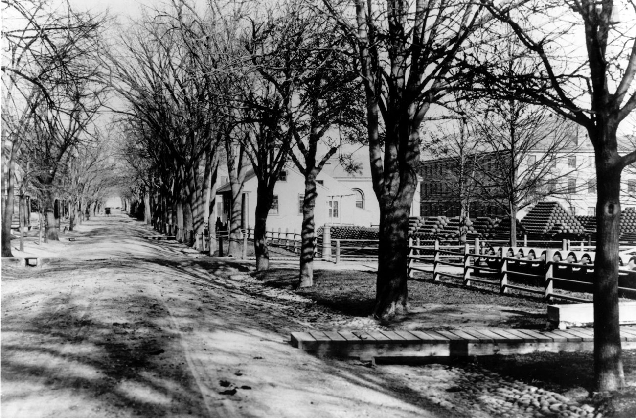
In 2001, intercity service returned to North Station with Amtrak’s Downeaster to Portland, Maine (later extended to Brunswick), using the Lowell and Haverhill lines to the New Hampshire border. It has become one of the more popular routes in New England.[14] Due in part to this, North Station was the 24th busiest Amtrak station in the country in fiscal 2019, and the sixth busiest in New England (behind South Station, ProvidenceNew Haven Union, Back Bay and Route 128).[25]

The 2007-expanded waiting area in 2017

In April 2006, the MBTA announced plans for an enlargement of the waiting area at North Station.[26] The project covered over the southern 80 feet (24 m) of the platforms, adding 20,000 square feet (1,900 m2) of waiting and retail space. The $5 million project was completed in February 2007.[27][28] Two large train information displays, with electronic noises to imitate Solari boards, were added in November 2007.[29]

Boston Garden Towers changes

Beginning in early 2016, Boston Properties built ‘The Hub On Causeway’, a mixed-use development including two towers, on the former Boston Garden site. The development included a new entrance to the rail station from Causeway Street opposite Canal Street, plus an underground passageway from the rail station to the subway station.[30][31] The passageway opened on January 6, 2019.[32]

Installation of fare gates on the North Station concourse began on March 24, 2022.[33][34] The gates were activated on October 1, 2022.[35]

Drawbridge replacement

The two aging two-track drawbridges at North Station are planned to be replaced by two new three-track spans, which will be more reliable and have higher capacity. The unfinished sixth platform will be completed to serve long out-of-service tracks 11 and 12, the Fitchburg mainline will be slightly relocated to provide more layover space near the maintenance facility, and FX interlocking will be reconfigured.[36] The signals contract associated with the new drawbridges was awarded in May 2019.[37] As of November 2022, signal work is expected to be completed in August 2023, while construction on the drawbridges has not begun.[38]

As New England’s largest sports and entertainment arena, TD Garden is the home of the storied NHL’s Boston Bruins and NBA’s Boston Celtics franchises and hosts over 3.5 million people a year at its world-renowned concerts, sporting events, family shows, wrestling, and ice shows.

Since its opening in 1995, TD Garden has hosted over 200 events a year. In 2014, owner and operator Delaware North invested over $70 million for a comprehensive arena-wide renovation to upgrade the fan experience including redesigned concourses, new concession offerings and upgraded technology.

The award-winning state-of-the-art TD Garden is a year-round, 19,600-seat arena, fully equipped with three private restaurants – Harbor View, Legends and the Level 5 Bistro – 90 executive suites, 1,100 club seats, a multi-million dollar high definition video scoreboard and complete 360-degree LED technology.

The Leonard P. Zakim (/ˈzeɪkəm/) Bunker Hill Memorial Bridge (also known as “The Zakim”) is a cable-stayed bridge completed in 2003 across the Charles River in Boston, Massachusetts. It is a  replacement for the Charlestown High Bridge, an older truss bridge constructed in the 1950s.

The bridge and connecting tunnel were built as part of the Big Dig, the largest highway construction project in the United States. The bridge’s unique styling quickly became an icon for Boston, often featured in the backdrop of national news channels, to establish location, and included on tourist souvenirs. The bridge is commonly referred to as the “Zakim Bridge” or “Bunker Hill Bridge” by  residents of nearby Charlestown.

The Leverett Circle Connector Bridge was constructed in conjunction with the Zakim Bridge, allowingsome traffic to bypass it.

Design
The bridge concept was designed by Swiss civil engineer Christian Menn in collaboration with bridge designer Miguel Rosales and its design was engineered by American civil engineer Ruchu Hsu with Parsons Brinckerhoff.[2][3][4] Wallace Floyd Associates, sub-consultants to Bechtel/Parsons Brinckerhoff, was the lead architect/urban designer and facilitated community participation during the design process.[5][6]

The bridge is a cable-stayed bridge in a harp configuration with cradles carrying each strand through their pylon. The main portion of the Zakim Bridge carries four lanes each way (northbound and southbound) of Interstate 93 (concurrent with U.S. Route 1) between the Thomas P. “Tip” O’Neill Jr. Tunnel and the elevated highway to the north. Two additional lanes are cantilevered outside the cables, which carry northbound traffic from the Sumner Tunnel and North End on-ramp. These lanes merge with the main highway north of the bridge. I-93 heads toward New Hampshire as the “Northern Expressway”, and US 1 splits from the Interstate and travels northeast toward Massachusetts’ North Shore communities, crossing the Mystic River via the Tobin Bridge.

The Charles is a tidal river 80 miles long with a watershed of 309 square miles. For 280 years, Bostonians used the rise and fall of the river tides to perform municipal functions, from powering mills to flushing away sewage and industrial waste.

Charles River, Gridley Locks, Harbor Walk

Looking upstream from the locks

That tidal fluctuation stopped with the construction of the first Charles River Dam in 1910. This turned the river from a tidal estuary into a fresh-water basin. If you ever visited the Museum of Science(opens in a new tab), you stood on this dam.

And if you looked at the narrow channel that runs between the museum and the Boston shore, you saw the very first lock that allowed river traffic to pass through the dam safely. That first dam no longer functions to control the river’s water level. Both the lock and the eight sluices under the Science Museum remain open.

Charles River, Dams, Locks, Map

The New Charles River Dam and Locks

Narrow Lock, Gridley Locks, Charles River, Boston Harbor

Narrow lock looking downstream

A new, larger Charles River Dam with the Gridley Locks and Pumping Station were constructed in 1978 just a short way downriver.

The new structure was named for Colonel Richard Gridley, George Washington’s chief engineer in the Continental Army. Col. Gridley engineered the fortifications at the Battle of Bunker Hill in 1775, and at Dorchester Heights, where General Howe and his army were forced to evacuate Boston in March of 1776.

I’m not going to go into detail on how the locks work or what it’s like to go through them. That’s a separate, and more technical, topic. You can learn all about it, however, and go through the locks yourself by taking Boston By Foot’s Architecture Cruise(opens in a new tab). This tour should resume next year when, I hope, life has returned to something resembling normality.

The dam contains three individual locks, two narrow and one wide, and those lock gates hold the pedestrian pathway across the Charles. That’s right, you walk across the tops of the lock gates when they are closed. When they are open, you wait for the boat or barge to clear the lock.

Crossing the Charles

Gridley Locks, Warning signs, Movable walkways, Harbor Walk

This is the entrance

The walk across the locks can go quickly or slowly, depending on the seasons. In the summer, boat traffic from the Charles into Boston Harbor and from the harbor into the river can be heavy. The locks work continually, with boats circling or waiting for their turn.

In the fall and winter, river traffic drops off and you can walk the zig-zag metal grid from one shore to the other with no delays. Pedestrians, bikers (walk your bike), and dogs all use the locks to cross the river. The long brick building close to the Cambridge side, holds the dam mechanism that prevents flooding and keeps the river’s water level steady.

How to Cross the Gridley Locks

Lovejoy Wharf, Harbor Walk, Charles River Dam, Zakim Bridge

Lovejoy Wharf: walk straight ahead

Getting to the Gridley Locks is pretty easy but you have to know where you’re going. In typical Boston fashion, the signage is less than helpful.

  1. Start on Causeway Street.
  2. Turn onto Lovejoy Wharf, keeping the Zakim Bridge(opens in a new tab) on your left and the new condominiums on your right. The sign points you toward the Harborwalk, which you can pick up on the other side of the Lovejoy Wharf buildings. There, you can turn toward either the Charlestown Navy Yard or South Station.
  3. Walk past the brick Lovejoy Wharf complex(opens in a new tab). (It’s huge; you can’t miss it.) You will see a State Police building and State Police boats on the right.
  4. Look for the entrance to the locks. It’s straight ahead, marked by signs warning that the gates move. You will probably see people walking in both directions.
  5. Take the path.The floor is a metal grid and there are handrails along the way, so don’t worry about falling into the water. You will also encounter wider places where you can wait if a crowd is coming through or the gates are opening.
  6. The path passes along the dam structure and ends at Paul Revere park in Cambridge.

The Gridley Locks and Photo Ops

That’s it. Easy peasy. And it’s fun. Also, pretty.

Stop along the way and take pictures. On a beautiful day, you can get some lovely shots of the river, nearby bridges (more than you think), and construction of the new Charlestown Bridge(opens in a new tab). (Yes, I know its official name is the North Washington Street Bridge but no one calls it that.) This structure has been so stripped down it took me a few minutes to identify what I was looking at. Should you be so inclined, you can photograph the progress of building the new bridge from this vantage point.

And now you know. Happy crossing.


Zakim Bridge, Harborwalk, Charles River, Gridley Locks

The Zakim Bridge from the locks

Battle of Bunker Hill, with Breed’s Hill at the center.
Location of the Battle of Bunker Hill and the Bunker Hill Monument Due to its close proximity to Boston and its pivotal role during the Battle of Bunker Hill, Breed’s Hill  in Charlestown is mostly remembered for its colonial and revolutionary ties. Settled by English colonists in 1625 and first known as “Cherton,” Charlestown became an important location of craft production thanks to deposits of clay and other raw materials. Home to three hills, there have been disagreements about the names of these heights since the 1600s. According to historian Richard M.

Ketchum:
To the south of it [Bunker Hill], and connected to it by a lower, sloping ridge, was a height of land not sufficiently distinguished to bear any particular name. Some called it Charlestown Hill; others, considering it an appendage of Bunker Hill, referred to it by that title; while some of the local people, out of deference to a farmer whose cattle
grazed there, called it Breed’s. Its steep western flank, covered with orchards and gardens, leveled out near the settlement of Charlestown.

Bunker and Ebenezer Breed, were mostly undeveloped with some farmhouses and pastures.2 Lacking trees along the hills, residents of Boston had an unobstructed view of the Charlestown Heights from the northern section of town.3
After the skirmishes at Lexington and Concord, both the British and colonial forces focused on defensible locations surrounding the town of Boston. As the colonials dug trenches in Roxbury and  Cambridge, the British forces began to prepare to take both the Charlestown and Dorchester Heights: “First, a detachment would move out against Dorchester Neck, throw up two redoubts there, and then attack the rebel post at Roxbury. Once Boston was safe from attack in that direction, Howe would take a large force to Charlestown Heights and either attack the Americans in
Cambridge or outflank that post.” Planned for June 18, General Gage and his staff felt confident they would prevail by the end of the day.4

Learning of the plan, the colonial forces arrived at the Charlestown Heights first on June 16, 1775. Though there are conflicting reports of where the redoubt should have been placed, construction began around 12:30 am on June 17 at Breed’s Hill. After building their defenses throughout the course of the day, the colonists held the high ground as the British troops landed along the Charlestown shoreline. Over the course of about two hours, the battle raged throughout the peninsula. Pitting 2,200 British troops against a varying number of Provincial (colonial) troops led by
Colonel William Prescott, it would become one of the bloodiest battles of the American Revolution.

Over 1,000 British soldiers, officers, and Marines were killed or wounded. Approximately 300 to 500 of the 1,400 to 1,800 provincial soldiers were killed, wounded, or captured. Breed’s Hill would remain in the hands of the British Army until March 1776.5  Though the King Solomon Lodge Masons dedicated a Monument dedicated to Joseph Warren in 1783, a new effort to honor all those who fought during the battle did not begin until the 1820s. On
June 17, 1825, on the 50th anniversary of the battle, a large crowd gathered for a cornerstone-laying ceremony for the future Bunker Hill Monument located at the top of Breed’s Hill. Among those present that day were the General Marquis de Lafayette and former Massachusetts senator, Daniel Webster. It took another 18 years for the Monument to be realized.6

Established on just four of the original 10 acres of the battle, the rest of the area soon became house lots and, eventually, the original Charlestown High School. Annexed by Boston in 1874, Charlestown became a popular neighborhood for working-class Irish immigrants.

In 1923, the Commonwealth of Massachusetts, then the caretaker of the Bunker Hill Monument, installed this plaque (below) on the exterior of the Bunker Hill Lodge adjacent to the Monument.

Breed family members had appealed to the state, as they had previously appealed to the Bunker Hill Monument Association when the Association owned the Monument, that the name “Breed’s Hill” was not displayed somewhere prominently on the hill. State officials agreed and installed this plaque.

Tudor Wharf

Known also as the Boston Naval Shipyard and the Boston Navy Yard, the Charlestown Navy Yard opened in 1800 as one of the first navy yards of the US Navy. The Charlestown Navy Yard lies in Boston’s Inner Harbor and is at the junction of the Charles and Mystic Rivers. By the time the Yard closed in 1974, it had spread across many acres and contained numerous buildings, piers, dry docks, and more.

Long before the United States established the Charlestown Navy Yard, the tidal flats of this area provided seasonal sustenance to local Indigenous communities for thousands of years. These communities, whose descendants are the Massachusett, called the land Mishawum or “Great Springs.” These flats also became a landing for British infantry transports in the Battle of Bunker Hill on June 17, 1775.

The newly-formed United States emerged from its War of Independence facing threats to its overseas trade. As recommended by President George Washington in 1794, Congress passed the Navy Act, approving the construction of six frigates. This act reestablished the United States Navy that originated as the Continental Navy during the American Revolution. One of those six frigates from 1794 was the USS Constitution.

Getting Started

The US Navy established the Charlestown Navy Yard along with five other navy yards. The other yards were located along the Atlantic coast of the 16-state union: Portsmouth, New Hampshire; New York City, New York; Philadelphia, Pennsylvania; Washington D.C.; and Norfolk, Virginia. Among the first buildings constructed in the Yard was a storehouse, called the Navy Store, now known as Building 5, and military housing: the Commandant’s House, the Officers’ Quarters, and the Marine Barracks. The first ship built in the Navy Yard was the USS Independence in 1814. As the biggest ship, called a ship-of-the-line, in the early US Navy, it served alongside smaller frigates like the USS Constitution.

Workers in the Yard built and repaired ships that challenged the British Navy in the War of 1812. Among those ships repaired in the Yard were five of the original six frigates ordered in 1794. All were at least 13 years old by the start of the War of 1812 and all needed repairs. None of these frigates had been built in the Navy Yard. The War of 1812 and the Mexican American War (1846) presented the first big challenges for the workers in the Charlestown Navy Yard since it opened in 1800.

By the 1850s, many ships in the US Navy had steam-powered engines for propulsion, with masts and sails kept as a secondary source of power. The Navy added two new features to the Charlestown Navy Yard by the 1850s: the Ropewalk and Dry Dock 1, both steam-powered. Two of the most famous of the wooden, steam ships built in the Yard were the USS Hartford, which became the flagship of Admiral David G. Farragut during the Civil War, and the USS Merrimack, which became the Confederacy’s Virginia.

The Civil War

The biggest challenge that faced the US Navy in the 19th century was the American Civil War. During the Civil War, the US Navy had to patrol and blockade over 3,000 miles of the southern coast of the United States, some of its interior rivers and international waters. The Navy had fewer than 90 ships in 1861 and it now needed hundreds more. During the war, the Charlestown Navy Yard became one of the Navy’s most productive yards.

Workers at the Charlestown Navy Yard built, repaired, or remodeled over 170 warships during the war. Some of these ships included private ships workers converted to warships to augment the US naval fleet. One of the newer buildings operating in the Navy Yard during the Civil War was the Machine Shop. Machine Shop workers specialized in steam engines for wooden ships and for the newer ironclad ships.

The most well-known naval battle of the Civil War was the clash of the ironclad ships at Hampton Roads, Virginia. This battle inspired the building of numerous ironclad ships by the US Navy. Workers at the Navy Yard and at nearby contractors’ yards launched about ten ironclads during the war.

The American Civil War also led to the innovative ship design known as the double-ender, a ship intended for river travel. This ship could change direction without turning around; workers in the Charlestown Navy Yard made five of them.

In 1865, workers installed a railway system in the Yard to move supplies into and around the Yard. Following the Civil War, the workload and the number of workers decreased at the Charlestown Navy Yard, continuing a Navy tradition of post-war lulls in shipbuilding.

Dirt road lined with trees stretches into the distance on the left side of the photograph, buildings and piles of cannons are on the right side.
Charlestown Navy Yard in 1874 before the modern industrial era of World War I and II.

BNHP, BOSTS 8650-2

The New Navy

A modernization period began in the US Navy in the 1880s, called the era of the New Navy. The US Congress authorized the building of a fleet of steel warships. Part of this authorization included building a second, larger dry dock (Dry Dock 2), additional piers, and a new Forge Shop for the Charlestown Navy Yard. The Navy expected the Yard to build and repair larger steel ships and manufacture all the anchors and anchor chains for this New Navy.

By the Spanish-American War in 1898, Navy ships had hulls of iron or steel and Charlestown Navy Yard workers repaired over fifty of these ships during this short war. In 1904, sixty-five thousand spectators witnessed the launching of the first all-steel ship built at the Charlestown Navy Yard, the USS Cumberland.

By 1915, the Navy had expanded the Yard by constructing nearly 50 new buildings and further developing the Yard’s railroad system. The US Navy was becoming one of the world’s largest navies.

World War I

When the U.S. formally entered World War I (WWI) in 1917, the US Navy had the large task of transporting thousands of US Army soldiers to France and back. Charlestown Navy Yard workers converted three captured German ocean liners and other ships into troop transports; one of the converted liners, the USS America, made nine round trips.

Yard workers repaired and outfitted over 450 ships during WWI including battleships and submarines. Because many Yard workers enlisted in the armed forces in WWI, the Navy turned to women to fill jobs at the Charlestown Navy Yard. The Navy created an enlistment rank called Yeomen (F), F for female, in the Naval Reserve. Over 700 Yeomen (F) worked as telephone and telegraph operators, stenographers, bookkeepers, and typists in the Yard.

In 1917, ten thousand spectators came to the Charlestown Navy Yard to witness the launching of the largest ship ever built in the Yard up until that time, the USS Bridge. The Bridge was the first refrigerated supply ship built by the US Navy. A post-war decrease in U.S. naval forces plus an international treaty that limited navy sizes decreased the work force at the Charlestown Navy Yard in the 1920s.

The hull of a ship from within a dry dock.
USS BRIDGE in Dry Dock 2, Charlestown Navy Yard, 1917. The largest ship built in the Yard up until then.

BNHP, BOSTS 10536-136

World War II

Starting in the 1930s, workers in the Charlestown Navy Yard started the biggest ship-building and ship-repair era in the history of the Charlestown Navy Yard. By the time World War II (WWII) ended in 1945, workers in the Yard launched over 6,000 naval vessels. Destroyers that took one year to complete in 1941 were finished in only 3-4 months by 1945. Due to increased production during WWII, the Charlestown Navy Yard did not have enough space to complete the workload. In response, the Navy built additional facilities at the South Boston Annex along Boston’s Outer Harbor.

Over half the ships ever built in the Yard were built by its workforce during WWII when the Yard had over 50,000 employees. During this time of crisis, the Navy Yard opened its doors to women and people of color. For the first time, the opportunity to make livable wages was available to thousands of people.

The Cold War

After World War II, workers in the Charlestown Navy Yard upgraded Navy vessels including the Fletcher-class destroyer, the USS Cassin Young. These vessels received advanced radar and sonar systems, and some received new engines, missiles, and other enhancements during the 1950s and 1960s in the Yard. The Charlestown Navy Yard specialized in the building and repair of destroyers during WWII and the Cold War. Although not built in the Yard, the USS Cassin Young symbolizes that effort. The USS Cassin Young has been a part of the National Parks of Boston since 1980.

Navy Yard workers were mostly civilians supervised by naval officers, and the Yard functioned like any other industrial plant. While these workers provided critical labor and many excelled in their positions, some experienced racism, sexual harassment, and discrimination. The naval officers had to resolve these issues and others that involved wages, working hours, conditions, and apprenticeship programs. Safety was always a concern since some jobs in the shipyard were hazardous; injuries and deaths from accidents were not unknown over the Yard’s long history.

More than a Shipyard

Within the Charlestown Navy Yard, the Navy provided housing to its military personnel, including the Marines, who worked in the Yard. The Charlestown Navy Yard also had a succession of Receiving Ships docked at the Yard for over a hundred years. A Receiving Ship was a barracks for new sailors and for sailors moving from one ship to another. Sailors also had on-the-job training aboard Receiving Ships. Starting in 1933, sailor housing and training was brought ashore, ending the era of the Receiving Ships.

Starting in 1915, the Yard served as the headquarters of the First Naval District. Naval officers in the Yard had the responsibility of defending parts of the Atlantic Coast of the U.S. There was also a small military prison in the Yard.

During all its years of service, the Charlestown Navy Yard not only provided ships with food, clothing, fuel, weapons, and other items, but also sent supplies to overseas naval stations. The Charlestown Navy Yard supported humanitarian and non-military missions. For example, in 1847, the USS Jamestown departed the Navy Yard to deliver food to the people of Ireland during the Great Famine and Admiral Richard Byrd’s Antarctica scientific expedition sailed from the Yard in 1933.

Aerial view of the Charlestown Navy Yard from the 1970s, with Boston harbor in the background.
Aerial view of the Charlestown Navy Yard from February 1974. The Marine Barracks, Commandant’s House, Officers’ Quarters, and Building 5 are all visible.

BNHP, BOSTS 8627

The End

The Charlestown Navy Yard operated for nearly 175 years from the age of sail to the age of steel. The U.S. Navy promoted and protected American interests across the globe, and Charlestown Navy Yard workers provided the Navy with ships and supplies. The Yard also served as the center of production for rope, anchors, and anchor chains for the entire Navy.

The federal government closed the Yard in 1974 and the Navy planned to rely more on private shipyards for its needs. The federal government set aside 30 acres of the Yard to serve as a national historic site; the remaining 100 acres and over 100 buildings became privately owned.

By preserving a portion of the Charlestown Navy Yard, the National Park Service memorializes the contributions of thousands of civilian workers and military personnel. The exhibit, “Serving the Naval Fleet” in the Charlestown Navy Yard Visitor Center in Building 5 tells some of this story. The USS Constitution and the USS Constitution Museum, affiliated with the ship since 1972, are also part of the historic Charlestown Navy Yard. The Charlestown Navy Yard became a National Historic Landmark in 1966.

The Hoosac Stores is a historic warehouse at 115 Constitution Road (formerly Water Street) in Charlestown, Massachusetts. Originally designated Hoosac Stores 1 & 2, it is a six-story load-bearing brick warehouse, set just outside the gate of the Boston Navy Yard.[2] A second, adjacent warehouse, identified as Hoosac Stores 3, was demolished in 2000 because it was structurally unsound.[3]

The Hoosac Stores 1 & 2 warehouse was built in 1895 as part of wide-ranging state effort to draw trade activity by the Fitchburg Railroad, which operated rail service to Albany, New York. The railroad notoriously included the Hoosac Tunnel, an expensive and politically controversial project in western Massachusetts that was eventually taken over by the state. The Charlestown terminal was known as the “Hoosac Dock”.[4] Hoosac Stores 3 was built in 1875 for the Cunningham Iron Works, and was leased by the railroad in 1919, which used it into the 1960s.[2] The surviving building is now owned by the National Park Service and is managed as part of the Boston National Historical Park‘s Navy Yard facilities.[4]

Huzzah! Her sides are made of iron!

USS Constitution is the oldest commissioned ship in the United States Navy. Naval officers and crew still serve aboard the ship today. The USS Constitution is operated by the United States Navy, a partner to the National Parks of Boston. The Naval History and Heritage Command, Detachment Boston in Building 24 at the Charlestown Navy Yard is responsible for the maintenance, repair, and restoration of USS Constitution. Across the pier from Constitution in Building 22 is the USS Constitution Museum. The Museum serves as the memory and educational voice of USS Constitution and provides engaging and hands-on experiences for all visitors. Here you can explore how the ship was built, sailed, and preserved.

Boston’s Most Storied Ship

Prior to independence, the thirteen American colonies enjoyed protection from pirates and foreign navies under the British Royal Navy. However, once the United States won independence, the young nation had to defend itself. In 1794, Congress authorized the construction of six warships to became the new United States Navy. One of these warships, USS Constitution, was built at Hartt’s shipyard in the North End of Boston. Construction began in 1794 and Constitution launched on October 21, 1797. The ship sailed its first cruise the next year as the Quasi-War with France emerged. Later it served in engagements with pirates off the Barbary Coast in the Mediterranean.

The greatest glory for Constitution, however, came during the War of 1812. Constitution‘s crew defeated four British frigates during three separate engagements. In battle, Constitution earned the nickname “Old Ironsides” because it appeared as if enemy cannonballs could not penetrate the ship’s strong oak hull.

Before and after these voyages, Constitution had to undergo constant repairs and refits. Most of this work was completed here at the Charlestown Navy Yard. After over 200 years in the Navy, Constitution still calls Charlestown home and relies on the same facilities for maintenance and repair.

Today, USS Constitution occasionally sails through Boston Harbor for special anniversaries and commemorations. USS Constitution and its US Navy crew go underway with the assistance of tugboats as they sail down the coast to Castle Island. In the harbor near Castle Island, the Navy crew fires a cannon salute before they turn around to return to the Charlestown Navy Yard.

Greyhound of the Seas

The first destroyers were designed at the beginning of the twentieth century to counter a small, but feared, ship – the torpedo boat. The destroyer, which also carried the newly invented torpedo, was developed to protect capital ships from torpedo boat attacks. Bainbridge, the first American destroyer, was commissioned in 1902. She displaced 400 tons, was 250 feet in length, mounted two three-inch guns and two torpedoes. As the new destroyers grew in size and carried more torpedoes, they replaced torpedo boats and assumed the role of torpedo attack ships.

In World War II, destroyers were truly all-purpose ships, ready to fight off attacks from the air, the surface and under the surface. They handled a variety of duties such as picket ship, escorting larger ships and convoys, shore bombardment, rescuing pilots who were forced down at sea and even acting as mailman for the fleet. The 2,050-ton Fletcher-Class destroyer was considered one of the best destroyers of the period. One hundred seventy-five of these ships were built between March 1941 and February 1945. Being 376 feet, 6 inches, in length meant that they could carry five five-inch dual-purpose guns, ten torpedoes, depth charges and antiaircraft guns. Their ability to refuel at sea enabled them to carry less fuel yet operate effectively in the vastness of the Pacific. Fletcher-Class destroyers incorporated the lessons learned from earlier destroyer construction along with ongoing combat operation.

Destroyers are still the workhorse ships in the modern navies of the world. Although they now carry guided missiles and are twice as large as Cassin Young, the destroyer is still an important and versatile type of combat vessel.

The Ship in the 1940s

USS Cassin Young was built by Bethlehem Steel Corporation at San Pedro, California and commissioned on December 31, 1943. Assigned to the Central Pacific, Cassin Young first experienced combat in April 1944, attacking Japanese strongholds in the Caroline Islands. In June, the ship escorted American amphibious forces that invaded the islands of Saipan, Tinian and Guam. In August, the ship was reassigned to Task Group (TG) 38.3, which included several aircraft carriers. For the remainder of the Pacific war, Cassin Young would be in the forefront of the naval offensive against the Japanese.

Between October 23 and October 27, 1944, TG 38.3 and Cassin Young participated in several actions that were part of the Battle for Leyte Gulf. She rescued over 120 men from carrier Princeton when that ship sank on October 24 and participated in the Battle of Cape Engano the next day when four Japanese carriers were sunk by the American carriers that Cassin Young was helping to escort. During the remainder of 1944, the ship continued to escort the carriers of TG 38.3 as they provided air cover to American troops engaged in the liberation of the Philippines. Cassin Young also experienced the new Japanese suicide tactic of the kamikaze aircraft for the first time.

In January 1945, TG 38.3 went to sea for attacks against the island of Formosa, Indochina (Vietnam) and southern China. American ships had proved that they could penetrate deep within enemy waters and the stage was set for the invasions of Iwo Jima and Okinawa. During February and March, Cassin Young supported Marine operations on Iwo Jima and helped “soften up” Okinawa for the upcoming assault on that island. In preparation for the Okinawa operation, Cassin Young was reassigned to Task Force 54, the gunfire and covering force for the entire invasion fleet.

April 1, 1945, was D-day at Okinawa. After escorting assault craft to the beaches and providing shore bombardment, Cassin Young took up the duties of radar picket ship, possibly the most hazardous duty performed by any warship during World War II. The picket’s role was to provide early warning of impending air attacks to the main fleet. The ships assigned to the fifteen picket stations bore the brunt of over fifteen hundred kamikaze attacks in the weeks and months ahead. Radar Picket (RP) Stations 1,2, and 3 faced the worst of these attacks. On April 6 the Japanese launched the first of ten massed attacks, sending 355 kamikazes and 341 bombers towards Okinawa. Cassin Young was on duty at RP Station 3. The ship downed three “bogeys” (enemy planes) and picked up survivors from the destroyers assigned to RP Stations 1 and 2 (both were hit and sunk by kamikazes).

Cassin Young was then assigned to RP Station 1 where, on April 12, the ship came under massive attack. Six kamikazes were shot down, but one hit the mast and exploded fifty feet above the ship. One sailor was killed and 59 were wounded. After repairs, Cassin Young returned to Okinawa in July for further duty. Only individual kamikaze attacks were now occurring as the Japanese hoarded 10,000 aircraft to throw against the U.S. fleet in the upcoming invasion of Japan.

Cassin Young’s most severe test came just sixteen days before Japan surrendered. At 3:26 a.m. on July 30, a single kamikaze crashed the starboard side of the main deck near the forward smoke stack. There was a tremendous explosion amidships and the ship lay dead in the water. The crew contained the damage, restored power in one engine and got the ship underway within twenty minutes. Casualties were 22 men dead and 45 wounded. Cassin Young was the last ship hit by kamikazes in the vicinity of Okinawa. For her determined service and gallantry on the Okinawa radar picket line she was awarded the Navy Unit Commendation. After returning to California, the ship was repaired, decommissioned on May 28, 1946, and placed in the reserve or “mothball” fleet.

The Ship in the 1950s

With the outbreak of the Korean Conflict, many destroyers were recalled to service. Cassin Young was recommissioned on September 7, 1951, and initially served in Atlantic and Mediterranean waters. In 1952, Cassin Young underwent a major overhaul at the Charlestown Facility, Boston Naval Shipyard, beginning her association with this navy yard.

In 1954, as part of an around-the-world cruise, the ship carried out patrols in Korean waters. From 1955-1959, Cassin Young performed routine duties in Atlantic and Caribbean waters with four Mediterranean deployments. During those years, the ship returned to the Boston Naval Shipyard five more times for overhauls to keep ahead of unavoidable problem: old age. But Cassin Young could still perform well, which she proved in 1959 when the ship was awarded the Battle Efficiency “E” for overall excellent performances in all exercises that year. On April 29, 1960, Cassin Young was again decommissioned and mothballed at Norfolk Naval Shipyard, Virginia.

The Ship Today

USS Cassin Young now has a new mission. Maintained and staffed by National Park Service staff and volunteers, Cassin Young is an example of the type of ship built, repaired, and modernized in the Charlestown Navy Yard. Although built in California, fourteen Fletcher-Class destroyers just like her were produced at this yard.

Before dry docks came into use in the late 15th century in England, the only way to service a ship’s hull was to “careen” it—heave it over on its side, still floating, or laying in the mud at low tide. It was difficult and time-consuming and put great strain on the hull. The answer was the dry dock. The concept is simple: float the vessel into a three-sided basin, then close the seaward end and remove all the water. The vessel settles on a cradle, its hull accessible. To undock: re-flood the basin, open the seaward end and float the vessel out.


282-2a_001
“Recoppering the Constitution” by Aiden Lassell Ripley, ca. 1965. [Courtesy Paul Revere Life Insurance Co. / USS Constitution Museum Collection 282.2a]

But the concept’s execution required a finely-engineered complex of masonry, engines, pumps, reservoir, tunnels, culverts, valves, and gates—in effect a huge well-coordinated machine. The Charlestown dry dock and the one built concurrently at Norfolk, Va., both designed by Loammi Baldwin Jr., were the first such naval structures in the United States. Six years under construction, the Charlestown dock was inaugurated in 1833 with the docking of Constitution. Over the course of its history Dry Dock 1 has been enlarged several times. In 1833, the dock was 341′; in 1858-60 the dock was extended to 357’; the final extension occurred in 1947- 48, when the dock became 415’ in overall length, the size that it is today.


It took the original eight pumps four to five hours to empty the tremendous basin. Other operations were to some extent governed by Boston Harbor’s 10-foot tide. After the dock was enlarged the water level did not rise as rapidly as the tide during filling, so it took two high tides to do the job. For emptying and filling, the caisson (door) was filled with water and sunk in place between grooves in the dock walls. For docking and undocking, the caisson was emptied and floated out of the way on the high tide. It took 24 men working hand pumps for an hour and a half to expel the water from the caisson.


01-013-copy-2-copy
September 1992, Dry Dock 1, Charlestown Navy Yard, at night. The keel blocks on the dock floor and angled haul blocks are ready to support USS Constitution for a four-year restoration. [Courtesy Naval History & Heritage Command Detachment Boston]

The original 1833 wooden caisson was replaced with a riveted steel gate that was launched October 31, 1901, and placed in service in 1902. Dry Dock #1 had its third caisson installed on April 1, 2015. The new caisson, built by Steel America in Norfolk, VA, weighs 296 tons and was launched from its barge into Boston Harbor by “Chesapeake 1000”, the largest East Coast floating crane that is capable of lifting 1000 tons


Charlestown Navy Yard is part of Boston National Historical Park, one of 407 parks in the National Park System. Visit www.nps.gov to learn more about parks and National Park Service programs.

Boston National Historical Park is a unique collaboration of government owned and privately owned and operated historic sites associated with the colonial struggle for independence and the birth and growth of the United States. These nationally significant attractions include Old South Meeting House, the Old State House, Faneuil Hall, Old North Church, the Paul Revere House, the Bunker Hill Monument, the Bunker Hill Museum, Dorchester Heights Monument, and the Charlestown Navy Yard, including USS Constitution, the USS Constitution Museum, and USS Cassin Young.

The CHARLESTOWN FERRY (Boston-Long Wharf) has 2 stations departing from Charlestown and
ending in Long Wharf (South).


CHARLESTOWN FERRY ferry route operates everyday. Regular schedule hours: 6:45 AM – 8:15 PM
Day Operating Hours Frequency
Sun 10:15 AM – 6:15 PM 30 min
Mon 6:45 AM – 8:15 PM 15 min
Tue 6:45 AM – 8:15 PM 15 min
Wed 6:45 AM – 8:15 PM 15 min
Thu 6:45 AM – 8:15 PM 15 min
Fri 6:45 AM – 8:15 PM 15 min
Sat 10:15 AM – 6:15 PM 30 min

 PRESERVING SHIPBUILDING HISTORY IN A GROWING CHARLESTOWN NAVY YARD

Three proposals from private developers for the redevelopment of Pier 5 in the Charlestown Navy Yard are under review by the Boston Planning and Development Agency for new housing and recreational opportunities.

Historic Boston Inc. is part of the developer Urbanica’s team, which proposes to build 89 income-restricted apartments on the pier surrounded by a public promenade.  A park at the the far end of the pier will provide the public with recreational opportunities in the summer and a skating rink in the winter.  The new buildings on the pier will also have a green roof of community gardens that are accessible to the public, and the development proposes additional sailing slips for the Courageous Sailing Center which is currently located on Pier 4.

The Charlestown Navy Yard is one of the nation’s oldest ship building facilities.  Begun in 1801 for the recently constituted United States Navy, Boston’s Navy Yard was one of the most important in the young United States and would remain so into the 20th century. During World War two along, 6000 ships were built, repaired or launched out of the Navy Yard. The US Navy decommissioned the Navy Yard in 1974 and, although it now offers an array of public and private uses such as the historic USS Constitution, museums and hotels, and important medical and research facilities, the gray granite buildings, piers and dry docks are reminders of Boston’s rich maritime history.

Any one of the proposed plans will transform Pier 5 into a dense development of modern buildings.  But one tiny structure – Building 123, also known as the Pumphouse – will remain along the drydock’s edge to help tell the story of the Navy Yard’s ship building history.   The Pumphouse is a small round single-story structure built along with Drydock #2 in 1905 to manage water flow in and out of the massive Drydock #2 nestled between Pier’s 4 and 5.

Drydock #2 was a large basin with a caisson at the far end that would form a barrier to prevent water from entering the drydock.  A ship built within the enclosed drydock could be launched by pumping water into the drydock until the ship floated, and then removing the caisson.  A ship could also be brought into the flooded drydock for repairs, requiring that water be pumped out of the enclosed space once the ship was secured.  The pumps that made these actions possible were enclosed within the small neo-classical Pumphouse in Building 123, and operated from 1905 until the Navy Yard closed in 1974.

Should Urbanica be designated developer of Pier 5, Historic Boston will assist with plans to restore the Pumphouse and re-activate it for public uses.  Our plans call for the building to include an interpretive center that will help to tell the Navy Yard’s story, and Pier 5’s extraordinary shipbuilding role.

The Anchor at Shipyard Park in historic Charlestown Navy Yard is the Boston area’s newest community gathering space for all ages. Yes – this is a beer & wine garden that is family friendly.

With unparalleled panoramic views of Boston Harbor and the downtown skyline, this twostory public outdoor venue features an open-air wine and beer garden, multi-level  fountain, waterfront mezzanine, lush grass lawns, swing chairs and cozy lounge seating nestled in a historic Navy Yard structure.

The wine and beer garden will feature a selection of local and international brews with selections from all New England states including Down the Road (Mass.,) Long Pine (Maine), Long Trail (Vermont) and Narragansett Del ‘s Shandy (Rhode Island.)

The robust wine selection is provided by 90 Cellars and will include sangria and bubbly in addition to Crook & Marker, an organic spiked seltzer. In addition, there are non-alcoholic options including expresso, coffees, teas, freshly squeezed lemonade with more options added to the menu weekly.

On the food front, they will be offering lobster rolls, turkey BLT, veggie hummus wraps, salads and bar snacks. They plan to expand their food offerings throughout the summer and will also partner with the East Boston Boys & Girls Club to offer baked goods.

The Anchor is an all ages, family and pet-friendly gathering space that will offer inclusive and dynamic programming and events, public art, youth initiatives and complimentary public amenities. In addition to the special events, lawn games including giant Jenga and checkers are available every day.

The Anchor is located at 1Shipyard Park in Charlestown, MA and will be open MondayThursday from 4:00 pm-11:00pm and 11am-11pm Friday-Sunday.

The Anchor at Shipyard Park in historic Charlestown Navy Yard is the Boston area’s newest community gathering space for all ages. Yes – this is a beer & wine garden that is family friendly.

With unparalleled panoramic views of Boston Harbor and the downtown skyline, this two-story public outdoor venue features an open-air wine and beer garden, multilevel fountain, waterfront mezzanine, lush grass lawns, swing chairs and cozy lounge seating nestled in a historic Navy Yard structure.

The wine and beer garden will feature a selection of local and international brews with selections from all New England states including Down the Road (Mass.,) Long Pine (Maine), Long Trail (Vermont) and Narragansett Del ‘s Shandy (Rhode Island.)

The robust wine selection is provided by 90 Cellars and will include sangria and bubbly in addition to Crook & Marker, an organic spiked seltzer. In addition, there are non-alcoholic options including expresso, coffees, teas, freshly squeezed lemonade with more options added to the menu weekly.

On the food front, they will be offering lobster rolls, turkey BLT, veggie hummus wraps, salads and bar snacks. They plan to expand their food offerings throughout the summer and will also partner with the East Boston Boys & Girls Club to offer baked goods.

The Anchor is an all ages, family and pet-friendly gathering space that will offer inclusive and dynamic programming and events, public art, youth initiatives and complimentary public amenities. In addition to the special events, lawn games including giant Jenga and checkers are available every day.

The Anchor is located at 1Shipyard Park in Charlestown, MA and will be open Monday-Thursday from 4:00 pm- 11:00pm and 11am-11pm Friday-Sunday.

Boston’s only two-story public gathering space and open-air wine and beer garden The Anchor features a diverse beverage selection including beers, wines, sangria and bubbly as well as teas, coffee and lemonade. Savory snacks and a curated menu in collaboration with partner restaurants are available seven days a week

The Constitution Museum serves as the memory and educational voice of USS Constitution by
collecting, preserving, and interpreting the stories of “Old Ironsides” and those associated with
her. It seeks to engage all ages in the story of Constitution to spark excitement about maritime
culture, naval service, and the American experience. It shares “Old Ironsides”’ contributions
with a global audience, and strives to be the best museum possible based on scholarship and
innovative ways of sharing Constitution‘s stories.
As the memory and educational voice of USS Constitution, the USS Constitution Museum
preserves, displays, and interprets artifacts and archival material related to the Ship and her
crew through interactive exhibitions, compelling programs, and engaging outreach initiatives.
The Museum was incorporated in 1972 as a private, non-profit, and non-government funded
interpretive complement to USS Constitution, an active-duty U.S. Navy vessel, the oldest
commissioned warship afloat in the world, and America’s Ship of State. This allowed the Navy
to clear Constitution’s decks of display cases so that visitors could see the Ship as a sailing
vessel, rather than as a floating museum, and for artifacts to be cared for in proper
environmental conditions.
On April 8, 1976, naval historian Samuel Eliot Morison cut the ribbon to open the Museum to
the public in its present facility in Charlestown Navy Yard’s Building 22 (the old pump house for
Dry Dock #1), located just across the pier from “Old Ironsides.” Since opening, the Museum has
doubled in size and quadrupled in visitation. Working with the National Park Service, the
Museum expanded into two adjacent buildings and built a connecting corridor in the mid-1990s. In 2001, the Museum completed renovations on a new state-of-the-art collections
storage facility and research library. Today, over 350,000 people visit the Museum each year to
learn, explore, and research, making it one of Boston’s most-visited museums.

Reach Out to Cycleboat Boston